
Very Warm Weekend More Humid Sunday Showers Thunderstorms Monday PM

Very Warm Weekend More Humid Sunday Showers Thunderstorms Monday PM
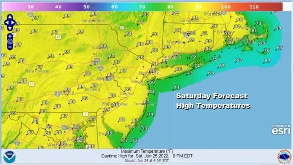
Our weekend is underway and we are going to enjoy a nice first weekend of summer on the last weekend of June. The satellite view shows mostly cloud free skies. The radars are nice and quiet. High pressure is settled along the coast. The next cold front is not due until Monday. This leaves us pretty much in a good place today and Sunday. Sunshine will rule today with highs reaching the middle to upper 80s. Temperatures will be cooler along the shore with local sea breezes.
SATELLITE

WEATHER RADAR

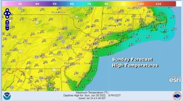
Sunday it will be the same story except that humidity levels will be coming up to the point where it will be uncomfortable outside. We will call it very warm to hot with highs reaching 85 to near 90 degrees. No thunderstorms or showers are forecast except for perhaps in Pennsylvania and NY state west of I-81. The high moves offshore and Monday will bring the next cold front.
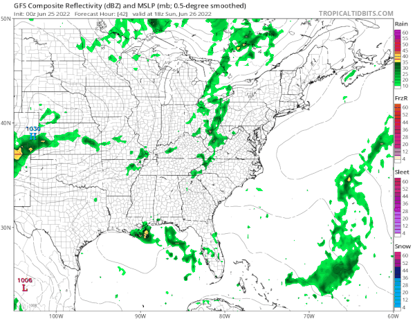
Timing of the cold front looks to be around the middle of the day on average. This probably means no severe weather risks due to the time of day and the lack of daytime heating. Highs Monday will be in the upper 70s and lower 80s. The front keeps moving and drier slight cooler and less humid air returns for Tuesday and Wednesday with sunshine forecast for both days.

Highs will be in the 70s to near 80 Tuesday and back into the low and middle 80s Wednesday. The rest of next week is more of the same. We warm up and turn more humid Thursday and Friday. A cold front will Saturday with showers and thunderstorms and then a cool dry air mass takes over for next Sunday and Monday. It is a simple straight forward pattern driven by a northwest flow from Canada and no sign of that pattern breaking down anytime soon.
BE SURE TO DOWNLOAD THE FREE METEOROLOGIST JOE CIOFFI WEATHER APP &
ANGRY BEN’S FREE WEATHER APP “THE ANGRY WEATHERMAN!
MANY THANKS TO TROPICAL TIDBITS & F5 WEATHER FOR THE USE OF MAPS
Please note that with regards to any severe weather, tropical storms, or hurricanes, should a storm be threatening, please consult your local National Weather Service office or your local government officials about what action you should be taking to protect life and property.


