Very Warm Humid Sunday Late Thunderstorm Cooler Less Humid Memorial Day
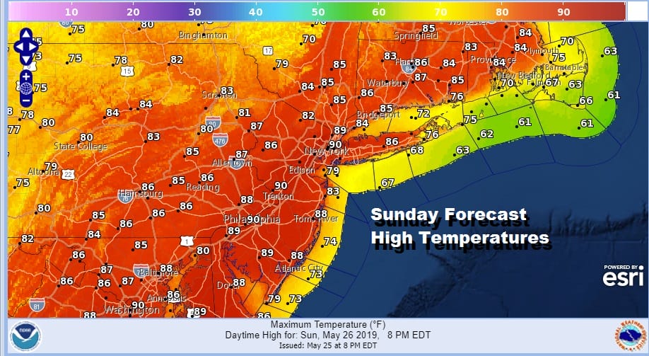
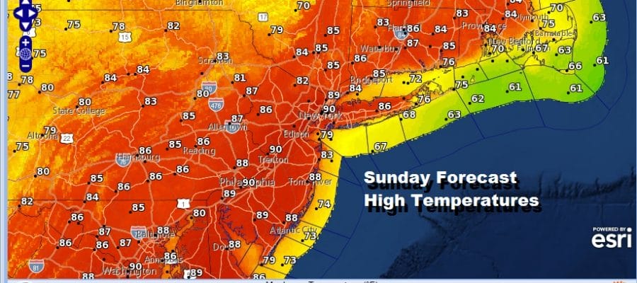
The second day of the Memorial Day holiday weekend will be the warmest and most humid of the three days and the one beach day of the 3. At least at the shore temperatures should reach the 70s to near 80 before any sea breeze takes hold. That breeze won’t make it far inland so most highs today will be in the 80s with the warmest inland areas possibly getting close to 90 degrees. Sunshine and uncomfortable humidity will give way to a cold front coming through Sunday night. I’m leaving the chance for a downpour or a thunderstorm for the late afternoon and evening. The best chances may be south of NYC across Central & South Jersey & Southeast Pennsylvania.
SATELLITE

REGIONAL RADAR

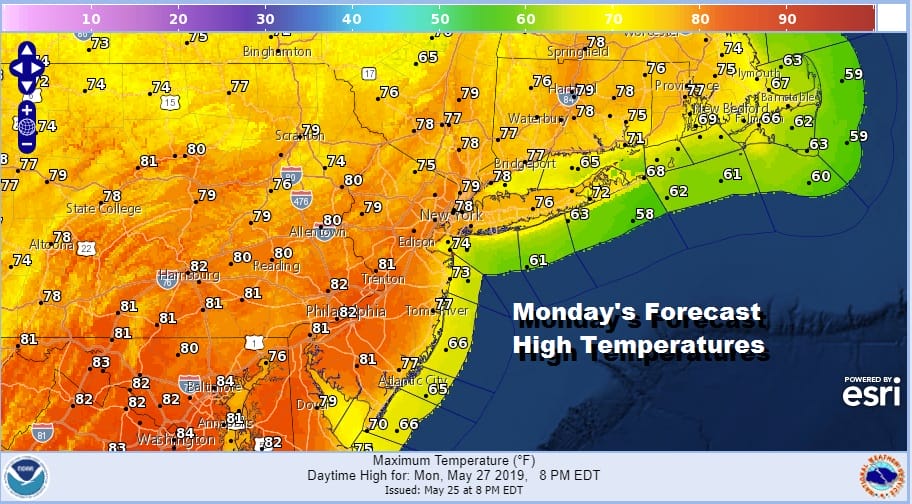
Weather conditions improve once the front passes later Sunday night and everything should be long gone before Monday morning. Monday Memorial Day is shaping up to be a nice day and a cooler day than Sunday with low humidity and sunshine. Highs will be in the mid 70s to lower 80s and zero chance of any rain.
Tuesday brings issues. Sunday’s front stalls to the south and starts to inch northward as a warm front. To the north of the front it will be an onshore flow and temperatures just in the 60s while to the south temperatures will reach the 80s. Just when and where that front will be during the course of the day is anyone’s guess at this point but it would certainly mean areas from NYC north and east will be in the land of ocean winds and temperatures in the 60s. We will also have clouds and some rain to contend with during the day Tuesday.
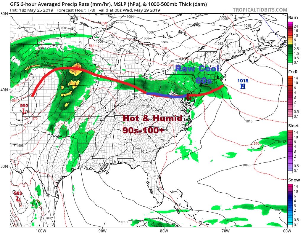
We will figure out the temperature dilemma later today or on Monday. It would seem that eventually the front does get by sometime on Wednesday which will allow hot humid air from the south to push further north. It may not come in time for Wednesday though I would suspect temperatures will push into the 70s and 80s in most places if we get enough sun. This leaves Thursday is the hot day this week with temperatures reaching into the 90s in many locations. Another cold front arrives Thursday night so look for showers and thunderstorms late Thursday and Thursday night. The front might linger a bit on Friday but cool dry air comes in just in time for next weekend. This is the plan at least for time being.
MANY THANKS TO TROPICAL TIDBITS FOR THE USE OF MAPS
Please note that with regards to any tropical storms or hurricanes, should a storm be threatening, please consult your local National Weather Service office or your local government officials about what action you should be taking to protect life and property.


