Very Cold Weather Pattern Starts December As Winter Arrives Early

Very Cold Weather Pattern Starts December As Winter Arrives Early
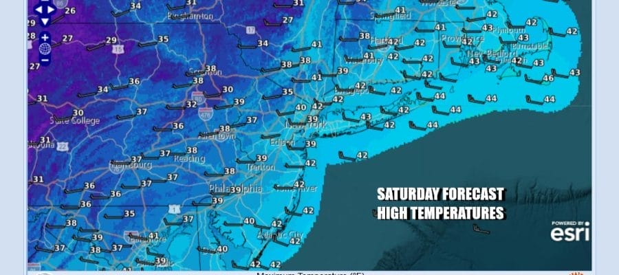
The long holiday weekend continues and it is cold. We are ending the month of November that has gone from being very warm and incredibly dry to seeing a rainier pattern return and now we have very cold air covering much of the Eastern US and that cold air will be around in one form or another for the rest of the weekend and all next week and possibly a bit beyond that. Temperatures today will have a hard time getting out of the 30s under a mix of sun and clouds and gusty west to northwest wind.
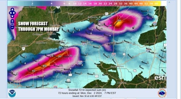
In Western NY, Northwest Pennsylvania and Northeast Ohio, the Lake Effect Snow Warnings continue for a second day. Much of yesterday’s snow was centered on Northeast Ohio and the counties of Southwestern NY south of Buffalo. Today we see the area of snow expanding northward in Western NY to just north of Buffalo and also heavy snows will continue in areas of North Central NY. 72 snow forecasts indicate another 4 to 5 feet of snow will fall on top of yesterday’s 1 to 2 feet that fell in Northeast Ohio and Southwestern NY. We can see the streamers clearly on the satellite and radar loops.
SATELLITE WITH LIGHTNING STRIKES
WEATHER RADAR
Tonight we will see mainly clear skies and very cold lows Sunday morning in the 20s with some teens in colder sections inland. Sunday is going to be another partly sunny and cold day and once again we will likely see temperatures not get out of the 30s for daytime highs. The average high this time of year is in the upper 40s to around 50 degrees.
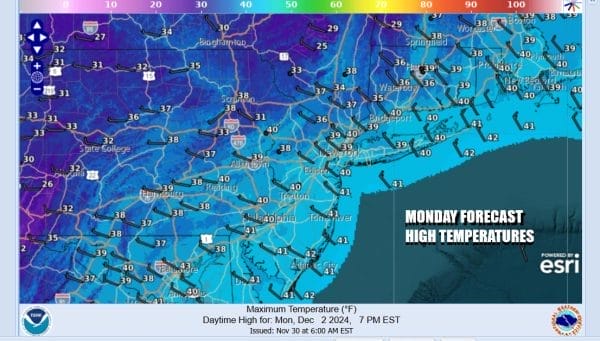
This leads to another cold night in the 20s and teens Sunday night into Monday morning and another cold day to start off the week. Skies will be partly sunny Monday and it will again be on the cold side of average. Most highs will be in the upper 30s to some lower 40s.
There is another cold front that will be heading eastward for midweek as low pressure develops over the Great Lakes and moves eastward across Southern Canada. This is going to usher in another shot of colder air for the end of the week. Lake effect snows will abate Tuesday only to fire up again once the low and front pass.
There are a series of diving systems moving southeast out of the Plains. One such system is going to try to do just that late in the week and we see some models picking up on this idea. If this verifies it would mean some snow and ice for the interior areas of the Southeast and Mid Atlantic before it spreads farther north into New Jersey and Southern New England. European models are showing a system that doesn’t dive southward and instead moves east across the Great Lakes with another trailing front.
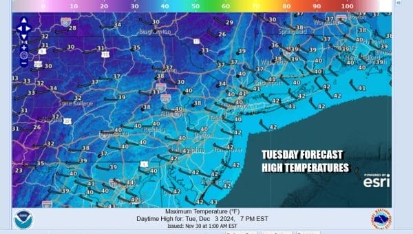
Meanwhile Tuesday will be a partly to mostly sunny cold day. After starting out in the 20s and teens highs willr each the upper 30s and lower 40s. Wednesday sees a cold front approach and this will mean cloudy skies with rain and snow showers near the coast and some snow showers further inland. This appears to be a light event with limited moisture and some colder areas that stay mostly snow will see perhaps a coating to an inch or perhaps 2. Wednesday highs will be in the 30s. Colder air is back for Thursday and Friday and then we will see whether we have an issue for wintry precipitation next weekend.
BE SURE TO DOWNLOAD THE FREE METEOROLOGIST JOE CIOFFI WEATHER APP &
ANGRY BEN’S FREE WEATHER APP “THE ANGRY WEATHERMAN!
MANY THANKS TO TROPICAL TIDBITS FOR THE USE OF MAPS
Please note that with regards to any severe weather, tropical storms, or hurricanes, should a storm be threatening, please consult your local National Weather Service office or your local government officials about what action you should be taking to protect life and property.

