
Very Cold Tonight Into Sunday Morning,
Very Warm Tuesday & Wednesday With Gusty Winds Developing

Very Cold Tonight Into Sunday Morning,
Very Warm Tuesday & Wednesday With Gusty Winds Developing

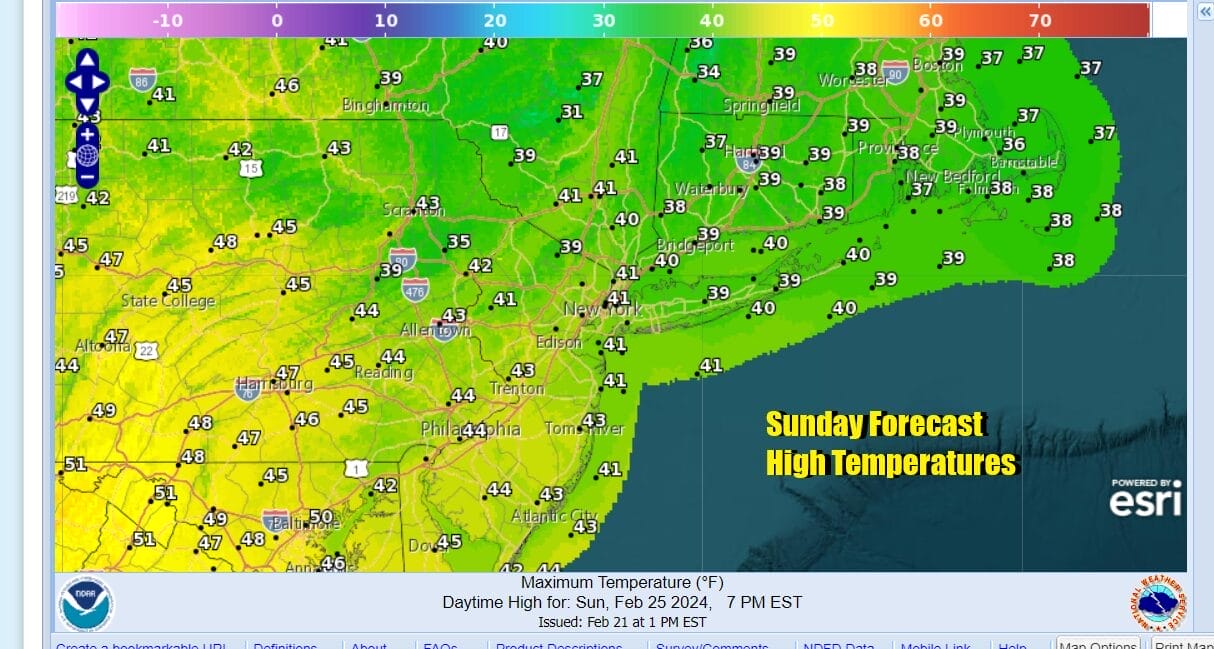
Low pressure to the east and offshore continues to edge eastward but we have an upper trough that is going to move through today. This will bring in a shot of colder air that will keep temperatures from going much of anywhere today. Most highs this afternoon will be in the upper 30s and lower 40s with clouds and some breaks of sunshine.

The upper trough is also going to produce some areas of scattered showers which don’t amount to much but will be a bit of a nuisance as some places will see those showers and others will not. The best chances seem to be across Southern Pennsylvania and Southern New Jersey southward. Once the upper trough clears the coast late today skies will clear tonight and lows Sunday morning will be quite cold, in the teens inland and lower 20s in warmer urban areas.
SATELLITE WITH LIGHTNING STRIKES

WEATHER RADAR

This shot of cold air is in quick and it will be moving out rather quickly as well. The high pressure area building in tonight will already be offshore by midday Sunday. Winds will turn southwest and the warm up will begin. Sunday will be a day of sunshine and afternoon highs will reach the upper 30s and lower 40s.
The warm up will accelerate rather quickly Monday which should be a good day in general with sunshine. Wind direction Monday will be the key to high temperatures as along east and south facing shorelines, a south wind will likely keep temperatures in the 40s while just inland with more of a southwest wind, Monday afternoon highs will reach the 50s everywhere.

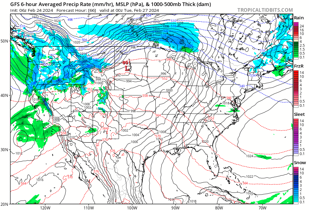
The warm up will accelerate even more as we head into Tuesday and Wednesday. High pressure will be offshore and that high will strengthen some as a ridge aloft builds. Meanwhile we have a strong storm coming into the Pacific Northwest over the weekend that will move east across the Northern Rockies and Plains and then make its way to the Northern Great Lakes.
The southwest flow strengthens and winds will pick up Tuesday. There will be a warm front to the south that will be pushing northward so we look for some sunshine giving way to clouds Tuesday. Winds from the south and southwest will pick up making for a breezy afternoon and evening. Temperatures will respond to the lengthening day and strengthening sun and highs could reach the 60s inland and west of the coast
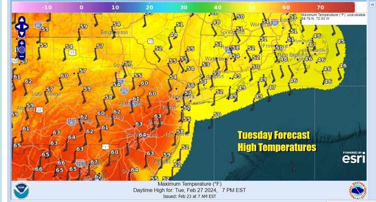
South and east facing shorelines as well as much of Southern and Southeastern New England will be cooler in the 50s and even some 40s over Eastern Long Island and Southeast New England. Some rain will arrive later Tuesday night into Wednesday morning as the warm front goes by and then we will sit and wait for the approaching cold front to the west.
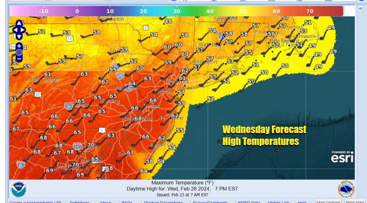
Once the warm front passes winds bend more southwest rather than south and this pushes the 60s further north into the Hudson Valley and interior Southern New England. It will be a little lower near the coast but warmer than Tuesday. Southwest winds will pick up further to 20 to 30 mph and gusty. Then we have the approaching cold front. This front seems to be slowing down as it heads east so we will see rain likely hold off until later Wednesday and night and lasting into Thursday before it ends. There is a chance that some inland areas could see a change to snow before it ends as there is another quick shot of colder air behind it but these things are often long shots if they happen at all. The end of next week will be colder but dry and another warm up gets underway next weekend, which by the way, is the first week of March.
BE SURE TO DOWNLOAD THE FREE METEOROLOGIST JOE CIOFFI WEATHER APP &
ANGRY BEN’S FREE WEATHER APP “THE ANGRY WEATHERMAN!
MANY THANKS TO TROPICAL TIDBITS FOR THE USE OF MAPS
Please note that with regards to any severe weather, tropical storms, or hurricanes, should a storm be threatening, please consult your local National Weather Service office or your local government officials about what action you should be taking to protect life and property.
(Amazon is an affilate of Meteorologist Joe Cioffi & earns commissions on sales.)


