Very Cold Air Arrives For Friday Weekend Snow Chance Next Week

Weather in 5/Joe & Joe Weather Show Latest Podcast
Very Cold Air Arrives For Friday Weekend Snow Chance Next Week
We are seeing the arrival of very cold air across the Northeast and Middle Atlantic states today. Low pressure developing in Eastern North Carolina moves east and strengthens into a major ocean storm. A strong upper low drops strengthens and drops southeast from Eastern Canada to New England and sets up a north northeast flow aloft from Greenland south into the Middle Atlantic states. This is will be the coldest shot of air of the winter so far.
SATELLITE

While the satellite shows breaks of sunshine around we also see clouds from the ocean storm to the south and the upper low to the north. The radars are picking up on snow showers over New England and Upstate NY while to the south we see some bands of snow from an upper trough in the Central Appalachians and the last of the snow in Southern Virginia and North Carolina offshore and moving away to the east.


For the rest of the day it will be clouds and sun, a developing gusty wind and temperatures holding mostly in the low to mid 30s and then by Friday morning we will see lows in the teens with single digits north and west of the coast.
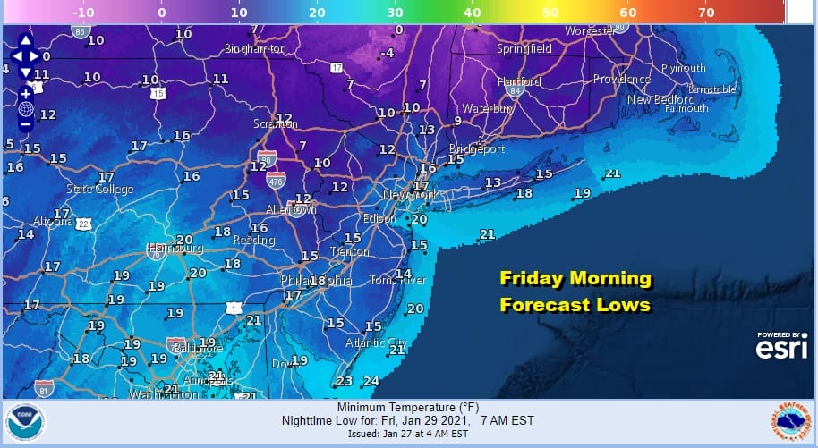
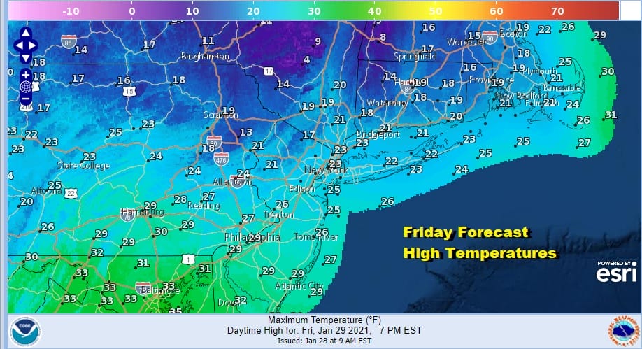
Friday will be a very cold day with sunshine and clouds, strong gusty winds and temperatures that will probably be not much higher than the low to mid 20s and colder areas north of the coast will have a tough time even getting back to 20! Wind chills will be in the single digits and low teens.
On to very cold weekend with Saturday morning lows in the low to mid 20s with single digits inland. Saturday will be sunny breezy and cold with most highs in the 20s. Then we turn our attention to the next storm system headed our way for later Sunday and Monday.

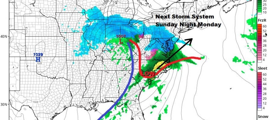
Much like the system from 2 days ago we have a primary low that will be headed across the Ohio Valley and weakening and a developing secondary in the Carolinas that will be the main system. What makes this system different from the one from two days ago is that it has much more upper air support with it.
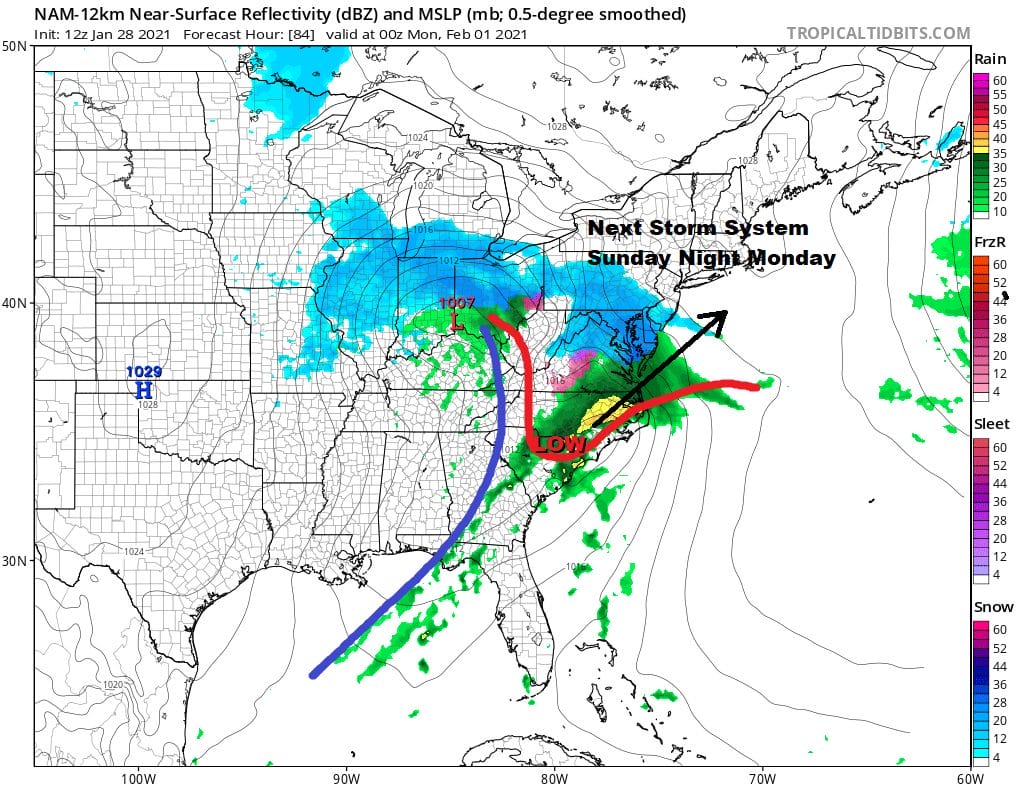
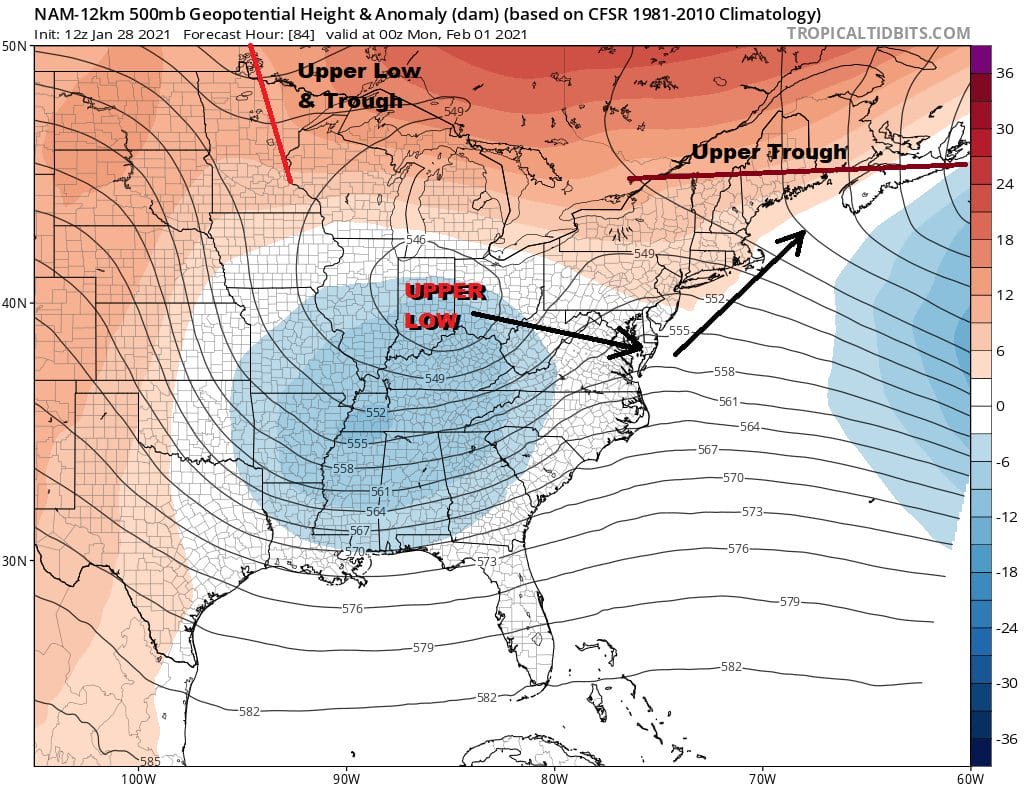
Even though the upper support is more impressive on the approach there are issues here with an upper low to the east that has to pull out far enough to the east. The second is an upstream system on the upper left that is coming into play as it drops southeastward. These complications make for a rather disjointed looking system behind the time frame of next Sunday as the secondary low moves northeastward.
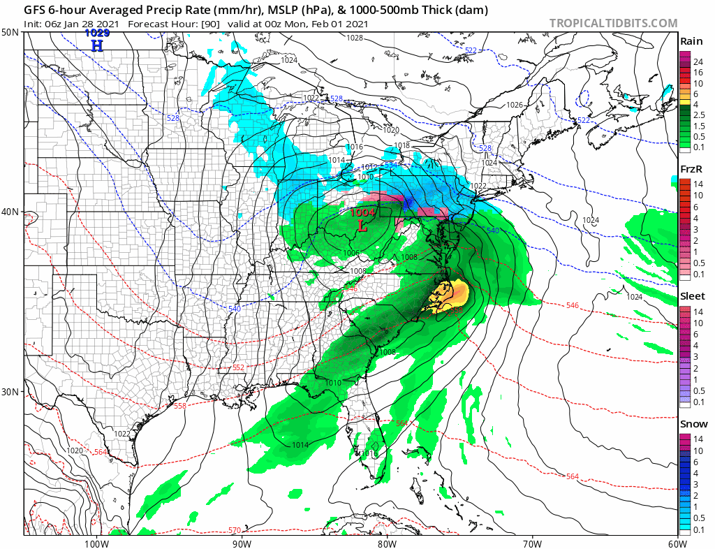
There are also issues for mixing along the coast that need to be considered as well. It would seem that this room for this storm to turn northward rather than get squashed to the south but I remain cautious in a winter that has not seen anything impressive as far as a storm setup is concerned since the storm of Mid December. For now we will call for some snow beginning late Sunday across Maryland, Delaware, Southern Pennsylvania and Southern New Jersey and then moves northward toward through New Jersey and into Southern New England, the Hudson Valley, NYC, and Long Island on Monday and leave it at that for the time being.
BE SURE TO DOWNLOAD THE FREE METEOROLOGIST JOE CIOFFI WEATHER APP &
ANGRY BEN’S FREE WEATHER APP “THE ANGRY WEATHERMAN!
MANY THANKS TO TROPICAL TIDBITS FOR THE USE OF MAPS
Please note that with regards to any severe weather, tropical storms, or hurricanes, should a storm be threatening, please consult your local National Weather Service office or your local government officials about what action you should be taking to protect life and property.


