Unsettled Weather Ahead Showers Late Tonight On And Off Sunday

Weather in 5/Joe & Joe Weather Show Latest Podcast
Unsettled Weather Ahead Showers Late Tonight On And Off Sunday
Today is going to be the better of the two weekend days but there are issues today. We do have clouds on the satellite view. There are fewer clouds to the north and east and a bit more to the south and west. This will be a day of variable cloud cover with some areas seeing breaks of sun so that controls how high the temperatures get.
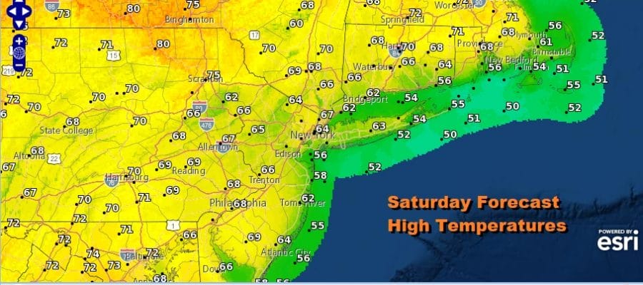
Most areas today will see highs in the 60s but there will be 70s as you head south toward Southern Pennsylvania south into Maryland and also north of NYC into interior New England. Along the immediate coast the wind off the ocean will keep temperatures in the 50s.
SATELLITE

Next comes a front that swings through Sunday morning. It looks like an arm that brings an area of showers. They should move in during the early morning hours Sunday and be done from west to east during the morning. However there will be more scattered showers around during the afternoon and evening with dry periods in between.

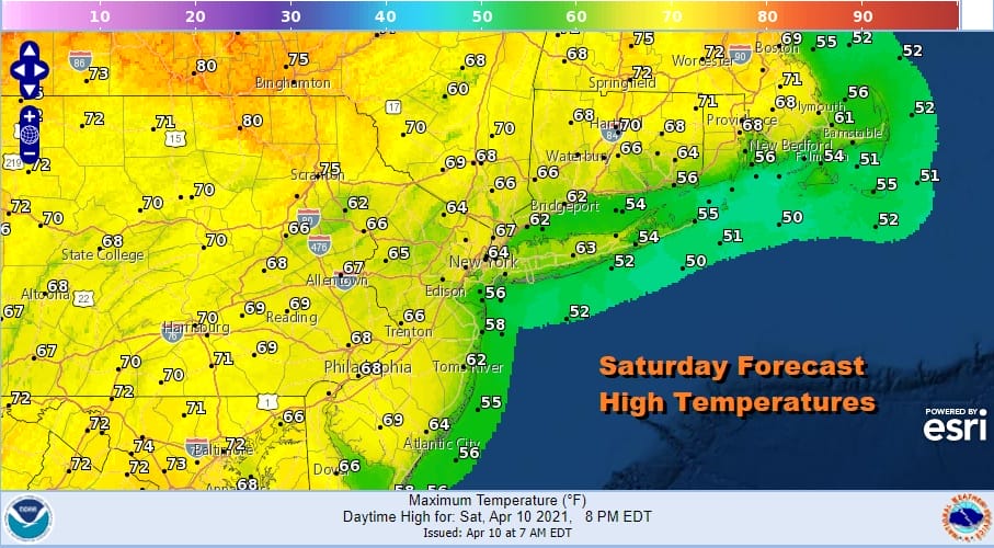
Sunday will be another day where temperatures will be hard to figure. South and west of NYC to Philadelphia, Baltimore and Washington and surrounding areas, temperatures will reach into the 70s while from NYC and Northern New Jersey north and east highs will be in the low to mid 60s at best due to more cloud cover.
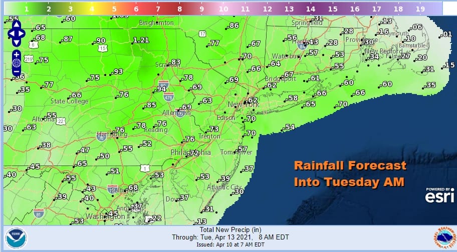
The new week brings clouds and on and off showers Monday Tuesday and Wednesday. No one system is strong. They all have areas of showers with them that at least into Tuesday morning don’t produce a lot of rain. From Sunday through Tuesday morning rainfall totals will average around a 1/2 to 3/4 inch and perhaps we might see the same from any showers that are around Tuesday into Wednesday. Temperatures Monday will be in the 50s from NYC north and east and 60s south and west. Most highs Tuesday and Wednesday will be in the 60s.
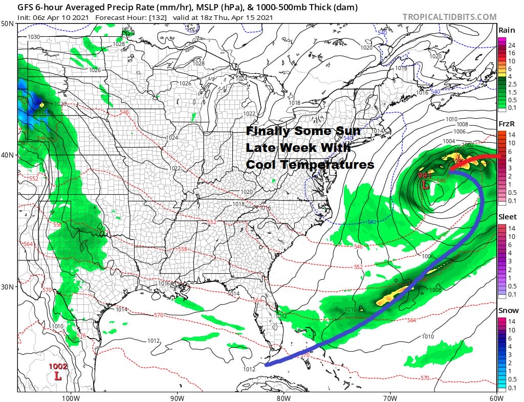
Wednesday’s system is likely to be the strongest of the bunch as low pressure moves southeast from the Great Lakes and redevelops offshore and moves east. The storms strengthens offshore and that allows for drier air to return to the Eastern US to finish off the week with sunshine and cooler than average temperatures.
BE SURE TO DOWNLOAD THE FREE METEOROLOGIST JOECIOFFI WEATHER APP &
ANGRY BEN’S FREE WEATHER APP “THE ANGRY WEATHERMAN!
MANY THANKS TO TROPICAL TIDBITS FOR THE USE OF MAPS
Please note that with regards to any severe weather, tropical storms, or hurricanes, should a storm be threatening, please consult your local National Weather Service office or your local government officials about what action you should be taking to protect life and property.


