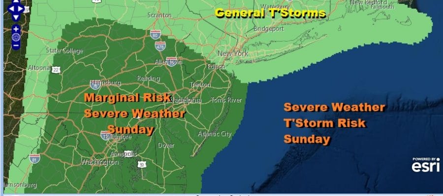
Severe Weather Risk Sunday Central New Jersey to Pennsylvania Southward

Weather in 5/Joe & Joe Weather Show Latest Podcast
Severe Weather Risk Sunday Central New Jersey to Pennsylvania Southward
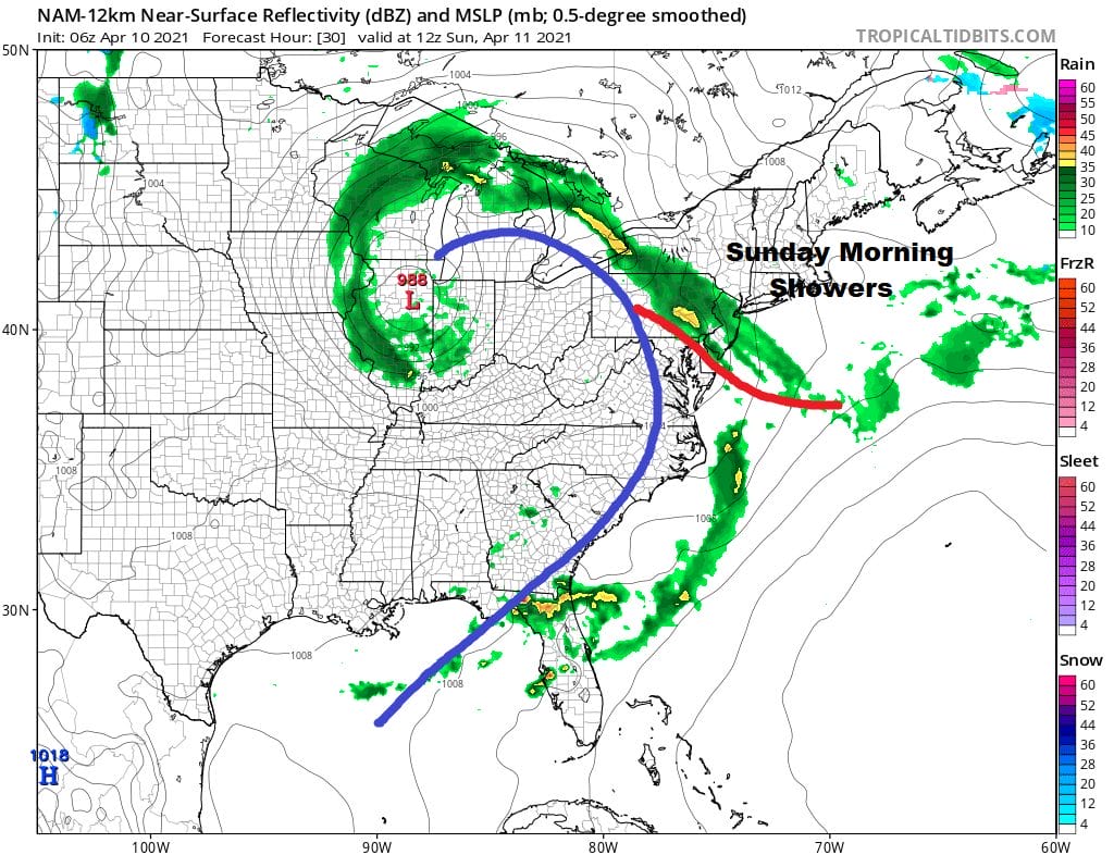
After an in and out sun kind of day (depending on location) and highs close to 70 in many areas inland, we are looking at more clouds to the south. Low pressure is heading for the Great Lakes and a front is lifting up from the southwest with more clouds and showers. Those showers will come in during the early morning hours Sunday and last into mid morning before ending from west to east.
SATELLITE

With clouds and those showers moving in, most lows tonight across the region will be in the low to mid 50s. Sunday morning sees the showers covering much of the area. The front will be moving northward and showers will start to end from south to north though east and north of NYC showers could linger into the afternoon.
This is going to create a wide spread in temperatures on Sunday. North and east of NYC clouds could be an issue all day and temperatures might not get out of the 50s. Meanwhile south and west of NYC the winds will go southwest and there could even be some sunshine breaking through the clouds. That will likely send highs in these areas into the 70s!

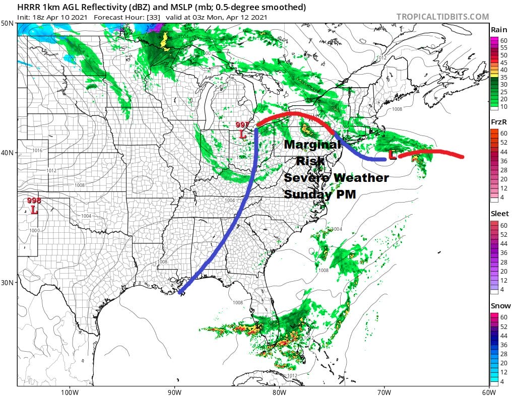
This could mean severe weather issues as low pressure moves east across the Ohio Valley and a cold front approaches. The Storm Prediction Center has added an area of marginal risk of severe weather into Central and Eastern Pennsylvania and in New Jersey south of Route 78.

The severe weather risk extends south into Virginia, Maryland, and Delaware. The HRRR model seems to pick up on this possibility for late Sunday into Sunday evening showing some thunderstorm clusters developing by evening.
While we do have risk for thunderstorms this is one of those situations where some see storms and others don’t so don’t be shocked if the evening winds up being rain free. We are going to see chilly air build down from Canada Monday and Tuesday while leaving a frontal boundary nearby. These leaves us in clouds and the chance for showers on Monday but not an all day rain by any means. Highs will be in the mid 50s to near 60. The chance for scattered showers continues on Tuesday with clouds around and highs just in the upper 50s and lower 60s. Low pressure develops to the southeast and brings a chance for rain or showers on Wednesday with most highs in the 50s. Weather conditions should improve for Thursday and Friday as the low moves away to the east but it will be in the chilly side of normal.
BE SURE TO DOWNLOAD THE FREE METEOROLOGIST JOE CIOFFI WEATHER APP &
ANGRY BEN’S FREE WEATHER APP “THE ANGRY WEATHERMAN!
MANY THANKS TO TROPICAL TIDBITS FOR THE USE OF MAPS
Please note that with regards to any severe weather, tropical storms, or hurricanes, should a storm be threatening, please consult your local National Weather Service office or your local government officials about what action you should be taking to protect life and property.


