Typhoon Lan Long Range Weather Pattern Eastern US
SHOP THE JOESTRADAMUS STORE
Typhoon Lan Long Range Weather Pattern Eastern US
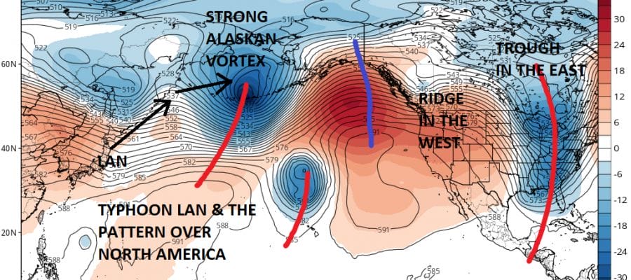
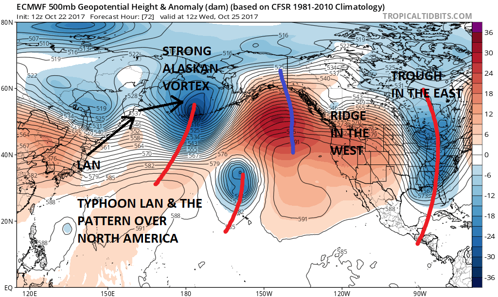
It isn’t often that we pay attention to typhoons in the Western Pacific but back in the winter of 2014-2015 two typhoons that recurved near Japan and headed toward the Gulf of Alaska were big players in the weather pattern over North America. Recurving typhoons in the Western Pacific can energize a strong storm in the Gulf of Alaska. This creates downstream effects with a strong ridge of high pressure aloft building in the Western US and in turn a deep trough in the Eastern US. Sometimes these typhoon recurvatures can create a weather pattern that can last a few weeks or more. In the case of 2015 it wound up lasting from mid January right until the end of March.
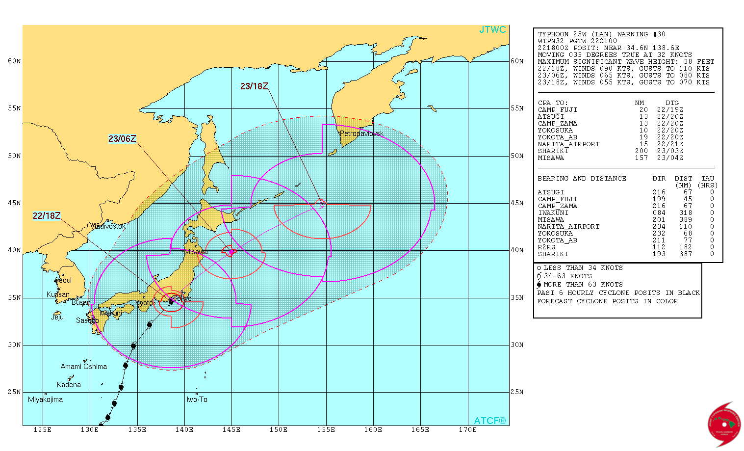
Typhoon Lan is making landfall near Tokyo right now with 105 mph winds. It will continue northeastward and become a strong extra tropical cyclone in the Northeast Pacific and head for the Bering Sea. From here models strengthen this upper low over Alaska which creates a strong ridge in the Western US and the corresponding deep trough in the Eastern US.
Whether this is a short term change or longer term remains to be seen however at least for the next 10 days or so this scheme seems to be locked in place. The other development closer to home is the situation in the Northwest Caribbean where pressures will be lower than normal later this week and next weekend. Right now on the satellite loop there is disturbed weather there but for the moment upper level conditions are not conducive for development.

We mention this because both the GFS & European model develop some sort of tropical system in the Northwest Caribbean next weekend and the European argues for some sort of coastal low early next week riding up the Eastern Seaboard. We are not ready to jump aboard that ship at the moment but it does offer some interesting possibilities going forward.
MANY THANKS TO TROPICAL TIDBITS FOR THE WONDERFUL USE OF THE MAPS
 GET JOE A CIGAR IF YOU LIKE

SHOP THE JOESTRADAMUS STORE
Weather App

Don’t be without Meteorologist Joe Cioffi’s weather app. It is really a meteorologist app because you get my forecasts and my analysis and not some automated computer generated forecast based on the GFS model. This is why your app forecast changes every 6 hours. It is model driven with no human input at all. It gives you an icon, a temperature and no insight whatsoever.
It is a complete weather app to suit your forecast needs. All the weather information you need is right on your phone. Android or I-phone, use it to keep track of all the latest weather information and forecasts. This weather app is also free of advertising so you don’t have to worry about security issues with your device. An accurate forecast and no worries that your device is being compromised.
Use it in conjunction with my website and my facebook and twitter and you have complete weather coverage of all the latest weather and the long range outlook. The website has been redone and upgraded. Its easy to use and everything is archived so you can see how well Joe does or doesn’t do when it comes to forecasts and outlooks.
Just click on the google play button or the apple store button on the sidebar for my app which is on My Weather Concierge. Download the app for free. Subscribe to my forecasts on an ad free environment for just 99 cents a month.
Get my forecasts in the palm of your hand for less than the cost of a cup of Joe!