Two Dry Days Before Cloudy Rainy Conditions
Begin Saturday Lasting Into Next Week

Two Dry Days Before Cloudy Rainy Conditions
Begin Saturday Lasting Into Next Week
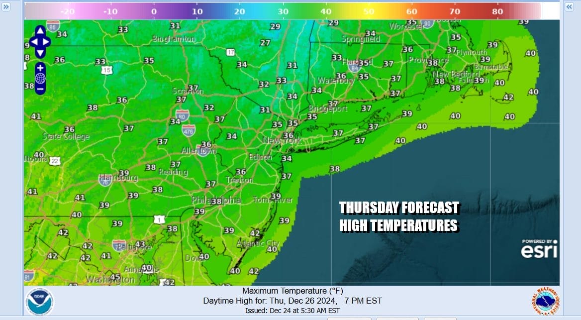
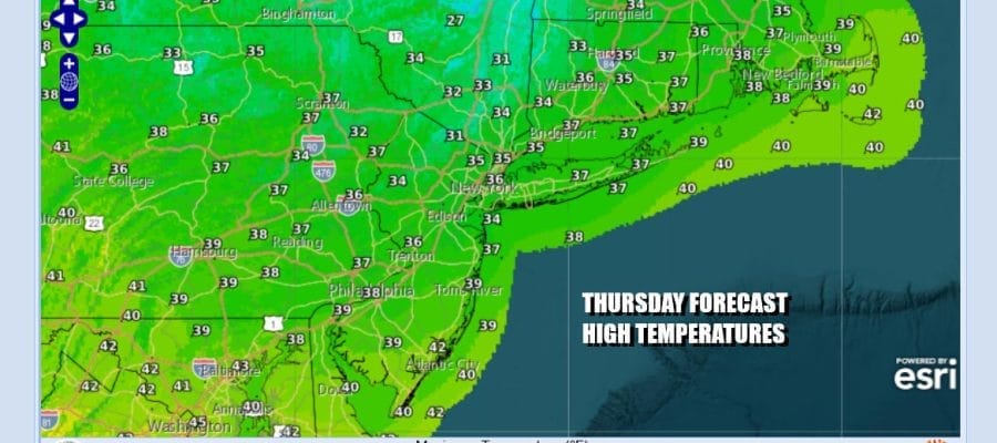
Today is the day after Christmas and better known as Boxing Day. It is also the 14th anniversary of one of the biggest post Christmas storms to impact Eastern Pennsylvania to Southern New England and has become known as the Boxing Day snowstorm which dumped 1 to 3 feet of snow in some places. Obviously we are not seeing anything like that today or anytime soon. We have high pressure along the East Coast built from New England to Georgia and that will bring no worse than partly sunny skies today. Most highs will be in the mid 30s to near 40 degrees. Radars along the East Coast are nice and quiet.
SATELLITE WITH LIGHTNING STRIKES

WEATHER RADAR

Meanwhile in parts of the South, particularly from East Texas to Louisiana as well as parts of Mississippi, Oklahoma, and Arkansas we have a developing low that will produce thunderstorms, severe weather risk, and elevated tornado risk late today into tonight. The Storm Prediction Center has indicated that there is up to a 5 percent tornado risk in the zone. We probably will see some tornado activity develop in this zone through remember these are very small scale features and it is not going to be a widespread severe weather event.

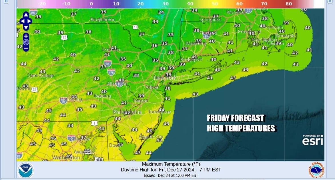
This lead system is ahead of a second area of low pressure that develops over the Southern Plains and heads to the Great Lakes over the weekend. Between these two system we are going to see weather conditions start to deteriorate over the weekend across the Northeast and Mid Atlantic states. Ahead of this Friday we will see no worse than partly sunny skies and highs will be mostly in the 30s.
An onshore flow develops Friday night and into the weekend so clouds will be rolling in. Saturday will be a dreary day with lots of clouds and there could be some patchy rain around, though we do not expect it to rain all day long. Temperatures will rise some, at least into the 40s though it could reach low 50s in South Jersey and points southward.

Sunday is likely to bring a more important weather front as low pressure heads to the Great Lakes. We expect to see showery rains to develop, particularly Sunday afternoon and lasting into Sunday night. This could be a significant rain producer of an inch or more. Sunday highs will reach the 50s in most locations. Look for rain Sunday night. We should see some improvement Monday into Tuesday, New Year’s Eve but another cold front could bring more showers Tuesday night before it turns colder behind the front. Longer term the pattern looks colder for the start of January and it may be a sustained cold pattern that develops across much of the Eastern and Southern US.
BE SURE TO DOWNLOAD THE FREE METEOROLOGIST JOE CIOFFI WEATHER APP &
ANGRY BEN’S FREE WEATHER APP “THE ANGRY WEATHERMAN!
MANY THANKS TO TROPICAL TIDBITS FOR THE USE OF MAPS
Please note that with regards to any severe weather, tropical storms, or hurricanes, should a storm be threatening, please consult your local National Weather Service office or your local government officials about what action you should be taking to protect life and property.


