Satellite pictures continue to show that disturbed weather in the Eastern Atlantic continues to get better organized and it seems likely that a tropical depression will be forming soon as the system continues to move slowly to the west.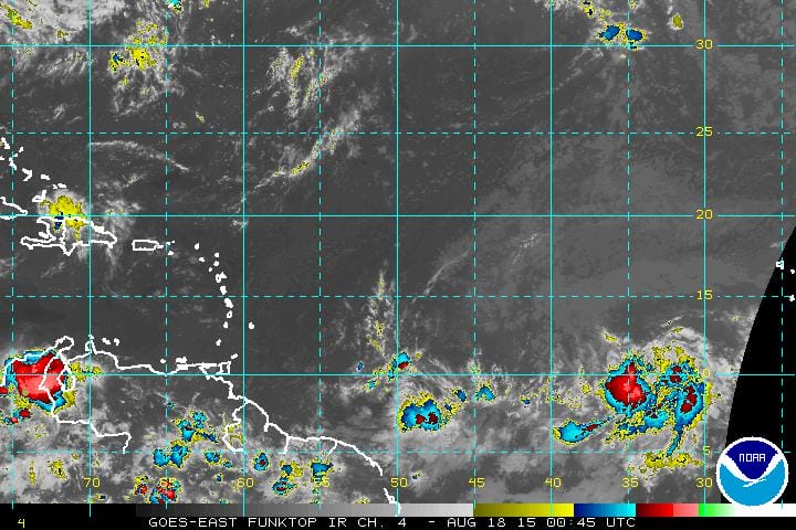 Looking at the satellite loop you can see 2 things. In the eastern Atlantic clouds are moving from east to west telling us that it is in a low shear environment which should allow continued development. But if you look at the system ahead of it near 50W the clouds there are being blown away to to the northeast which indicates a hostile environment to the west. Now it is a long way until the eastern Atlantic system gets to that area and there is no guarantee that the shear will still be there as the upper low responsible for that could weaken in time. This is something we will be watching over the next several days. We need to see if the overall upper air profile changes in the Atlantic as the tropical disturbance continues its track to the west. The National Hurricane Center gives this a 60 percent probability of tropical cyclone formation.
