Tropical Storm Watch North Carolina Maria 105 MPH Winds Moving North
SHOP THE JOESTRADAMUS STORE

Tropical Storm Watch North Carolina Maria 105 MPH Winds Moving North
…TROPICAL STORM AND STORM SURGE WATCHES ISSUED FOR A PORTION OF
THE COAST OF NORTH CAROLINA…
SUMMARY OF 500 PM EDT…2100 UTC…INFORMATION
———————————————-
LOCATION…29.4N 73.0W
ABOUT 425 MI…685 KM SSE OF CAPE HATTERAS NORTH CAROLINA
MAXIMUM SUSTAINED WINDS…105 MPH…165 KM/H
PRESENT MOVEMENT…N OR 350 DEGREES AT 9 MPH…15 KM/H
MINIMUM CENTRAL PRESSURE…941 MB…27.79 INCHES
WATCHES AND WARNINGS
——————–
CHANGES WITH THIS ADVISORY:
A Tropical Storm Watch has been issued for the coast of North
Carolina from Surf City northward to the North Carolina/Virginia
border, including the Albemarle and Pamlico Sounds.
A Storm Surge Watch has been issued for the coast of North Carolina
from Cape Lookout northward to Duck.
SUMMARY OF WATCHES AND WARNINGS IN EFFECT:
A Tropical Storm Watch is in effect for…
* Surf City northward to the North Carolina/Virginia border
* Albemarle and Pamlico Sounds
A Storm Surge Watch is in effect for…
* Cape Lookout to Duck
SATELLITE LOOP

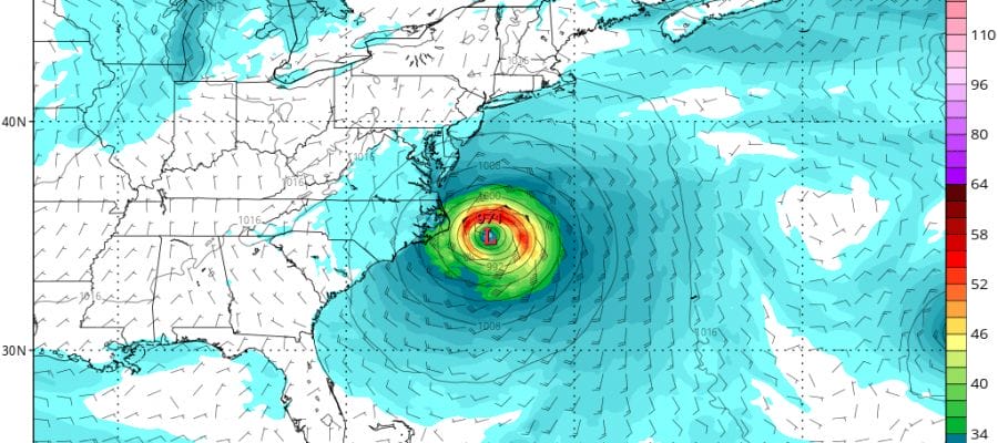
Hurricane Maria continues on a course slighty north of due west off the Florida East Coast and it looks like it will make a close pass to the Outer Banks of North Carolina. The core of the hurricane will remain offshore barring a last minute small shift to the west. Maria’s pressure has fallen to 942 mb but the winds have not increased as the system is rather large in size. For example compared to Hurricane Lee which is miniscule, Maria’s gales go out over 200 miles to the east and 150 miles to the west. Lee’s gales only go out 30 nautical miles which is basically the size of a rural zip code.
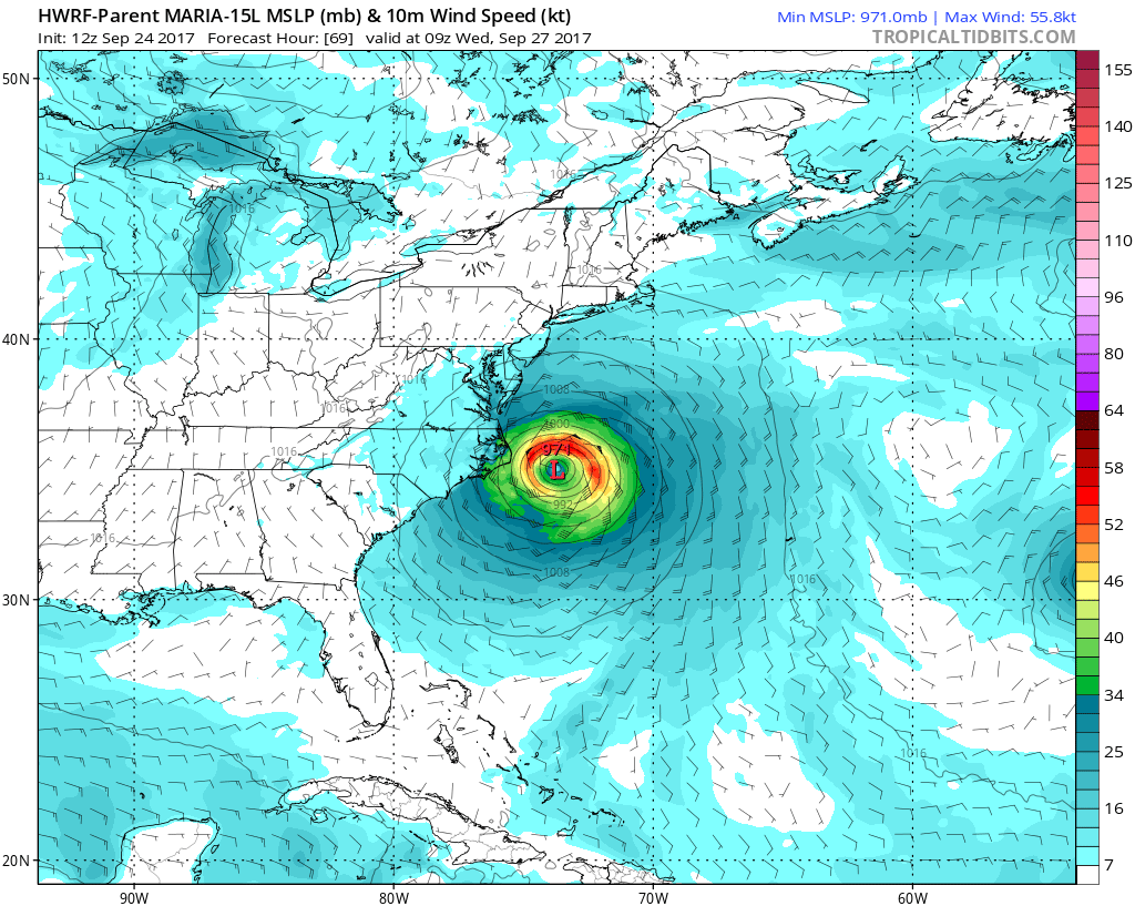
Weather models have been doing some flpping around today. The GFS which has been the furthest west of all the models is now further east. The HWRF yesterday was the furthest east of all the models and it is now the most west of the bunch with the European model close to this. Bottom line is a close pass to the Outer Banks and the core of the hurricane should stay offshore.
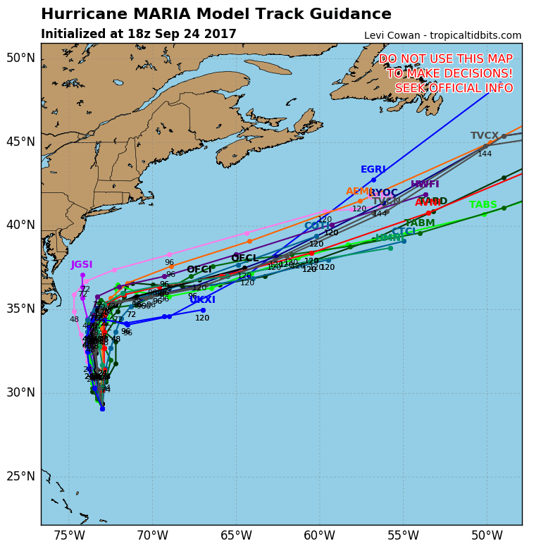
The hurricane tracking models are all pretty much the same with a sharp right turn to the East Northeast. The strengthening jet stream in the Northeast will drive Maria out to sea and put an end ot our ridiculously warm late summer in early fall weather.
NATIONAL HURRICANE CENTER ADVISORY
DISCUSSION AND 48-HOUR OUTLOOK
——————————
At 500 PM EDT (2100 UTC), the center of Hurricane Maria was located
near latitude 29.4 North, longitude 73.0 West. Maria is moving
toward the north near 9 mph (15 km/h), and this general motion with
some decrease in forward speed is expected through Tuesday. On
the forecast track, the core of Maria will move well east of
the southeast coast of the United States during the next day or so.
Maximum sustained winds are near 105 mph (165 km/h) with higher
gusts. Some fluctuations in intensity are possible during the next
24 hours, but gradual weakening is expected to begin by Monday night
or Tuesday.
Maria is a large hurricane. Hurricane-force winds extend outward up
to 60 miles (95 km) from the center and tropical-storm-force winds
extend outward up to 230 miles (370 km).
The latest minimum central pressure estimated from NOAA
reconnaissance aircraft data is 941 mb (27.79 inches).
FiOS1 News Weather Forecast For Long Island
FiOS1 News Weather Forecast For New Jersey
FiOS1 News Weather Forecast For Hudson Valley