Tropical Storm Warnings Florida West Coast & Keys Elsa Crossing Western Cuba

Weather in 5/Joe & Joe Weather Show Latest Podcast
Tropical Storm Warnings Florida West Coast & Keys Elsa Crossing Western Cuba
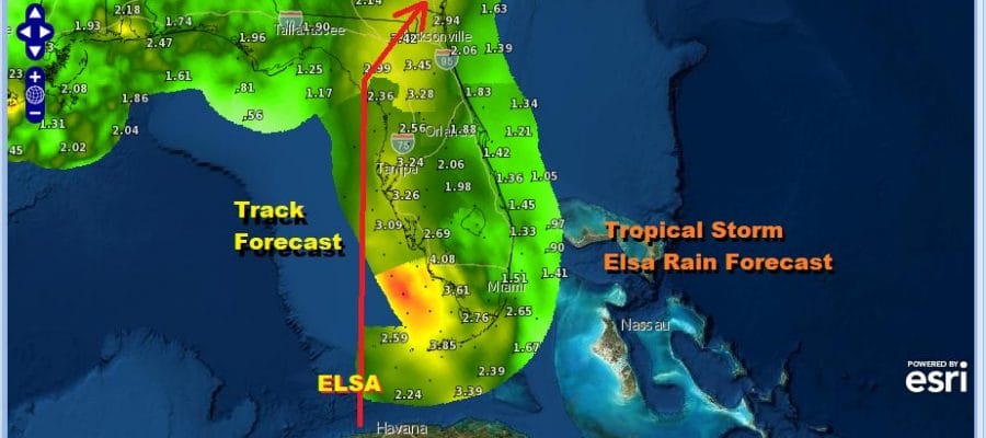
Tropical Storm Elsa continues to move northwestward and is in the process of crossing West Central Cuba. It will emerge into the Florida Straits tonight and then is forecast to move just west of Key West Florida Tuesday morning. The cloud structure on the satellite has a rather ragged look to it and this storm remains “tilted” to the east. The mid level center is to the east of the low level center which has been in issue with this storm for days. This has prevented any organization much beyond tropical storm strength in the last two days.
SATELLITE

Rain bands from Elsa are approaching the Florida Keys and the “core” such as it is can be now seeing at the bottom of the radar loops coming into view. Look for radar activity to increase this afternoon and tonight we will be able to see the circulation clearly on the southeast regional radar as well as the Key West radar.
KEY WEST FL WEATHER RADAR


SUMMARY OF 1100 AM EDT…1500 UTC…INFORMATION
———————————————–
LOCATION…21.5N 81.2W
ABOUT 20 MI…35 KM ESE OF CAYO LARGO CUBA
ABOUT 140 MI…225 KM SSE OF HAVANA CUBA
MAXIMUM SUSTAINED WINDS…65 MPH…100 KM/H
PRESENT MOVEMENT…NW OR 310 DEGREES AT 14 MPH…22 KM/H
MINIMUM CENTRAL PRESSURE…1006 MB…29.71 INCHES
The Tropical Storm Warning along the west coast of Florida has been
extended northward to the Suwannee River, including Tampa Bay.
The Storm Surge Watch along the west coast of Florida has
been extended northward to the Ochlockonee River.
The Tropical Storm Watch along the coast of the Florida panhandle
has been extended westward to Indian Pass, Florida.
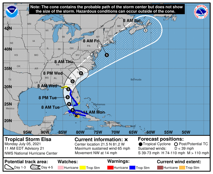
The latest forecast track from the National Hurricane Center shows Elsa straddling the west coast of Florida just offshore and then making landfall along the Florida Coastal Bend early Wednesday. From there it rides up I-95 exiting offshore near Southeast Virginia or Northeastern North Carolina sometime on Thursday.
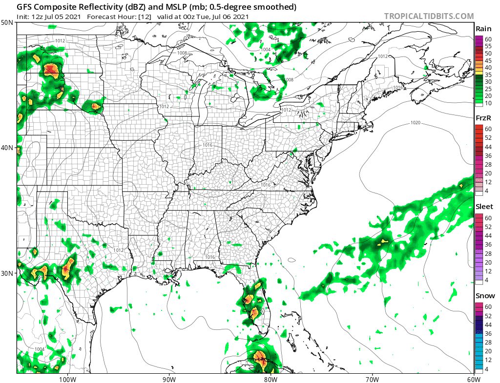
While the NHC track is offshore east of New Jersey and south of Long Island the new run of the GFS has other ideas as it tracks the low representing Elsa north northeast just inland of the coast. This is due to the next upper trough hanging back over the Great Lakes and creating an opening for a more northerly course. It is the first of the models to pick up on this possibility and it will enhance rains late this week from a cold front and thunderstorms that we will get regardless. More on this with our latest video on Youtube.
BE SURE TO DOWNLOAD THE FREE METEOROLOGIST JOE CIOFFI WEATHER APP &
ANGRY BEN’S FREE WEATHER APP “THE ANGRY WEATHERMAN!

MANY THANKS TO TROPICAL TIDBITS & F5 WEATHER FOR THE USE OF MAPS
Please note that with regards to any severe weather, tropical storms, or hurricanes, should a storm be threatening, please consult your local National Weather Service office or your local government officials about what action you should be taking to protect life and property.


