Tropical Air Returns Fred Spreading Rains Northeastward Through Appalachians

Weather in 5/Joe & Joe Weather Show Latest Podcast
Tropical Air Returns Fred Spreading Rains Northeastward Through Appalachians
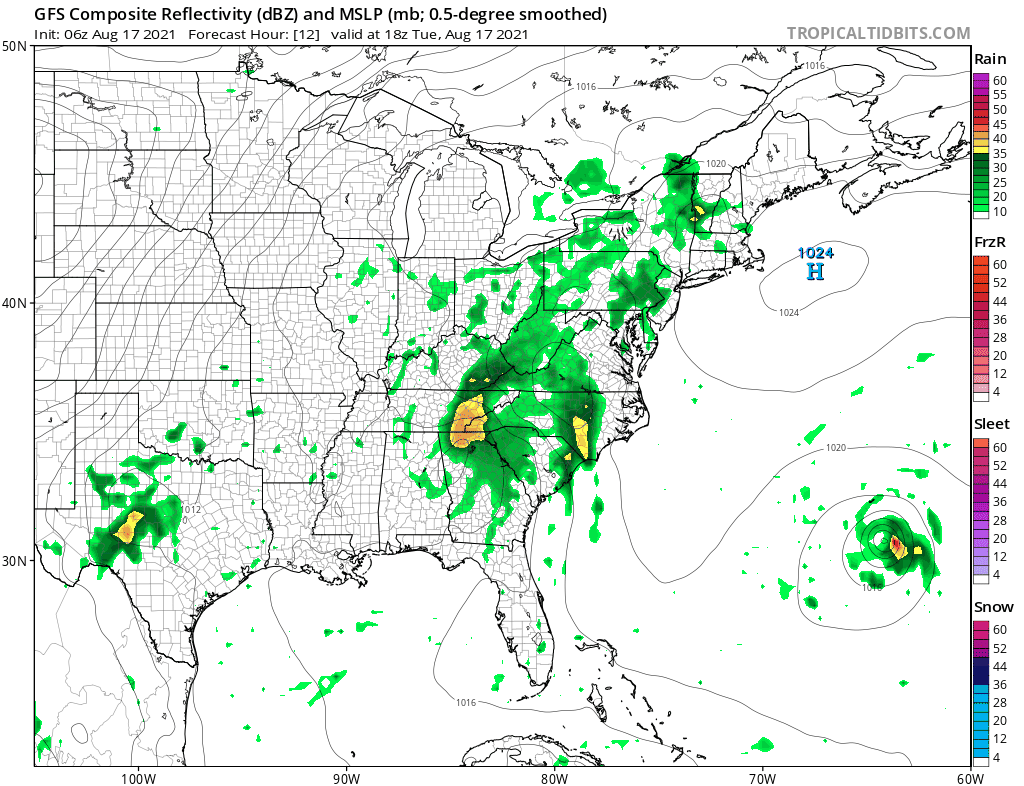
We are watching tropical air making a northward push up the East Coast. A warm front lies to our south and that front will eventually find its way into upstate NY and New England. Clouds have taken over with a small exception along the coastline where they are taking a little more time to get there but they will. Waves of showers and downpours are in our future for the next several days and perhaps into the weekend. Tropical Storm Fred is now a depression as it continues to weaken. It is the swirl on the lower left of the satellite and it is bringing heavy rains to Northern Georgia and up the Southern Appalachians today. That rain heads northeast tonight and Wednesday.
SATELLITE

Warm frontal showers and a few heavier downpours are moving into upstate NY. Another wave follows late today into tonight with the bulk of the shower activity inland. Temperatures today will be in the 70s to near 80 degrees. Winds will be onshore until the warm front passes.
WEATHER RADAR


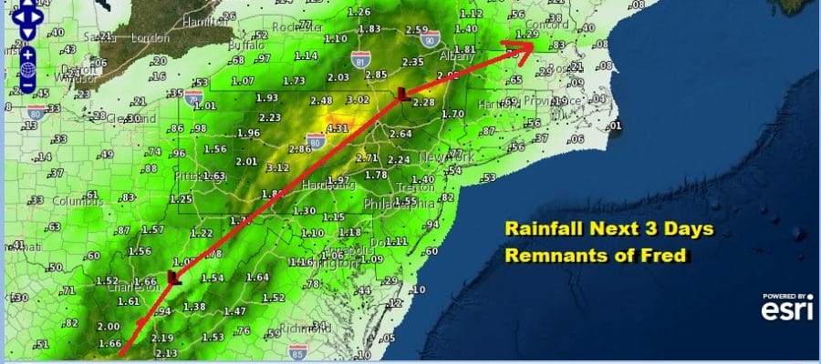
The bulk of the heavier downpours with the remnants of Fred will pass west of the coast. Basically if you are west and northwest of I-95 you will see heavier rainfall amounts. The potential for flash flooding lies probably along and west of the I-81 corridor in Pennsylvania where several inches or more of rain is likely. The heaviest rainfall over the next several days will lie just north and west of the track of the remnant low of Fred.
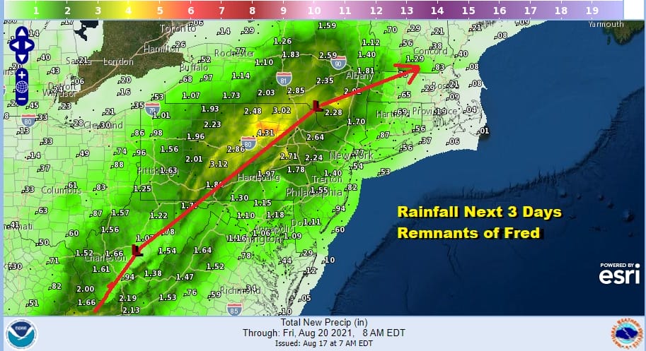
Here is a close up view of rainfall amounts for Eastern Pennsylvania to Southern New England. Notice the coastal amounts are far less than the inland amounts and this happens when a tropical system takes a track well inland in the mountains.

While there will be waves of rain coming up from the southwest through at least Friday, there will be dry periods in between. It will certainly not be continuous as the GFS shows they come and they go. The forecast approach is to forecast generally cloudy skies. Some areas near the coast could occasionally get some self destruct breaks of sun. It will be very humid as tropical air saturates the atmosphere. Temperatures will be reaching into the 80s each day Wednesday through Friday.
The weekend will put us back in the typical August weather flow with afternoon scatterered downpours or thunderstorms with clouds and sun and highs in the 80s. Offshore the GFS is picking up on Tropical Storm Henri which it drifts westward and further west than previous runs before it turns northward up the coast and offshore. We mentioned yesterday on Weather in 5 that this outcome was possible where Henri will somehow meander closer to the coast and this might create some surf and tidal issues over the weekend. This run does bring Henri rather close to Cape Cod. It should be noted that this model stands alone with its track well to the left (west) of the others. For now we will lay it aside and see where today’s model runs take us.
BE SURE TO DOWNLOAD THE FREE METEOROLOGIST JOE CIOFFI WEATHER APP &
ANGRY BEN’S FREE WEATHER APP “THE ANGRY WEATHERMAN!

MANY THANKS TO TROPICAL TIDBITS & F5 WEATHER FOR THE USE OF MAPS
Please note that with regards to any severe weather, tropical storms, or hurricanes, should a storm be threatening, please consult your local National Weather Service office or your local government officials about what action you should be taking to protect life and property.


