Thunderstorms Moving Through With Cold Front Usher in a Sunny Weekend

Thunderstorms Moving Through With Cold Front Usher in a Sunny Weekend

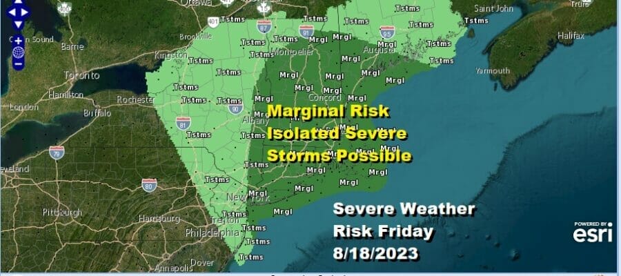
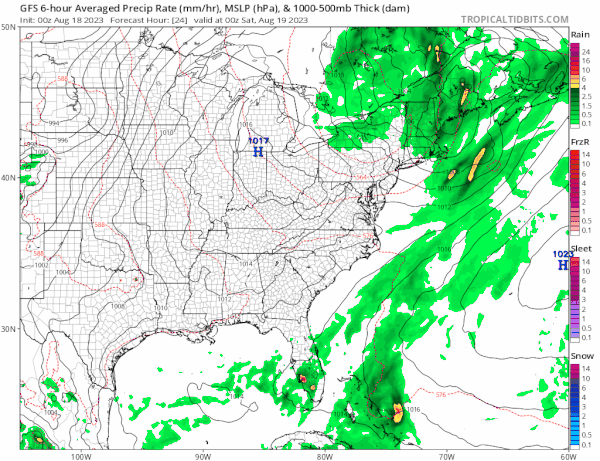
A line of thunderstorms is moving from west to east across New Jersey and the Catskills and Hudson Valley this morning, heading east into New England later this morning and this afternoon so this is an area of moving severe weather risk as we go through the day. Thunderstorms will move through and then weather conditions will improve from west to east later today. Marginal risk covers much of Southern and Southeastern New England, Long Island and NYC but the risk diminishes from west to east as the day wears on.
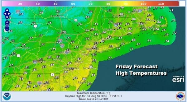
This cold front ushers in the arrival of a dry aor mass from Canada, the Great Lakes and Ohio Valley. Dew points will drop during this afternoon as temperatures top in the 80s and humidity levels come way down. Look for decreasing clouds and perhaps some developing sunshine from west to east during this afternoon.
SATELLITE WITH LIGHTNING STRIKES

WEATHER RADAR

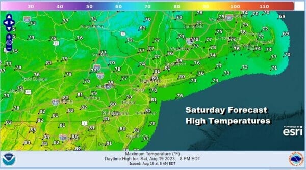
Skies should clear out nicely tonight and lows by morning will be in the mid 50s to lower 60s. Saturday looks to be a very nice day of sunshine and very low humidity. Dew points will be in the lower 50s and in some places in the upper 40s. Temperatures Saturday will top out in the pleasant upper 70s and lower 80s with no issues other than some passing clouds from time to time.
The core of the dry air mass will be overhead Saturday and then this high pressure cell will settle offshore. Sunday winds go mostly west and that will allow temperatures to rise rather quickly. Sunday will be a sunny day and highs will reach the mid to upper 80s. However dew points will be slower to rise to it should still be reasonably comfortable Sunday afternoon.
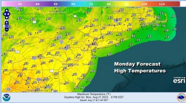
Monday looks to be the one hot day next week as the high is to the south and a west wind heats things up. Also we have a cold front that will be moving quickly southeastward from the Great Lakes and Eastern Canada. That front looks to pass through Monday night with nothing more than a shower or thunderstorm (if that). As to the daytume Monday it will be hot, more humid, and we will have sunshine with highs in the upper 80s and lower 90s.
The hot weather will be a one day affair as this cold front pushes south and high pressure builds across Southeastern Canada and New England for much of next week. This will put us in a northeast flow of somewhat cooler air. Tuesday will be one of those days where the further north you go, the cooler it will be.

If you are north of NYC in the Hudson Valley to Southern New England and points north and east, highs will be in the upper 70s to near 80. If you are south of Philadelphia and Southern New Jersey southward, highs will be in the mid 80s to near 90 until the cold front gets far enough south. Much of next week temperatures will finish below average thanks to the northeast flow that will probably be with us for much if not all of next week. Im not looking for the onshore flow to be problematic at the moment.
BE SURE TO DOWNLOAD THE FREE METEOROLOGIST JOE CIOFFI WEATHER APP &
ANGRY BEN’S FREE WEATHER APP “THE ANGRY WEATHERMAN!
MANY THANKS TO TROPICAL TIDBITS FOR THE USE OF MAPS
Please note that with regards to any severe weather, tropical storms, or hurricanes, should a storm be threatening, please consult your local National Weather Service office or your local government officials about what action you should be taking to protect life and property.
(Amazon is an affilate of Meteorologist Joe Cioffi & earns commissions on sales.)


