Thunderstorm Possibility Evening Sunny Thursday
Thunderstorm Possibility Evening Sunny Thursday
We have an upper air disturbance moving through this evening and it is not very strong. However it is strong enough to produce a few pop up showers and thunderstorms and we are seeing a few dotting the radars as they move to the east. There is the chance for a pop up downpour or thunderstorm this evening in a few spots but most will probably miss out. Once that disturbance goes by skies should clear out and we will have a nice cool night ahead with temperatures in the mid 50s to lower 60s on average. There are no weather issues for Thursday which looks mostly sunny with highs in the low to mid 80s away from the ocean.
SATELLITE LOOP

REGIONAL RADAR

LOCAL RADAR NEW YORK CITY

Some of those pop up thunderstorms are showing up on both the New York City and Philadelphia radars but as you can see they are few and far between.
LOCAL RADAR PHILADELPHIA


Friday it turns more humid as a cold front approaches. Tropical moisture from Tropical Storm Cindy attempts to get involved with this front. Most weather models would suggest the chance for passing showers or a thunderstorm Friday and Friday night. I think the best chances for showers on Friday dayside will be west of the coast but I can’t guarantee this. Showers and thunderstorms will be running around Friday night.
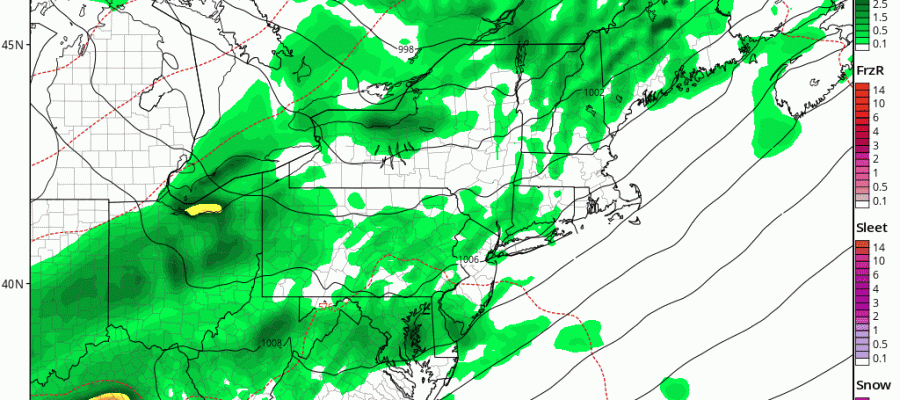
GFS MODEL FRIDAY NIGHT AND SATURDAY SHOWERS THUNDERSTORM
CLICK TO ANIMATE

The GFS model is rather bullish on some of Tropical Storm Cindy’s rain getting in here late Friday night and Saturday morning. The European is a little less bullish but still has some residual showers here Saturday morning which I think I will cover for in the forecast. Weather conditions should improve by Saturday afternoon. Sunday will be a very nice mostly sunny day with highs in the upper 70s and lower 80s with comfortable humidity.
 GET JOE A CIGAR IF YOU LIKE


