This Could Be The Last 90 Degree Day of the Summer, Cooler Pattern This Week

This Could Be The Last 90 Degree Day of the Summer, Cooler Pattern This Week
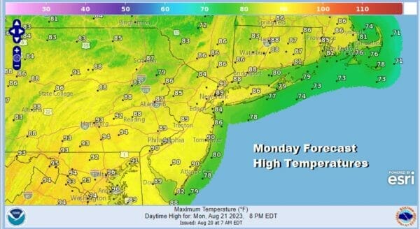
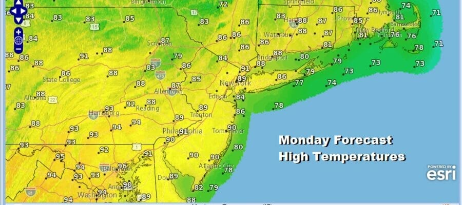
This has been an interesting summer and for some, a disappointing summer. Yes we still have another month to go before fall officially arrives but we are the the point now where average highs and lows are past the seasonal peak and are now slowly declining . As each day passes, getting to 90 degrees for a high becomes more and more difficult especially in the pattern we are in. The steepness of that decline accelerates in September. There have not been many hot days and stringing 3 days in a row of 90 degree plus highs (definition of a heatwave in our area of the Northeast) have been hard to come by. It seems given the persistent pattern of troughs in the East, if you havent had a 3 day or more heat wave by now, it is probably not going to happen. That leaves us with today which will be the one hot day of the next 7 or 8 with sunshine taking highs to the upper 80s to some lower 90s.
SATELLITE WITH LIGHTNING STRIKES

WEATHER RADAR

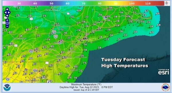
Yes the dew points will be coming up today tp between 65 and 70 and yes it will be more uncomfortable but an approaching cold front will put and end it that tonight. There could be a scattered shower or thunderstorm with the passage of that front this evening into tonight but any thunderstorms will be few and far between. The best chances for a shower or thunderstorm will be in Southern and Southeastern New England.
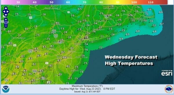
Once this front passes we have another dry air mass moving southeast from Canada that will build into the Northeast and Northern Mid Atlantic states for Tuesday and Wednesday. Dew points will be back in the low and middle 50s both days making it very comfortable. Both days will be sunny or at least no worse than partly sunny. High temperatures will be in the cool upper 70s and lower 80s.
Thursday brings in the next round of changes with a warm front/cold front combination. This brings arriving clouds, humidity levels going up, and the chance we could see a few scattered showers or a thundertorm. Highs will still be in the upper 70s to lower 80s thanks to more clouds. Later Thursday night and Friday a cold front will bring some showers and a few thunderstorms. Highs Friday will be in the low to a few middle 80s. However as that front passes east, another dry cool air mass will build in for late Friday and the weekend. This high is actually quite strong and it will leave us with highs in the 70s at best over the weekend. For now we will go with sunshine Saturday and perhaps some sunshine Sunday. The flow will be onshore northeast and there is some question whether the long fetch from the Canadian Maritime Provinces to the Mid Atlantic will bring in low clouds at some point. That is a late week forecast problem. Enjoy your Monday and the week ahead.
BE SURE TO DOWNLOAD THE FREE METEOROLOGIST JOE CIOFFI WEATHER APP &
ANGRY BEN’S FREE WEATHER APP “THE ANGRY WEATHERMAN!
MANY THANKS TO TROPICAL TIDBITS FOR THE USE OF MAPS
Please note that with regards to any severe weather, tropical storms, or hurricanes, should a storm be threatening, please consult your local National Weather Service office or your local government officials about what action you should be taking to protect life and property.
(Amazon is an affilate of Meteorologist Joe Cioffi & earns commissions on sales.)


