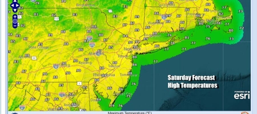
The Weekend Brings Mostly Dry Conditions Humidity Inches Higher,
Next Week Brings Multiple Rain Chances

The Weekend Brings Mostly Dry Conditions Humidity Inches Higher,
Next Week Brings Multiple Rain Chances

The latest shot of dry air from Canada was a quick one and we will see the humidity levels slowly rise this weekend. However we are not going back to the extreme levels of last week. It will still be reasonable this weekend weatherwise. Clouds are streaming up from the southwest but not enough to get rid of the sun completely. Look for partly sunny skies today with most highs in the middle to upper 80s. Temperatures of course will be a little cooler at shore locations.
SATELLITE WITH LIGHTNING STRIKES

WEATHER RADAR

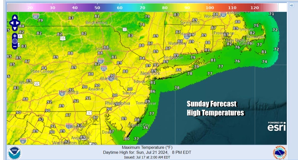
The dewpoints creeping higher and a little bit of instability might set off a few scattered showers or perhaps a thunderstorm later today. Much of that activity if it happens will be inland and most of you won’t see much out of them other than an increase in cloud cover. We will leave the risk for a shower or thunderstorm in the forecast for overnight and then go back to partly sunny skies for Sunday with highs again in the mid to upper 80s with cooler temperatures at the shore.
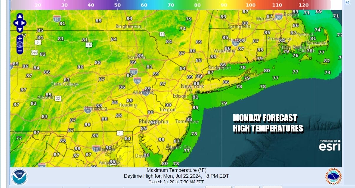
The upper flow is turning more southerly as we head into next week and there is moisture across much of the South and Southeast US. Showers and thunderstorms will be an issue in the Deep South as well as the Carolinas. The southerly flow will bring moisture and weather systems northeastward. This means there will be rain chances next week from time to time with the first chance late Monday afternoon into Monday night.

The moist southerly flow brings up higher humidity and dew points will be back into the 70s in most of Eastern Pennsylvania to Southern New England. At least this time around they won’t be coming with extreme temperatures. Monday will start partly sunny but we will look for the chance for some showers or a thunderstorm late in the day into Monday night. Highs Monday will be in the upper 80s and lower 90s.
Tuesday will be a very warm and very humid day with some sunshine but we see a solid chance for rain and thunderstorms late Tuesday into Wednesday morning as a more robust disturbance moves northeastward up the east side of the Appalachians. Tuesday highs will be in the mid to upper 80s as will high temperatures for Wednesday and Thursday where we see lingering chances for downpours or a thunderstorm. Be advised that much of the time this week it will not be raining so there are no real washouts along the way.
BE SURE TO DOWNLOAD THE FREE METEOROLOGIST JOE CIOFFI WEATHER APP &
ANGRY BEN’S FREE WEATHER APP “THE ANGRY WEATHERMAN!
MANY THANKS TO TROPICAL TIDBITS FOR THE USE OF MAPS
Please note that with regards to any severe weather, tropical storms, or hurricanes, should a storm be threatening, please consult your local National Weather Service office or your local government officials about what action you should be taking to protect life and property.
(Amazon is an affilate of Meteorologist Joe Cioffi & earns commissions on sales.)


