Humidity Edging Higher Week Ahead With Rain Chances Along The Way

Humidity Edging Higher Week Ahead With Rain Chances Along The Way

Humidity levels have been creeping higher since Saturday and we are going to be back in the soup for today as well as the week ahead. We will also be dealing with a series of waves moving around the Bermuda high. It is building into the Southeastern US. A southwest flow aloft is bringing up ripples in the flow. It will not be raining all the time but there will be some downpours and a few heavier thunderstorms to deal with during the week ahead.
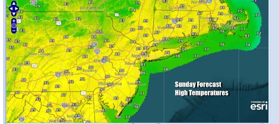
Today does look to be a shower free day across Eastern Pennsylvania to Southern New England. Skies should be no worse than partly sunny. Highs today will reach the mid to upper 80s. Dew points will be in the middle 60s which is humid but not oppressively so. We expect to see the radars mostly free and clear of any showers. Temperatures will be a little cooler at the shore as local sea breezes keep temperatures lower especially at area beaches.
SATELLITE WITH LIGHTNING STRIKES

WEATHER RADAR

Tonight and Monday dew points will rise to near 70 or so which is very uncomfortable. Warm and humid conditions are forecast tonight with most lows in the mid 60s to lower 70s. Monday will be a very warm to hot day with partly sunny skies. Late in the day the first of three waves of low pressure will be heading northeastward and we could see some downpours and thunderstorms coming up from the south during the late afternoon and into Monday night.
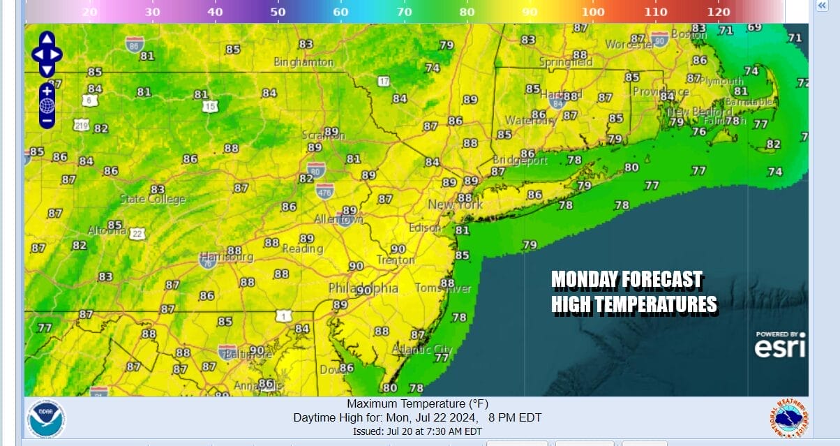
This first wave will move through Monday night and much of not all of the rain from this wave will be over by daybreak Tuesday. This will put us in a break period during the day with partly sunny skies and temperatures will be in the mid to upper 80s with high humidity. Temperatures again will be cooler along the shore.

The next wave of low pressure will approach Tuesday night and last through at least part of Wednesday. This will probably mean more clouds around for Wednesday and less in the way of any sunshine so temperatures will probably be a little lower but the humidity levels will remain high. Temperatures will likely top out in the low to mid 80s depending on how much sun we see. A third wave will approach Thursday with showers and some heavier thunderstorms with highs in the mid to upper 80s. This should be the last wave as the upper flow turns northwest. This should leave us with sunshine returning for Friday and next weekend is looking to be a dry very warm weekend. Daytime highs will be in the mid to upper 80s each day Friday through Sunday and nighttime lows will be in the mid 60s to lower 70s.
BE SURE TO DOWNLOAD THE FREE METEOROLOGIST JOE CIOFFI WEATHER APP &
ANGRY BEN’S FREE WEATHER APP “THE ANGRY WEATHERMAN!
MANY THANKS TO TROPICAL TIDBITS FOR THE USE OF MAPS
Please note that with regards to any severe weather, tropical storms, or hurricanes, should a storm be threatening, please consult your local National Weather Service office or your local government officials about what action you should be taking to protect life and property.
(Amazon is an affilate of Meteorologist Joe Cioffi & earns commissions on sales.)


