Humidity Up Through Thursday Rounds of Downpours
& Thunderstorms From Time To Time

Humidity Up Through Thursday Rounds of Downpours
& Thunderstorms From Time To Time
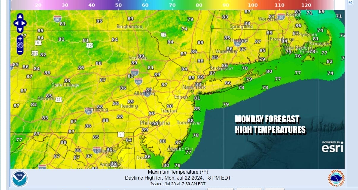
This is a week where we are dealing with a southwest flow in the upper atmosphere and a short wave trough in the Mississippi Valley. This creates an alley way for moisture to move up the East Coast and it will come in waves. The gfs model loop shows three such waves of moisture. Ahead of this today we are going to very warm to hot and humid with sunshine giving way to arriving clouds. Highs will be in the upper 80s to some lower 90s.
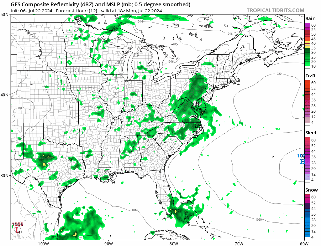
Satellite and radar loops show rain loading up over the Mid and South Atlantic states and clouds are streaming northeastward. We will see downpours and a few heavier thunderstorms begin to move into Southern New Jersey to Eastern Pennsylvania during the afternoon and then shift eastward to the rest of New Jersey, the Hudson Valley, NYC, Long Island and Southern New England this evening.
SATELLITE WITH LIGHTNING STRIKES

WEATHER RADAR

In this type of set up, severe thunderstorms are not an issue though there could always be the odd isolated cell. This will be more about rain and the potential for some heavy downpours. It should be noted that it doesn’t rain non stop for the next 4 days. The first wave will move out during tonight and most of the area should be drying up later tonight into Tuesday.

Tuesday dayside will be a break period so we will see partly sunny skies develop. Other than an odd downpour or thunderstorm, for most people most of the day will be rain free. Highs Tuesday will be in the mid to upper 80s. Then we have the second wave of downpours and thunderstorms that will develop from southwest to northeast Tuesday night and it will be gone for the most part by Wednesday morning.

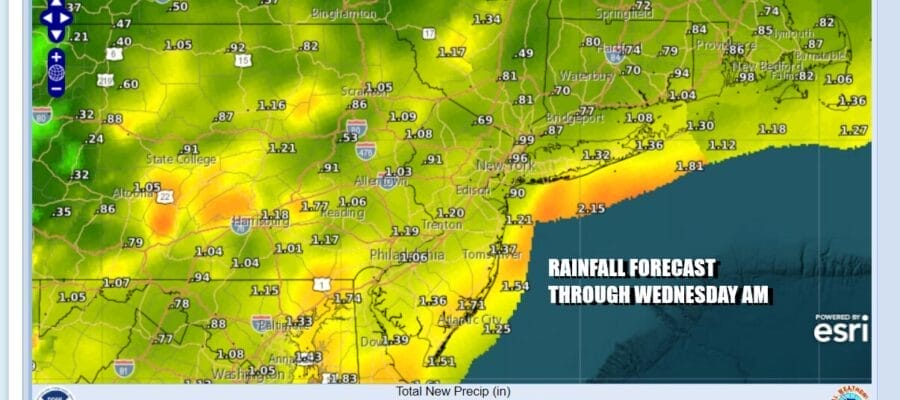
Rainfall amounts are forecast to be in a range of 3/4 inch to 1.25 inches for most Eastern Pennsylvania to Southern New England through Wednesday morning. However this is summertime and given the convective nature of the precipitation, some areas could wind up with higher amounts and sometimes it could be double the amount forecast.

Wednesday will be a cloudy to partly sunny day with the risk for scattered downpours and thunderstorms. Highs will be in the lower 80s for the most part. Thursday we see a cold front that will be approaching and this could set off some thunderstorms later in the day. Thursday highs will be in the 80s. Once the front passes we will see lower humidity arrive for Friday, Saturday and at least part of Sunday. However the air behind the front is not cool so we will likely see higher temperatures behind the front than ahead of it. The weekend does look to be a mostly rain free weekend.
BE SURE TO DOWNLOAD THE FREE METEOROLOGIST JOE CIOFFI WEATHER APP &
ANGRY BEN’S FREE WEATHER APP “THE ANGRY WEATHERMAN!
MANY THANKS TO TROPICAL TIDBITS FOR THE USE OF MAPS
Please note that with regards to any severe weather, tropical storms, or hurricanes, should a storm be threatening, please consult your local National Weather Service office or your local government officials about what action you should be taking to protect life and property.
(Amazon is an affilate of Meteorologist Joe Cioffi & earns commissions on sales.)


