Temperatures Moderate Quiet Next Week
With Another Blast of Bitter Air Thursday

Temperatures Moderate Quiet Next Week
With Another Blast of Bitter Air Thursday

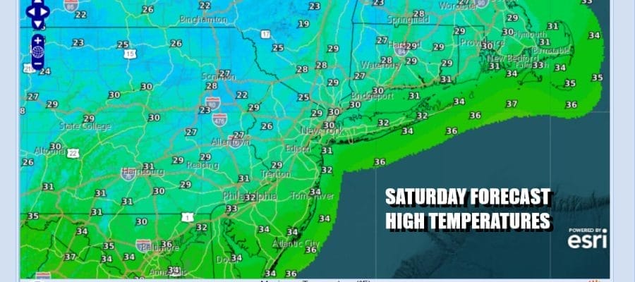
Weather maps are absent of any major storm systems today and for that matter, all of next week. Cold weather covers the Eastern US but we will see moderation set in for Sunday and early next week. As that warmer air arrives we may see some patchy clouds around today as the satellite loops show some clouds moving across the Great Lakes and into the Northeast US. There is little in the way of precipitation. Skies today should be no worse than partly sunny and after another very cold start in the teens to near 20, highs will reach the upper 20s and lower 30s.
SATELLITE WITH LIGHTNING STRIKES

WEATHER RADAR

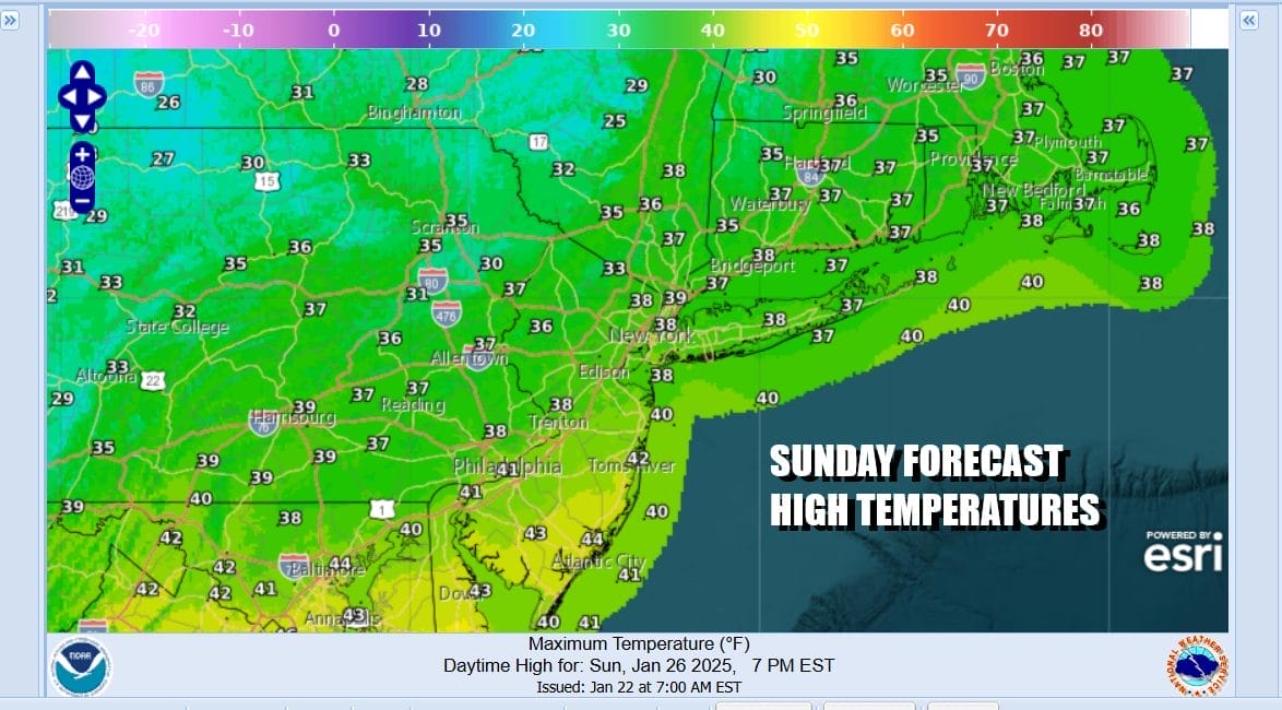
Tonight won’t be as cold and in fact it will be the first time in nearly a week where most areas bottom out in the relatively balmy 20s. That sets us up for a warmer Sunday. Westerly winds and some sunshine should take most highs to the upper 30s and lower 40s. The warmest readings will be in Southern New Jersey and points southward.
Next week will be about temperature volatility. The first have of the week will see temperatures a little above average and we will see two weather systems pass through. The first one Tuesday is a cold front. The second one will be Wednesday night into Thursday as low pressure looks to track to our north across Upstate NY and New England.
Behind the second weather system we will see what appears to be one last shot of bitter cold air coming for the end of next week. Once that plays through the pattern changes across the US to allow for a bit of a thaw to set in for later next weekend and beyond. Precipitation this coming week will be minimal across much of the Eastern US.
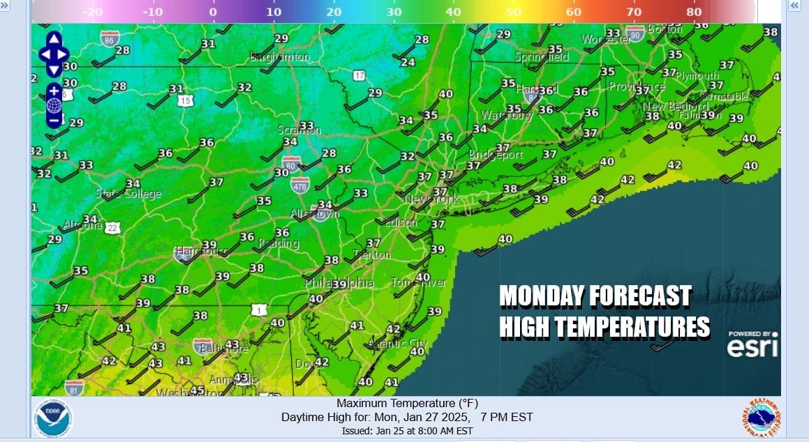
Monday and Tuesday we will probably see temperatures topping out in the upper 30s and lower 40s in most places and skies both days will be no worse than partly sunny. We see a chance for a snow shower or two Tuesday evening. There won’t be much change in temperature until the next low pressure system moves across New England. Then comes much colder air for Thursday and Friday and it will be back to single digits to near 10 by next Friday morning and day time highs just in the teens to lower 20s.
BE SURE TO DOWNLOAD THE FREE METEOROLOGIST JOE CIOFFI WEATHER APP &
ANGRY BEN’S FREE WEATHER APP “THE ANGRY WEATHERMAN!
MANY THANKS TO TROPICAL TIDBITS FOR THE USE OF MAPS
Please note that with regards to any severe weather, tropical storms, or hurricanes, should a storm be threatening, please consult your local National Weather Service office or your local government officials about what action you should be taking to protect life and property.


