Temperatures Dropping Backdoor Front Moving South Miserable Sunday Ahead
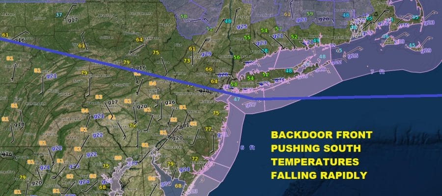
Temperatures Dropping Backdoor Front Moving South
Miserable Sunday Ahead
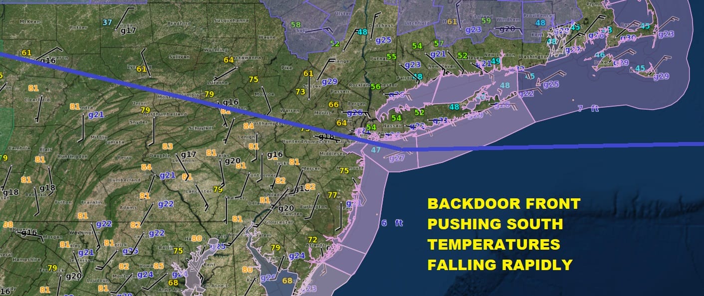
What a day it was with temperatures in the 80s across New Jersey and 70s in most areas from the Hudson Valley to Long Island and NYC. Now however the back door cold front is doing its dirty work as it moves southwestward. To the north of the front temperatures have dropped rapidly…some places seeing drops of 20 degrees or more in an hour. South of the front it is still in the lower 80s but that front will eventually make its way down to the Delmarva Peninsula so look for temperatures in Central and Southern New Jersey and Southeastern Pennsylvania to start dropping later this evening with an increasing northeast wind. Areas where the front has passed from Northeastern Pennsylvania to Northern New Jersey east to the Hudson Valley NYC Long Island and Connecticut will continue to see temperatures drop into the 30s in many areas by morning.
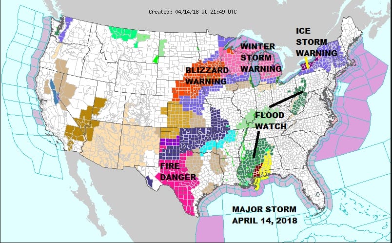
Winter Weather Advisories are posted for the Catskills as well as parts of the Hudson Valley north of Poughkeepsie and in Connecticut mainly north of Route 84 for the likelihood of freezing rain and sleet developing later tonight and on Sunday. You can see the extent of the impact of this major spring storm coming out of the Central Plains is huge. Ice Storm Warnings are posted for much of Western NY for tonight and Sunday and there could be some serious to severe icing conditions in this area westward back to Michigan. Blizzard warnings continue in the Central Plains and parts of the upper Midwest. Severe weather is moving across the Gulf States. Winter weather advisories are posted for much of NY State as well as western and central New England.
US SATELLITE

REGIONAL RADAR

Where the front has passed low clouds drizzle and light rain will being to move in from the east later tonight so look for radars to become a bit more active. Much of the steady precipitation this evening is well to the north and west but this will begin to shift southward overnight and on Sunday.
LOCAL RADAR NEW YORK CITY

LOCAL RADAR PHILADELPHIA


Sunday will be pretty much a miserable day. We don’t expect much rain but we will see annoying areas of light rain and drizzle on and off all day with temperatures just in the mid 30s to lower 40s.Areas in South Jersey and Southeastern Pennsylvania could be a bit warmer with highs mostly in the 40s likely. It seems that the 32 degree line could drop southward into Northwest New Jersey and Northeastern Pennsylvania north and east on Sunday and this will need to be watched in case it becomes cold enough for some freezing rain or sleet.
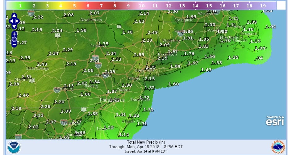
Sunday night into Monday afternoon as the storm pivots east and a cold front approaches look for heavy downpours to develop. 2 inches or more of rain seems likely and some urban flooding could occur. Also look for the chance for a few thunderstorms in the mix though they should not be severe. Weather conditions will start to improve from west to east late Monday. Monday’s temperatures should at least reach the 50s with some 60s likely Central and South Jersey southward while northern areas could still struggle. Tuesday looks dry and chilly with some sunshine and highs in the 50s.
 GET JOE A CIGAR IF YOU LIKE

FiOS1 News Weather Forecast For Long Island
FiOS1 News Weather Forecast For New Jersey
FiOS1 News Weather Forecast For Hudson Valley


