Temperatures 30 to 40 Degrees Cooler With Some Rain
We are experiencing a big change from yesterday’s record highs and all time record highs for October. Temperatures are 30 to as much as 40 degrees cooler from mid 90s to mid 50s in some areas. A cold front is stalled across Maryland and Northern Virginia which is creating an onshore flow. It also puts much of our area in lots of clouds and some overrunning. We have seen some on and off rain overnight and that will continue through today into tonight. We aren’t going to get a lot of rain from this and if we are lucky it will be on the order of a quarter to a half inch…maybe a few spots get a bit more in some heavier showers. Otherwise it will at least have time to soak in rather than run off.
SATELLITE

REGIONAL RADAR

You can see the rain on the regional radar is on the blotchy side though there is a solid area moving southeast from Western NY and Northern Pennsylvania. This should be sliding through the area from Northern New Jersey to Long Island. The rain seems to be lining up in a narrow band so there is less if you go both north and south. Many areas today will see temperatures not out of the 50s.
LOCAL RADAR NEW YORK CITY

LOCAL RADAR PHILADELPHIA


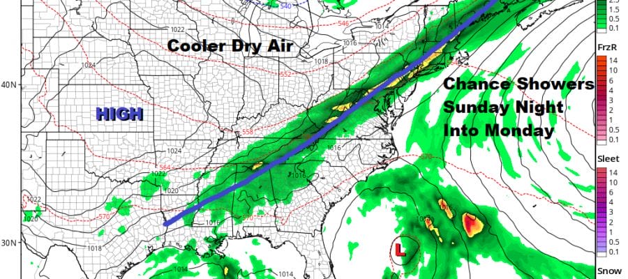
There is a second low that is moving eastward out of the Great Lakes which will be passing offshore overnight with another cold front sweeping south and east and taking all of this out to seas. Some showers tonight will come to an end during the early morning hours. Then we see developing sunshine for Friday with a gusty wind and temperatures in the 60s. Friday night into Saturday morning it will be quite cool with most lows in the 30s away from warmer urban centers and we could see some areas of frost Saturday morning in parts of Northwest New Jersey northward into the Hudson Valley and Connecticut.
Saturday looks nice and sunny and a good apple pumpkin picking kind of day. Highs will be just into the 60s. Sunday we will see arriving clouds and warmer temperatures in the 60s to near 70. A cold front will be approaching and we will see some showers moving in Sunday night into Monday.
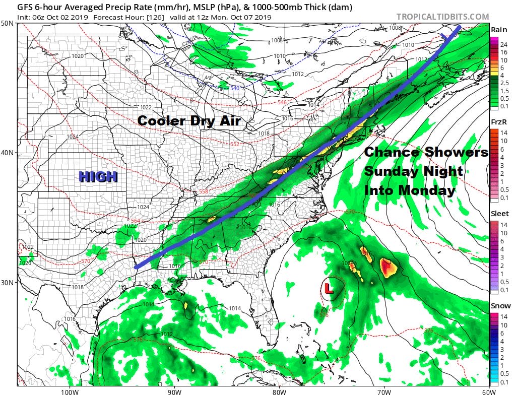
At least it will be some rain and it could be another quarter to three quarter inch affair for most of us. Then we move on to another shot of dry cooler air for the middle part of next week.
MANY THANKS TO TROPICAL TIDBITS FOR THE USE OF MAPS
Please note that with regards to any tropical storms or hurricanes, should a storm be threatening, please consult your local National Weather Service office or your local government officials about what action you should be taking to protect life and property.


