Sunshine Wednesday Heavy Rain Thursday Morning Father’s Day Weekend
We have a beautiful day underway across the area with lots of sunshine. There are some high clouds to the south and those will be very slowly pushing northward. Initially the dry air over us will fight it and keep those clouds thin. Later today the clouds could start to gain a bit of a foothold especially as you go south of NYC. We will also have an ocean wind developing today and that will keep temperatures capped in the 70s for highs. Clouds will continue slowly tonight as we watch a ball of rain moving up the coast. Nothing arrives until Thursday morning so there will be no issues this evening. Temperatures will settle in the 50s and lower 60s.
SATELLITE

REGIONAL RADAR

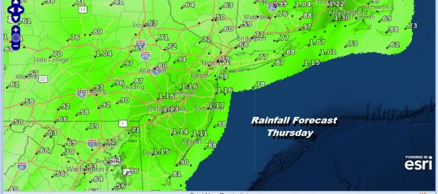
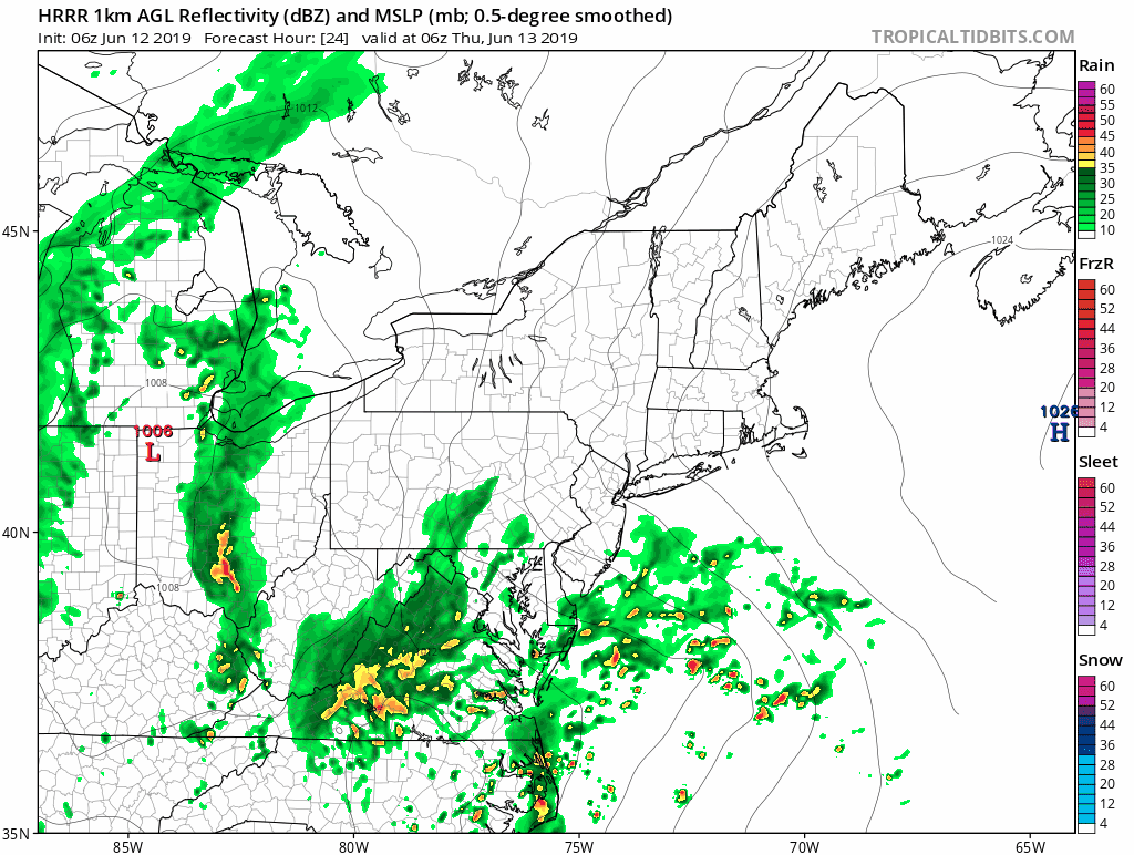
There are no issues on the radar today but we will start to see some showers show up on the regional radar later today in North Carolina and Southern Virginia. Rain will arrive in Southern Pennsylvania and Southern New Jersey around 2am, Philadelphia & NYC around 5-6am. This moves through rather quickly and will be impacting the Thursday morning commute so be sure to give yourself a little extra time to get to your destination.
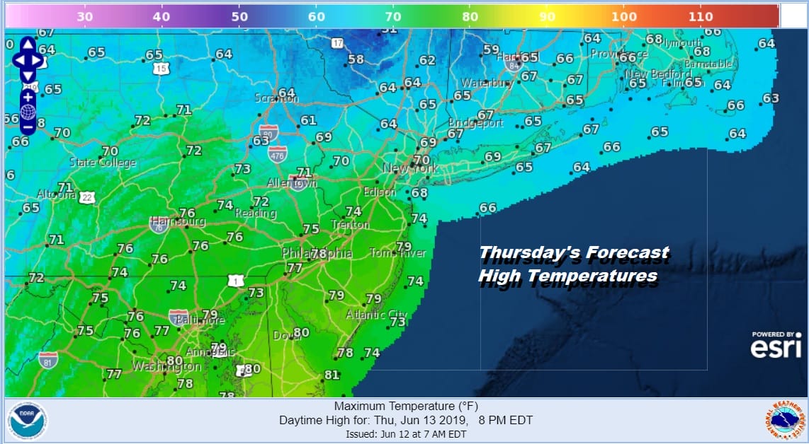
After this surge of rain goes by as low pressure moves up the coast and to the northeast, slow improvement will begin with clouds for the rest of the day. Temperatures will be in the 60s to lower 70s for highs in most places though we could see higher highs as you go south.
We are going to throw in the chance for another shower or thunderstorm Thursday evening but it will be widely scattered if it occurs at all. Then a cold front moves offshore and weather conditions improve even more Thursday night and Friday. Friday we will see a mix of sun and clouds with a gusty wind and highs in the upper 60s to mid 70s. We see no changes in the weekend outlook. Saturday we look for sunshine with highs in the upper 70s to lower 80s.
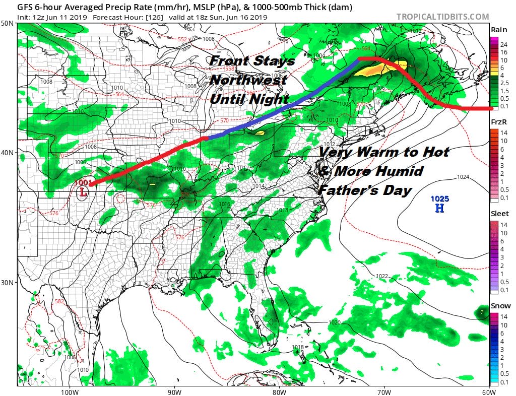
Sunday looks good for Father’s Day. We have a front to the north with a west southwest wind and high pressure off the East Coast. Look for some sunshine very warm and more humid conditions. Highs will be mostly in the 80s. I think some hot spots could get close to 90. There could be some scattered thunderstorms Sunday afternoon and evening mostly well inland in Pennsylvania and upstate NY then overnight in areas along the coast. We look to stay very warm and humid on Monday as this frontal boundary sits overhead which means the chance for showers and thunderstorms continues early next week.
MANY THANKS TO TROPICAL TIDBITS FOR THE USE OF MAPS
Please note that with regards to any tropical storms or hurricanes, should a storm be threatening, please consult your local National Weather Service office or your local government officials about what action you should be taking to protect life and property.


