Sunshine Warmer Temperatures Next Several Days Cold Front Arrives Sunday

Sunshine Warmer Temperatures Next Several Days Cold Front Arrives Sunday
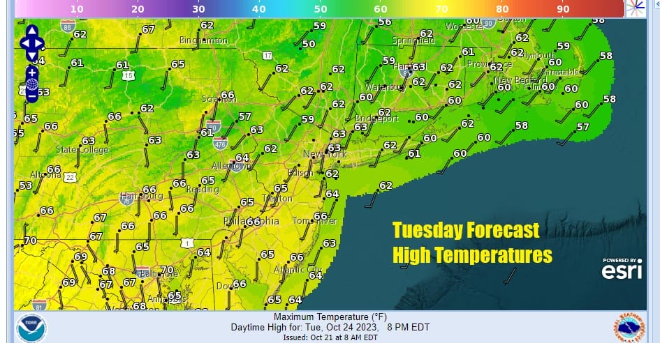
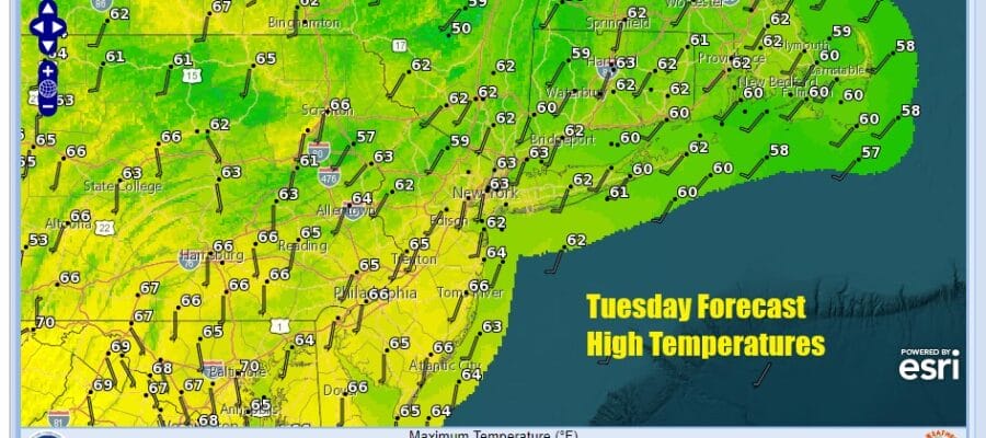
A chilly, and in some cases inland, frosty morning we are going to start to see temperatures move up. The satellite loop doesn’t show much in the way of clouds up and down the Eastern Seaboard and we thank an upper air high pressure ridge that is building in the Eastern US for keeping things dry and uneventful. Today will be a nice sunny day and high temperatures this afternoon will reach the low and middle 60s. Radars are quiet and they are pretty much in shutdown mode for the next 4 days.
SATELLITE WITH LIGHTNING STRIKES

WEATHER RADAR

Tonight won’t be as chilly with most lows in the 40s to around 50 except for some stray 30s in colder inland spots. Warmer urban will bottom in the low to mid 50s. Wednesday will be a mostly sunny and warmer day and it will be the first of 4 days in a row where highs will reach into the 70s.

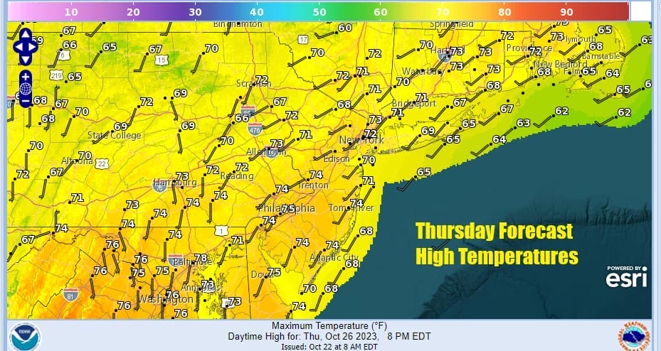
We will be in the lower end of the 70s Wednesday but Thursday and Friday it will be warmer. Long nights may start to see patchy fog developing during the nighttime and early morning hours away from warmer urban locations. Thursday and Frday we will have sunshine both days with high temperatures reaching the mid to upper 70s.

As far as the weekend goes, Saturday right now looks to be the better of the two weekend days. The next cold front approaches Saturday but doesn’t really arrive until Sunday. The ridge holds on making Saturday the warmest day of this stretch. We should see at least some sunshine with highs in the mid 70s to around 80 degrees!

Sunday is a bit of a question mark as it depends on the push of chilly air coming down into the Midwest over the weekend and how far east does that push get. We probably will see some clouds around Sunday and we may have to throw in the chance for showers. Sunday highs will back off from Saturday peaks with highs in the upper 60s and lower 70s. Next week we will see a shot of colder air come in as the pattern shifts around and the ridge in the Eastern US disappears.
BE SURE TO DOWNLOAD THE FREE METEOROLOGIST JOE CIOFFI WEATHER APP &
ANGRY BEN’S FREE WEATHER APP “THE ANGRY WEATHERMAN!
MANY THANKS TO TROPICAL TIDBITS FOR THE USE OF MAPS
Please note that with regards to any severe weather, tropical storms, or hurricanes, should a storm be threatening, please consult your local National Weather Service office or your local government officials about what action you should be taking to protect life and property.
(Amazon is an affilate of Meteorologist Joe Cioffi & earns commissions on sales.)


