
Sunshine Very Warm Near Record Highs Wednesday
Finally Some Rain Possible Sunday

Sunshine Very Warm Near Record Highs Wednesday
Finally Some Rain Possible Sunday
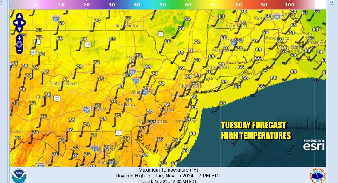
The pattern of 2 to 3 days cool followed by 2 to 3 days warm continues and today begins the warm pattern. A warm front is well to the north and that sets us up for a partly to mostly sunny day. Temperatures today will be able to climb higher than yesterday as winds will be more south southwest. Highs will reach the middle to upper 70s. Temperatures will be a little cooler along the shore. Radars are nice and quiet and once again it is another day of no rain. Since September 29th most of the area has seen under a tenth of an inch of rain.
SATELLITE WITH LIGHTNING STRIKES

WEATHER RADAR

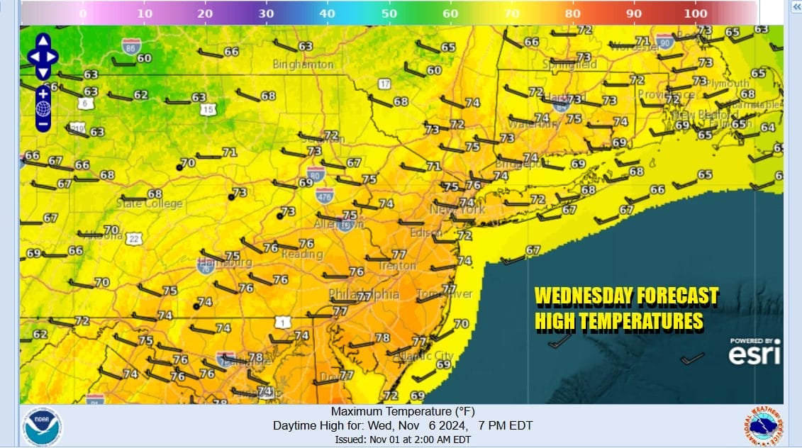
Tonight will be a warmish night with most lows in the 50s to around 60. Wednesday will be very warm and it could be another day of potential record high temperatures. A cold front is moving through but once again this is another case of the front coming through dry and the only thing that happens is a wind shift to the northwest later in the day. Skies will be no worse than partly sunny. Most highs will be in the upper 70s and lower 80s.
We are at least seeing signs that we may actually get an area wide rain very soon It does come over the weekend, specifically Sunday but after nearly 2 months of minimal rainfall, it will be welcomed by most. The upper ridge that has been sitting in the Eastern US and flexing its muscle is going to relax enough to allow low pressure developing in the Central Plains late this week to move to the Great Lakes over the weekend.

Tropical Storm Rafael in the Caribbean and near Jamaica today is forecast to become a hurricane as it heads to Western Cuba and eventually in the Gulf of Mexico. This storm could also have an hand in the weekend weather system as it eventually gets absorbed into the developing Central Plains low. This could enhance the rainfall as it rides northward up the Appalachians and spreads into the Mid Atlantic and Northeast Sunday.

Before we get there we have Thursday and Friday and both days will be warm but not quite as warm as Wednesday. Thursday highs will be in the upper 60s and lower 70s. Friday highs will be in the mid 60s to around 70 days. Both days will be no worse than partly sunny. As far as the weekend goes, Saturday is definitely going to be the better of the two days with sunshine giving way to some arriving clouds. Saturday’s highs will be in the upper 50s and lower 60s. Rain will likely arrive late Saturday night or early Sunday morning and last into Sunday night. with highs in the upper 50s and lower 60s. Right now we have the potential for a quarter to a half inch of rain and this could go a little higher with an injection of tropical moisture from the remnants of Rafael.
BE SURE TO DOWNLOAD THE FREE METEOROLOGIST JOE CIOFFI WEATHER APP &
ANGRY BEN’S FREE WEATHER APP “THE ANGRY WEATHERMAN!
MANY THANKS TO TROPICAL TIDBITS FOR THE USE OF MAPS
Please note that with regards to any severe weather, tropical storms, or hurricanes, should a storm be threatening, please consult your local National Weather Service office or your local government officials about what action you should be taking to protect life and property.


