DOWNLOAD MY NEW FREE JOESTRADAMUS WEATHER APP FOR ALL DEVICES
THE APP IS ABSOLUTELY FREE TO ALL BUT CONSIDERING SUBSCRIBING TO PATREON FOR A WEATHER EXPERIENCE FREE OF ADS, EXCLUSIVE VIDEOS FOR MEMBERS ONLY AND MUCH MORE…STARTS AT $2 A MONTH..MESSAGE ME AT ANY TIME
Sunshine Sunday Cold First Half Warmer Second Half No Storms Ahead
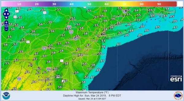
After the howling wind gusts of Saturday we have a more relaxed day ahead with sunshine. Friday’s storm system is now moving way east of the Maritimes and now comes the next weather system that the satellite loop shows swirling around the Midwest. Clouds are out to the west but they are moving more north than east so we should see sun for much of the day before clouds roll in late this afternoon and evening. Highs will be in the mid 50s to near 60 with sea breezes mainly confined to the immediate coast.
SATELLITE
REGIONAL RADAR
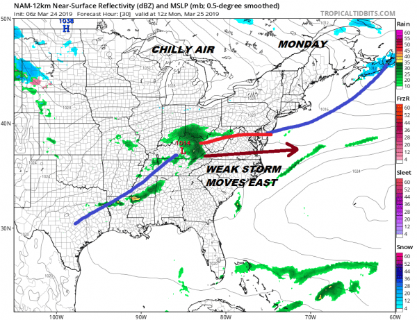
There are no real changes in the weather going forward for this week. It looks rather straight forward with a weak cold front moving through Monday morning with not much with it other than clouds and a passing shower. Then low pressure passes to the south and east late Monday and Monday evening. There will be an area of rain moving offshore to the south with little consequence other than a little rain in Southern Pennsylvania and Southern New Jersey. There could be a wet snowflake or two mixed in. Otherwise we are done with storm systems for this week.
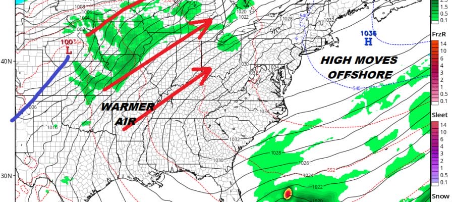
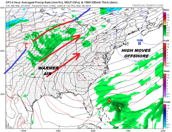
Tuesday and Wednesday it is back to sunshine and it will be rather chilly both days. Highs will be into the 40s and nighttime lows will be in the 20s to lower 30s. After Wednesday high pressure will be only very slowly moving out to the east and there is a large area from the East Coast back to the Plains that will be under a general southwest flow. It is always tricky in the early spring in situations like this. Clouds can sometimes keep temperatures from rising as far as you might like. Also inland areas will warm up faster than the coast where the wind passes partially over a 40 degree ocean.
We will take the chance that for most the warm-up late this week will be noticeable with highs reaching into the 60s late in the week away from the ocean. There will be a large upper high along the east coast which will likely keep the next cold front away until next weekend at the earliest. It is a quiet finish to the month of March. No major storms are on the horizon and we see April starting off much where March is leaving off. So far it seems that we are having a “normal” spring with volatility and steadily climbing higher highs and higher lows. It doesn’t look like winter is going to be extending itself.
MANY THANKS TO TROPICAL TIDBITS FOR THE USE OF MAPS
Please note that with regards to any tropical storms or hurricanes, should a storm be threatening, please consult your local National Weather Service office or your local government officials about what action you should be taking to protect life and property.


