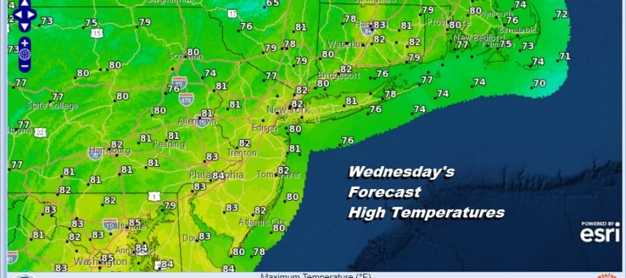
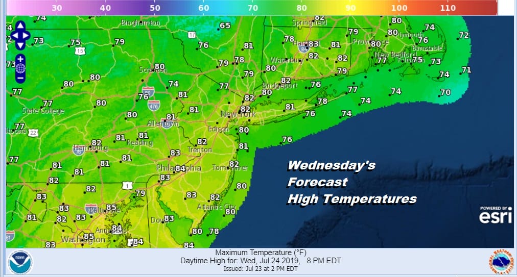
Sunshine Returns Wednesday Low Humidity Until The Weekend
The severe weather of yesterday is long gone but we continue to do some weather house cleaning this evening. We have a cold front that is offshore and only crawling eastward. We are waiting for another wave of low pressure to move along the frontal boundary to get the clouds out of the way. The clearing line is 100 or so miles to the northwest and so is some very nice dry air that covers the Great Lakes and Ohio Valley. This will arrive on Wednesday. However until then we still have clouds to deal with and the chance for some occasional light sprinkles or showers.
SATELLITE

REGIONAL RADAR

The regional and local radars are picking up on the light rain to the south. Heavier rain lies across the Carolinas but that should not make it here and stay offshore. we will be brushed by some of this light rain this evening and overnight mainly along coastal areas. Temperatures were in the cool 70s today and we will be headed to the 60s tonight.
LOCAL RADAR NEW YORK CITY

LOCAL RADAR PHILADELPHIA 

There are no weather issues for the next several days and we should be shower or thunderstorm free until Sunday. Sunshine Wednesday will return after some very early morning clouds which should move out quickly in the morning. Highs will reach the upper 70s and lower 80s.
Thursday looks nice and dry with sunshine and most highs between 80 and 85. Friday will be a bit warmer and a tad more humid but it will still be reasonable humidity wise with highs in the mid to upper 80s.
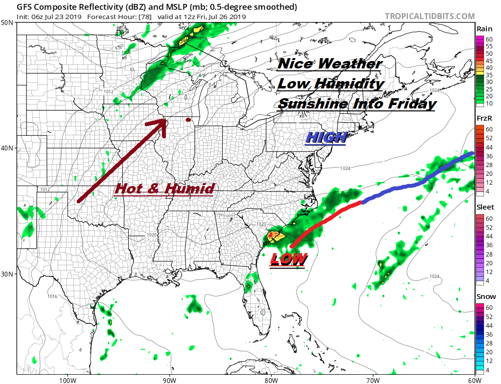
There are no changes in the forecast for the weekend. The high goes out to the northeast first before dropping southward. This shifts all the hot air to our west and north. A bit of an onshore flow will keep temperatures in the 80s Saturday with higher humidity but with sunshine. Sunday look for some sunshine very warm and humid conditions with highs getting back to near 90. No thunderstorms are forecast through the weekend.
TROPICAL DEPRESSION 3 HAS DISSIPATED OFF THE FLORIDA COAST
We can say goodbye to the tropical depression that formed yesterday off the Florida coast. Satellite pictures and loops show the low level center is gone and what is left is a ragged area of thunderstorms that will be absorbed by the frontal boundary to the north. There will be no issues from this at all along the East Coast.
MANY THANKS TO TROPICAL TIDBITS FOR THE USE OF MAPS
Please note that with regards to any tropical storms or hurricanes, should a storm be threatening, please consult your local National Weather Service office or your local government officials about what action you should be taking to protect life and property.


