
Sunshine Returns Temperatures Slowly Week Mostly Dry

Sunshine Returns Temperatures Slowly Week Mostly Dry
After a weekend of rain, wind, coastal flooding, and in some places even sleet, we have finally seen our coastal storm move far enough to the east we are have cleared out up and down the Eastern Seaboard at least for the time being. The key to the forecast is how the low drifts southward. We will be dealing with an onshore flow this week and that’s fine. A wind off the ocean can also mean nice weather if the high and low are position in such a way to favor dry air from the north.
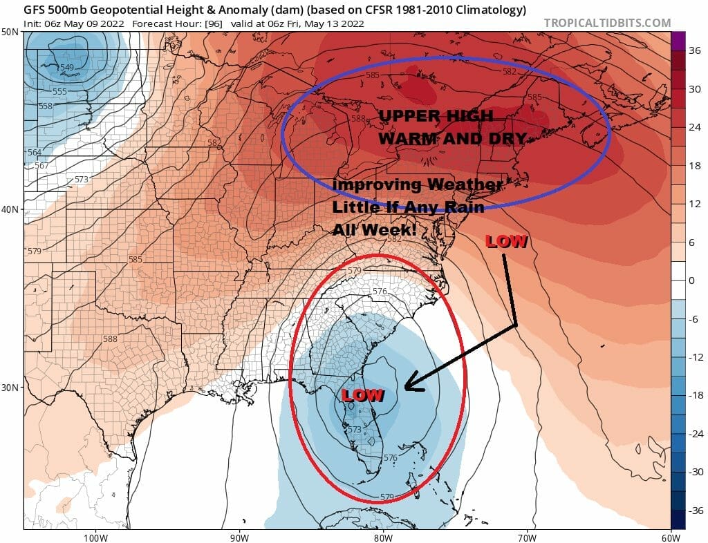
We have that situation right now as a large upper ridge is building over the top of the upper air storm forcing it to move southward. Since everythingin the atmosphere is doing the opposite of what it usually does, it should be no surprise that temperatures this week will have an upside down nature to them. If you want 80s you need to go north rather than south into Upstate NY and Southeastern Canada. To the south the upper low drifts south keeping winds surface and aloft mostly off the cool 50-55 degree ocean. Since the surface storm has weakened, we need not worry about rain probably all week.
SATELLITE

WEATHER RADAR

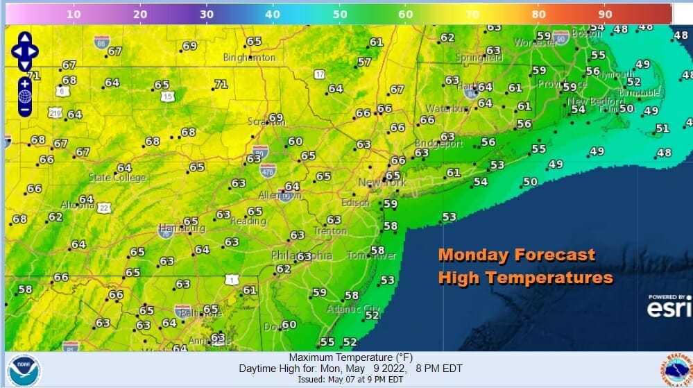
At least with the sunshine today and it will be there all day long, highs will reach into the 60s though it probably will be cooler along the immediate coast. Let’s just keep an eye on clouds off shore in case they should decide to rotate back westward. If that happens it probably will only impact the immediate coast. It is going to be a chilly night under mainly clear skies. Lows will be in the low to mid 40s but there will be lots of 30s inland.
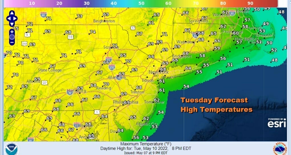
The sun will take temperatures a little higher each day. Tuesday sunshine should see highs from the mid 60s coast to near 70 or inland which is back close to average for early May. The trend continues Wednesday and Thursday. For now we will be optimistic with at least some sunshine each day especially inland. With the low offshore and to the south and the easterly flow we still need to be a little careful about clouds coming in from the east especially at night. Even if that happens they should burn off during the day.
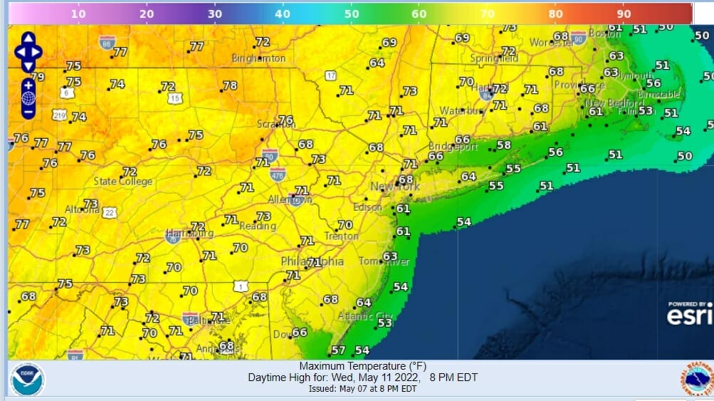
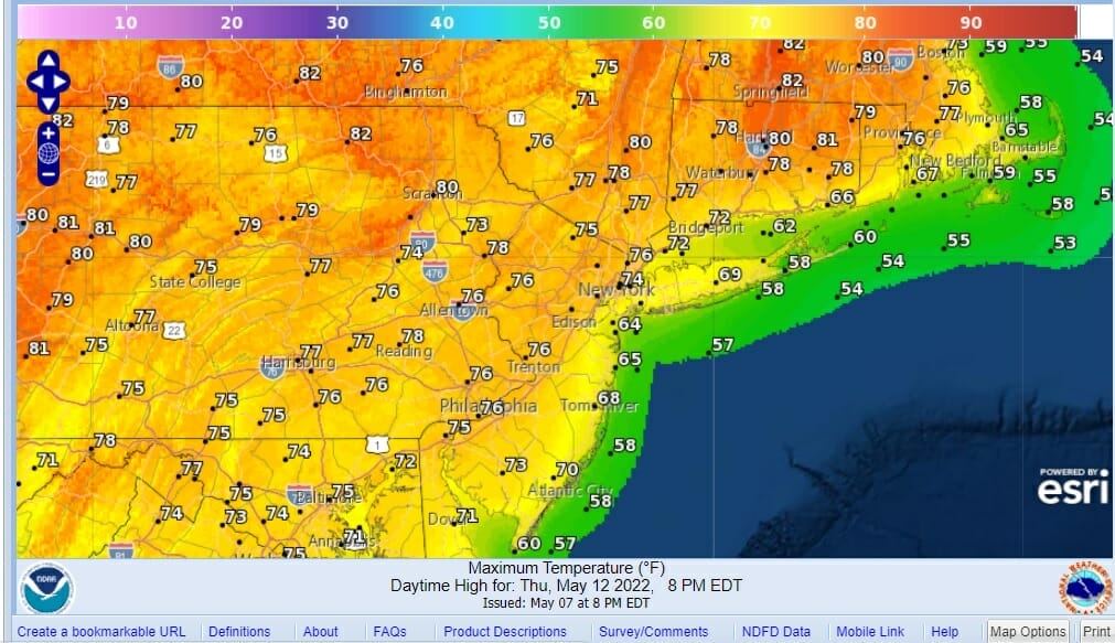
Wednesday forecast highs will be in the mid 60s to lower 70s so again a little higher each day. Thursday we take it up another notch with some sunshine in the forecast. Highs will reach the mid to upper 70s north northeast and northwest of the coast and lower 70s and 60s as you go south and east.
Friday is the day that the upside down nature really plays out with 80s to the north and 70s to the south. Each day this week subtract at least 10 degrees if you are near the coast. On to the weekend where we begin to see the upper atmosphere starting to normalize and the block finishes its breakdown, we will see a cold front approach from the Upper Mississippi Valley and that may probably draw up the chance for showers at some point Saturday and the chance we could see showers and thunderstorms on Sunday. There are hints of severe weather risk for Sunday but it is far to early to determine if that is going to play out. Enjoy the nice weather we have ahead of us today and much of the week.
BE SURE TO DOWNLOAD THE FREE METEOROLOGIST JOE CIOFFI WEATHER APP &
ANGRY BEN’S FREE WEATHER APP “THE ANGRY WEATHERMAN!
MANY THANKS TO TROPICAL TIDBITS & F5 WEATHER FOR THE USE OF MAPS
Please note that with regards to any severe weather, tropical storms, or hurricanes, should a storm be threatening, please consult your local National Weather Service office or your local government officials about what action you should be taking to protect life and property.


