Day 2 Of Sunshine Dry Week Continues Warming Slowly Early Weekend Outlook

Day 2 Of Sunshine Dry Week Continues Warming Slowly Early Weekend Outlook
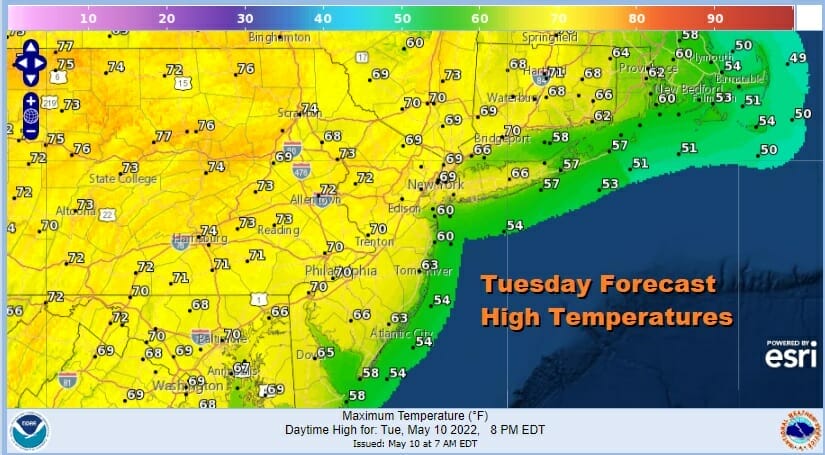
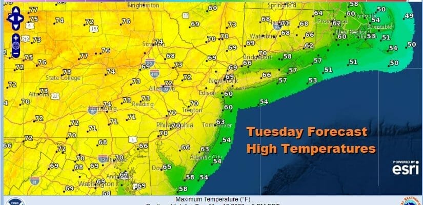
We often count how many days in a row we have seen rain but we should keep track of the nice weather tow and this is going to be day 2 of very nice virtually cloud free weather (with just a few minor exceptions). The weather maps look the same this morning. High pressure is to the north in Eastern Canada. Low pressure is sitting east off the North Carolina coast and stands out strongly on the satellite pictures. In between we sit with a northeast wind which can work against a warm up this time of year. Compensating that to some extent is the strong May sun. We finished with a little upside yesterday on the highs so we can add a few degrees today. I expect to see see highs in the 70s inland and cooler 60s near the shore. It will be a bit breezy at times especially along the coast.
SATELLITE

WEATHER RADAR

I didn’t see much change in the outlook for the rest of the week. We just have to keep an eye on the east to see if low clouds try to come in westward. If this happens it would be mostly at night and they would burn off quickly in the morning. Cool nights continue with mainly clear skies tonight with lows mostly in the 40s. Wednesday should be a nice sunny day with highs back into the 70s inland and 60s along the coast.

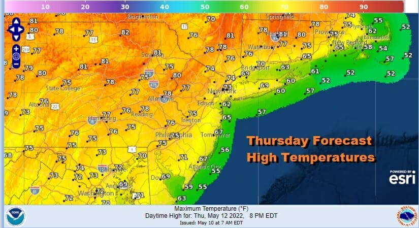
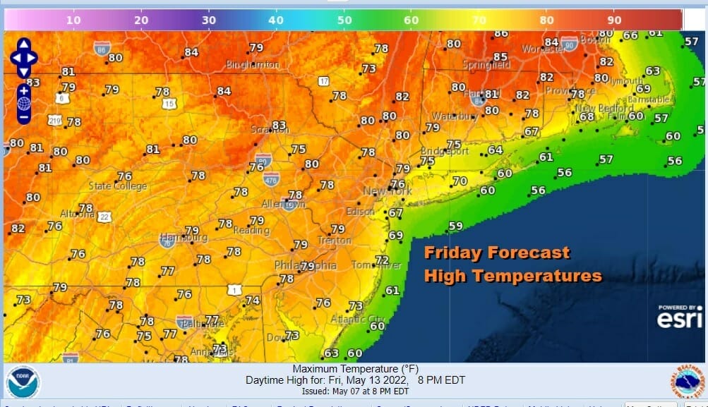
Thursday we will start to see the upside down pattern where it is warmer to the north and cooler to the south. Temperatures will reach into the 80s across upstate NY and Northern New England while to the south, again thanks to the northeast wind, it will be a little cooler. However the uptrend continues Thursday and Friday as long as we have some sunshine, which we will. Highs will reach the mid to upper 70s in many places Thursday and Friday and we could see a few 80s inland and north.
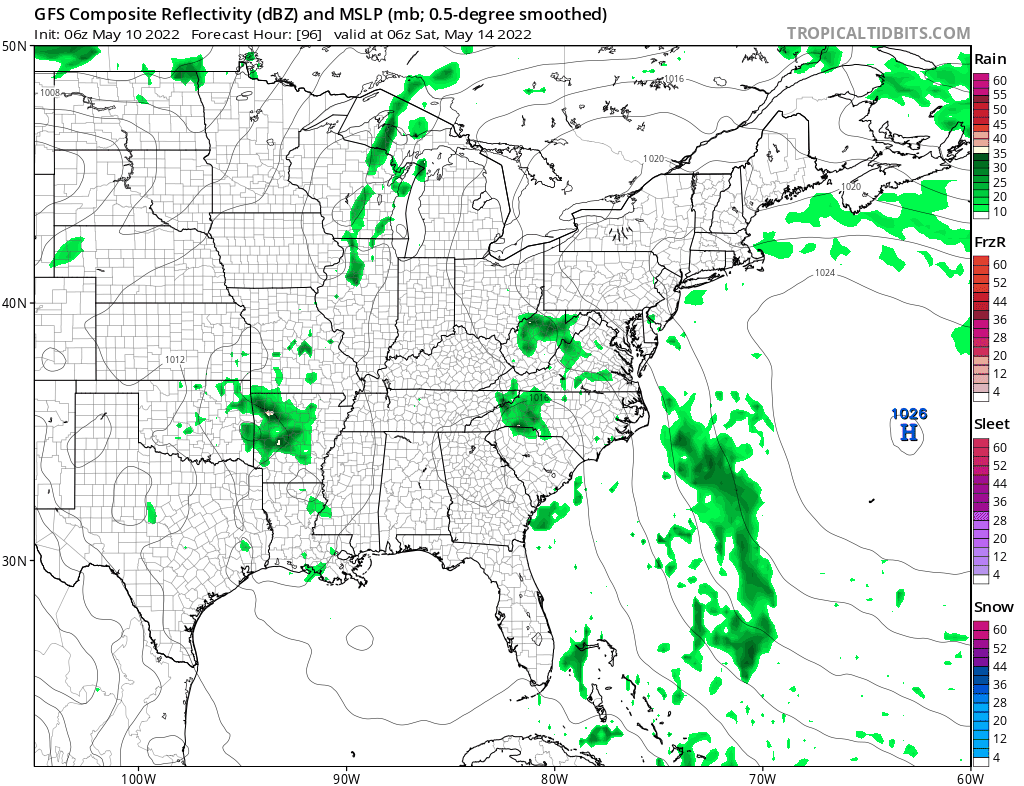
By the time we reach the weekend the breaking down process of the block will be complete and weather systems will start to move from west to east again with more regularity. We have a cold front approaching for late Sunday or Monday as we do have a bit of a timing and strength issue. The GFS being flatter (weaker) and faster brings a front through Sunday night with little fanfare other than a couple of showers. The European has a much stronger trough and slower front which would imply severe weather possibilities on Monday. Some moisture does come back over the weekend as the old ocean storm begins to move into the Southeast US. I’m thinking that the weekend will be on the warm side with temperatures in the 70s, again warmer as you head north into Upstate NY and New England.
I’m going to throw in the chance there could be a few scattered showers as a possibility. I don’t think it is anything that wipes out either day. Then we will try and figure out what the deal is with the next trough and cold front. One thing that is a positive to focus on is that we do not have a blocking pattern ahead of us so with systems moving along, we will at least have some nice days in between weather fronts and temperatures trending back to near average for mid May.
BE SURE TO DOWNLOAD THE FREE METEOROLOGIST JOE CIOFFI WEATHER APP &
ANGRY BEN’S FREE WEATHER APP “THE ANGRY WEATHERMAN!
MANY THANKS TO TROPICAL TIDBITS & F5 WEATHER FOR THE USE OF MAPS
Please note that with regards to any severe weather, tropical storms, or hurricanes, should a storm be threatening, please consult your local National Weather Service office or your local government officials about what action you should be taking to protect life and property.


