Sunshine Nice Warm Father’s Day Heatwave Gets Underway Next Week

Sunshine Nice Warm Father’s Day Heatwave Gets Underway Next Week
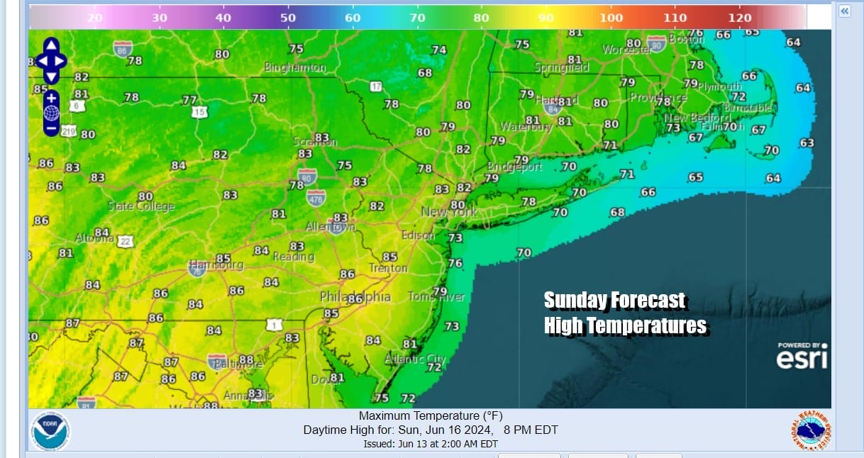
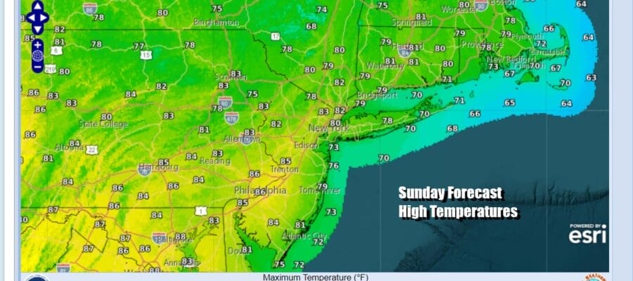
This Father’s Day Weekend has gotten off to a grand start with a sunny warm and comfortable Saturday.el Temperatures topped out in the upper 70s to lower 80s across Eastern Pennsylvania to Southern New England with dew points in the low 50s. You could not ask for better weather. This dry air mass will hang on for another day and we have no issues to worry about. The radars are nice and quiet. Satellite loops are generally clear. Tonight’s lows will be in the comfortable upper 50s to mid 60s in most places. Sunday will be a mostly sunny day with temperatures and humidity levels much loke Saturday. Highs will reach the upper 70s and lower 80s in most places.
SATELLITE WITH LIGHTNING STRIKES

WEATHER RADAR

The week ahead sees this dry air mass moving offshore as a powerful upper ridge (high pressure) builds aloft in the Mid Atlantic and Northeastern states. The upper high will reach its maximum strength Wednesday and Thursday and this is the time frame where we expect the hottest temperatures. Humidity levels will still remain reasonable Monday as the dew points creep a little higher but still in the manageable upper 50s to around 60 or so. Starting Tuesday and for the rest of the week humidity levels and coupled with the rising temperatures in the 90s, it makes for extreme discomfort.

Thunderstorm activity this week will be minimal until perhaps late in the week or next weekend. The strong upper high creates a stable environment so any storms that develop during the afternoon or even hours will be isolated in nature. Monday will be sunny and very warm. Highs will reach the upper 80s to near 90 degrees.

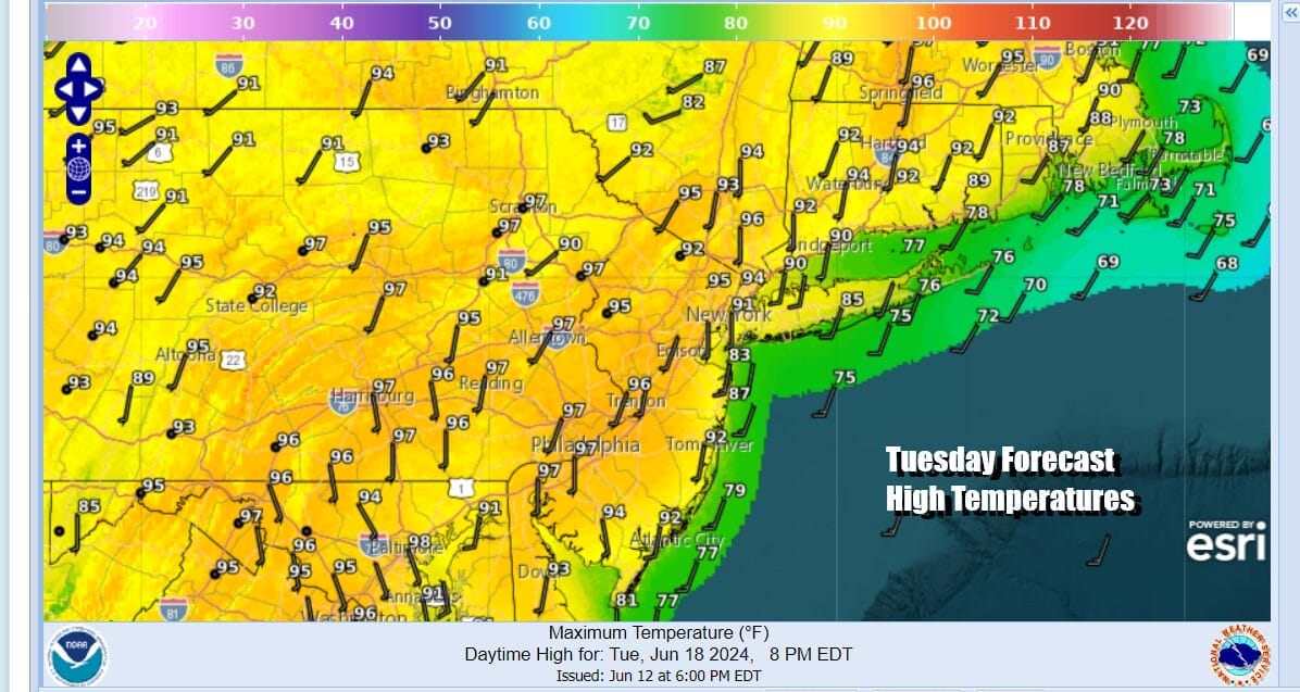
If you miss hitting 90 degrees for a high Monday, you will hit it Tuesday and lasting at least through Friday and possibly into next Saturday. Tuesday will be a hot day with blistering sunshine and temperatures that will reach the low and middle 90s. Humidity levels will jump higher and we will see heat index reading climb to over 100. Cooler sea breezes will develop but you may need to be on the beaches to enjoy the relief.
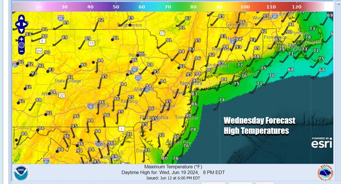
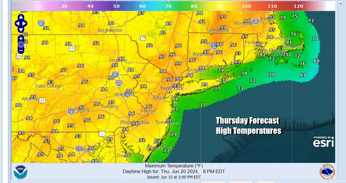
Wednesday the heatwave continues with lots of sunshine high humidity and little to no relief from any isolated thunderstorms that develop. They should be few and far between. Temperatures Wednesday and Thursday will reach the mid to upper 90s and 100 degree highs are not impossible especially away from the ocean. Cooling sea breezes will be confined to the immediate shore.
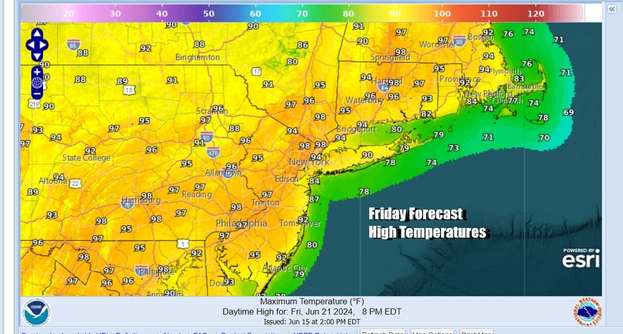
The strong upper ridge will start to weaken Friday but it will take a few days for it to weaken enough to allow a cold front to approach with showers and thunderstorms. This means that any break in the heatwave may not come until Saturday night or Sunday at the earliest. Friday will be another brutal day with highs reaching 95 to near 100 degrees with little in the way of any isolated thunderstorms.
90 degree plus highs are likely to continue next Saturday and then perhaps we could see some potential relief with a cold front and the chance for showers and thunderstorms Saturday night and Sunday. While the Eastern US is under the grips of this heat ridge, we will see below normal pressures in the Gulf of Mexico to the Southwest Atlantic. Weather models are hinting that one or possibly two tropical systems could spin up in this pattern later this week and will be monitor any potential tropical storm development.
BE SURE TO DOWNLOAD THE FREE METEOROLOGIST JOE CIOFFI WEATHER APP &
ANGRY BEN’S FREE WEATHER APP “THE ANGRY WEATHERMAN!
MANY THANKS TO TROPICAL TIDBITS FOR THE USE OF MAPS
Please note that with regards to any severe weather, tropical storms, or hurricanes, should a storm be threatening, please consult your local National Weather Service office or your local government officials about what action you should be taking to protect life and property.
(Amazon is an affilate of Meteorologist Joe Cioffi & earns commissions on sales.)


