Severe Weather Possible This Evening Father’s Day Weekend Looks Good Heatwave Starts Monday

Severe Weather Possible This Evening Father’s Day Weekend Looks Good Heatwave Starts Monday
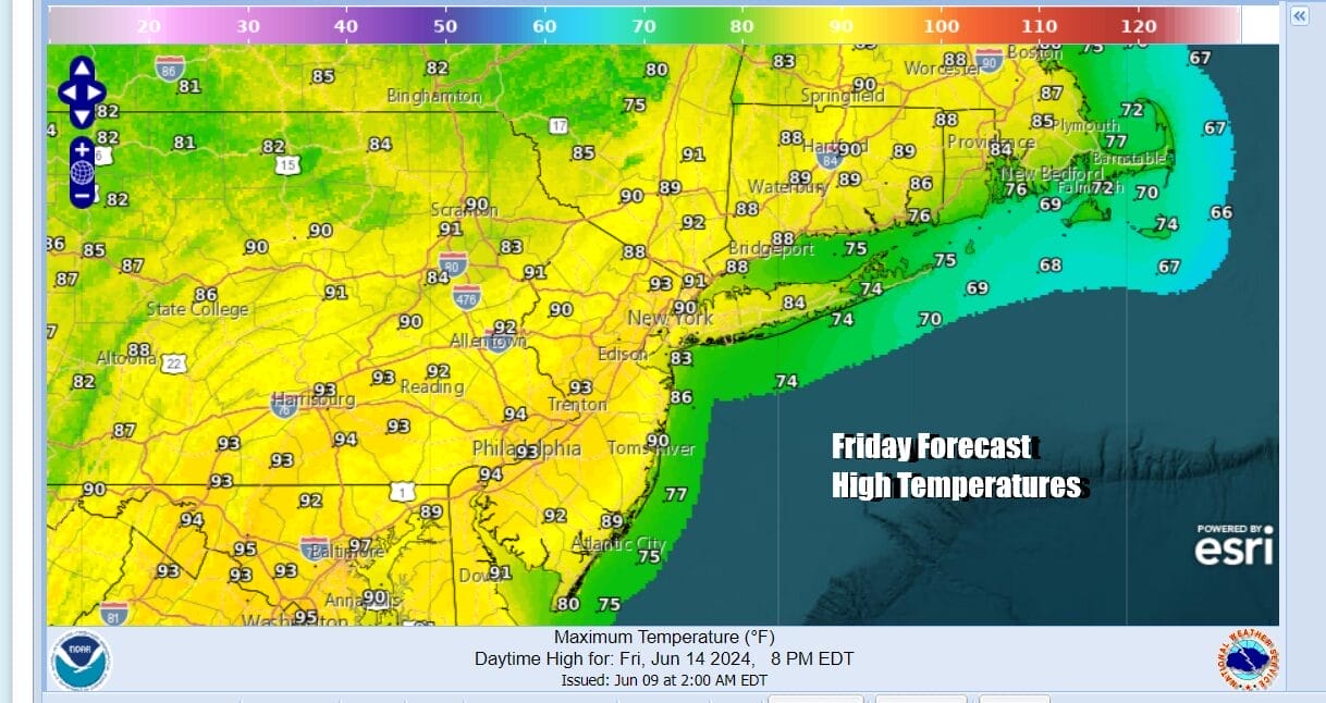
We are heading into a weekend of sunshine, low humidity and warm but reasonable temperatures for the Northeast and Northern Mid Atlantic states. Ahead of that today we are going to see sunshine and very warm to hot conditions as temperatures rise up to near 90 degrees in many inland locations. There may be some local sea breezes along south and east facing shorelines.
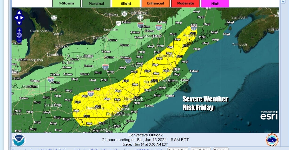
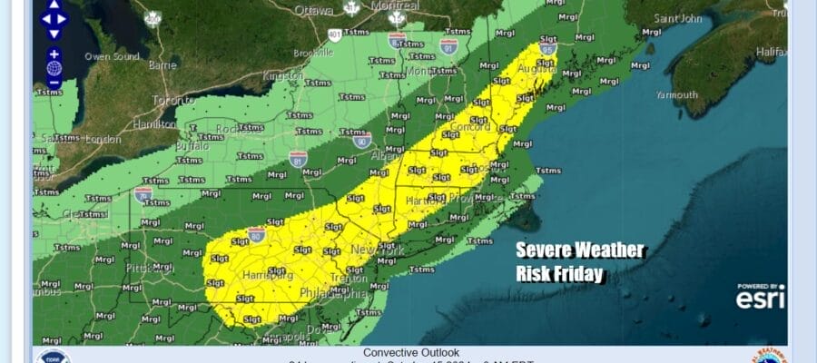
Satellite and radar loops show an upper trough and cold front moving east from the Great Lakes with numerous showers and thunderstorms. That front will arrive late this afternoon and early evening and move west to east across Eastern Pennsylvania to Southern New England. Conditions are favorable for some severe weather and the Storm Prediction Center has indicated a slight or 15 percent risk for severe thundertorms. Wind is the primary issue and gusts of 50 mph or more are possible as the front passes.
SATELLITE WITH LIGHTNING STRIKES

WEATHER RADAR

Once the front passes we will see improving weather conditions later tonight as skies clear or at least partially clear. Most lows tonight will be in the upper 50s to mid 60s. High pressure from the Great Lakes builds in for the weekend and we see no weather issues at all through Sunday. Skies will be mostly sunny for Saturday and highs will probably be in the low to mid 80s.


Sunday is Father’s Day and it will be a very nice day indeed. Plan for mostly sunny skies Sunday with low humidity and highs in the low to mid 80s. However this is the last day of reasonable temperatures and humidity because a heat wave pattern will be developing next week. A very deep trough will drop into the Western US and a corresponding very strong ridge will build in the Eastern US at the same time.

Upper highs as strong as this one are not common occurrences in the Eastern US. This is the sort of upper high you might see in the Plains or the Southern States. The migration of this upper high into the Northeast will create an opportunity for a streak of at least 5 days of 90 degree plus highs beginning Monday. When the upper high reaches its peak strength Wednesday into Thursday over the Northeast, we could see 100 degree highs.

All of this will come with little to no chance for an afternoon or evening thunderstorm. Monday highs will reach the upper 80s and lower 90s. Tuesday we will see highs in the low to mid 90s. Wednesday and Thursday of next week we will see highs in the mid 90s to near 100 degrees. This heat wave will likely extend into next weekend before any kind of cold front is able to get close let alone move through and bring relief.
BE SURE TO DOWNLOAD THE FREE METEOROLOGIST JOE CIOFFI WEATHER APP &
ANGRY BEN’S FREE WEATHER APP “THE ANGRY WEATHERMAN!
MANY THANKS TO TROPICAL TIDBITS FOR THE USE OF MAPS
Please note that with regards to any severe weather, tropical storms, or hurricanes, should a storm be threatening, please consult your local National Weather Service office or your local government officials about what action you should be taking to protect life and property.
(Amazon is an affilate of Meteorologist Joe Cioffi & earns commissions on sales.)


