Sunshine Moving Out Rain Moving In
Sunshine Moving Out Rain Moving In
We are going to squeeze out one more day of sunshine before the we see sunshine moving out and rain moving in. Some high clouds are swinging up as some rain to the west in Northwest Pennsylvania lifts northward. They will mask some some the sunshine today but overall it is a nice day. The more serious cloud cover arrives later this afternoon and thickens up tonight as low pressure moves across the Ohio Valley and heads for the Delaware coast Friday night and early Saturday morning. The satellite loop shows the well defined storm system as well as the upper level low which you can see clearly in the twist of clouds moving across Missouri.
SATELLITE LOOP

REGIONAL RADAR

LOCAL RADAR NEW YORK CITY

LOCAL RADAR PHILADELPHIA


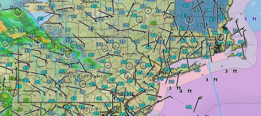
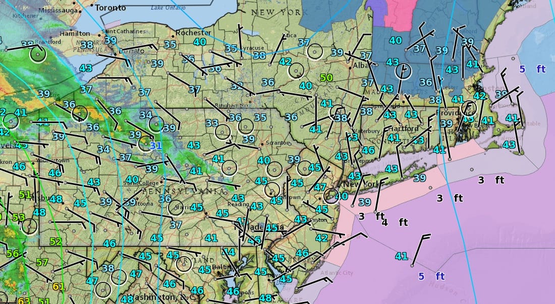
Temperatures today will reach the low to mid 50s which is about 5 degrees or so cooler than yesterday. Some rain will be at the coast around daybreak and then a soaking rain will develop as the day wears on and some of the rain will be heavy at times Friday afternoon and Friday night. Much of the area will see 1 to 2 inches of rain with some locally higher amounts so some local flooding is not out of the question.

Temperatures through all of this will be cold with readings in the upper 30s and lower 40s on Friday in most areas and dropping into the 30s Friday night into Saturday morning. I don’t think it will be cold enough for anything other than some sleet mixing in for areas south of Route 84 to just north and west of the coast. The accuulating wet snow and sleet will be well to the north in my view. Once the low pulls away Saturday morning weather conditions will begin to improve. Sunday looks to be the better of the 2 weekend days with sunshine and highs in the 50s.
 GET JOE A CIGAR IF YOU LIKE

LANDSCAPE COMPANIES FOR YOUR NEEDS
LONG ISLAND ROCKLAND COUNTY Connecticut

![]()

ROCKLAND COUNTY TRI STATE SNOW REMOVAL JOHNSTOWN PA


FiOS1 News Weather Forecast For Long Island
FiOS1 News Weather Forecast For New Jersey
FiOS1 News Weather Forecast For Hudson Valley
NATIONAL WEATHER SERVICE SNOW FORECASTS
LATEST JOESTRADAMUS ON THE LONG RANGE
Weather App

Don’t be without Meteorologist Joe Cioffi’s weather app. It is really a meteorologist app because you get my forecasts and my analysis and not some automated computer generated forecast based on the GFS model. This is why your app forecast changes every 6 hours. It is model driven with no human input at all. It gives you an icon, a temperature and no insight whatsoever.
It is a complete weather app to suit your forecast needs. All the weather information you need is right on your phone. Android or I-phone, use it to keep track of all the latest weather information and forecasts. This weather app is also free of advertising so you don’t have to worry about security issues with your device. An accurate forecast and no worries that your device is being compromised.
Use it in conjunction with my website and my facebook and twitter and you have complete weather coverage of all the latest weather and the long range outlook. The website has been redone and upgraded. Its easy to use and everything is archived so you can see how well Joe does or doesn’t do when it comes to forecasts and outlooks.
Just click on the google play button or the apple store button on the sidebar for my app which is on My Weather Concierge. Download the app for free. Subscribe to my forecasts on an ad free environment for just 99 cents a month.
Get my forecasts in the palm of your hand for less than the cost of a cup of Joe!


