
Sunshine Into Friday Rising Temperatures Thunderstorms Late Friday,
Father’s Day Weekend Looking Good

Sunshine Into Friday Rising Temperatures Thunderstorms Late Friday,
Father’s Day Weekend Looking Good

We continue with dry nice weather conditions on this Wednesday. There are no other upper troughs that will be moving through today so will see partly to mostly sunny skies in Eastern Pennsylvania to Southern New England. Temperatures today will reach the upper 70s to around or just over 80 degrees. Temperatures will be a little cooler at the shore with local sea breezes. There are no shower or thunderstorm issues to worry about and the radars will be nice and quiet. Under clear skies tonight, most lows will be in the upper 50s to middle 60s.
SATELLITE WITH LIGHTNING STRIKES

WEATHER RADAR

High pressure moves offshore overnight and Thursday and this will set up a west to southwest flow of warmer air. Dew points will be slow to rise so it will still be comfortable Thursday even though temperatures will be headed higher. We will have plenty of sunshine all day long and highs will reach the middle 80s away from the coast. Local sea breezes as usual will keep things cooler at the shore.

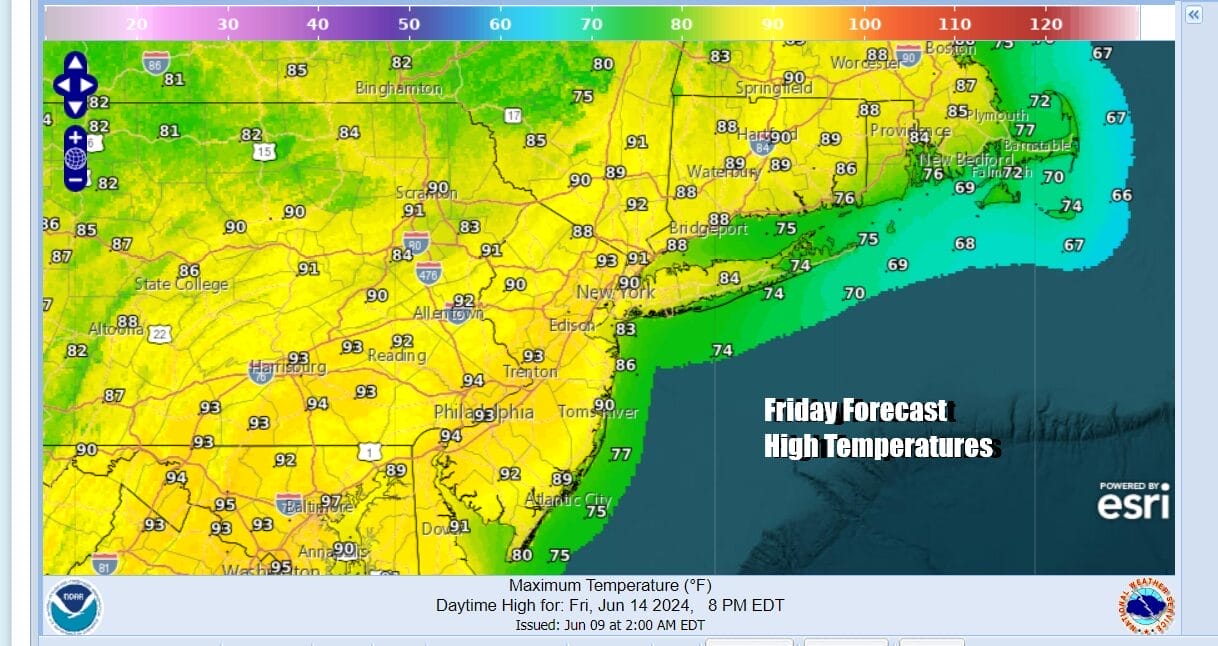
High pressure moving out means that the next weather system will be approaching. This will be a cold front that will be moving across the Great Lakes and Ohio Valley. An upper trough will swing across the Northeast as the front nears. Friday will be a very warm to hot day with sunshine into the afternoon. Highs will reach the upper 80s to around or just over 90 degrees. It will be cooler at shore locations wear we will probably have more of a south wind.
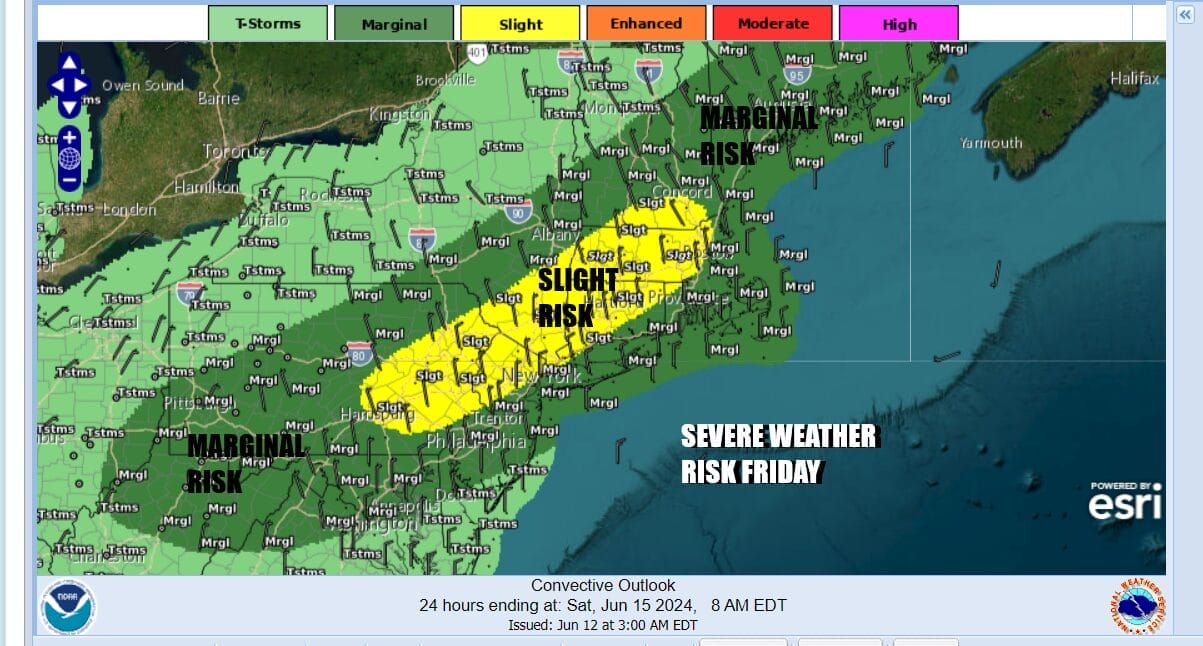
Showes and thunderstorms, likely in the form of a line will move southeast from Upstate NY and Pennsylvania and move through the area from west to east late in the day. The combination of rising dew points into the 60s plus the sharp nature of the upper air trough will lead to severe weather rissk. The Storm Prediction Center has indicated a marginal to slight risk for severe weather Friday from Maine to Virginia and this includes all the major metropolitan areas from Washington to New York City to Boston.
This weather front will keep moving along which is good news for the weekend. Skies should clear out during Friday night and we see Saturday and Sunday (Father’s Day) to be two very nice days of sunshine. Temperatures both days will likely top out in the upper 70s to lower 80s with low humidity. Next week opens the door to heat and humidity developing across the Eastern US and this could bring a couple of days of 90 degree plus highs.
BE SURE TO DOWNLOAD THE FREE METEOROLOGIST JOE CIOFFI WEATHER APP &
ANGRY BEN’S FREE WEATHER APP “THE ANGRY WEATHERMAN!
MANY THANKS TO TROPICAL TIDBITS FOR THE USE OF MAPS
Please note that with regards to any severe weather, tropical storms, or hurricanes, should a storm be threatening, please consult your local National Weather Service office or your local government officials about what action you should be taking to protect life and property.
(Amazon is an affilate of Meteorologist Joe Cioffi & earns commissions on sales.)


