Sunshine for the Labor Day Weekend No Rain Forecast Until Late Next Week

Sunshine for the Labor Day Weekend No Rain Forecast Until Late Next Week

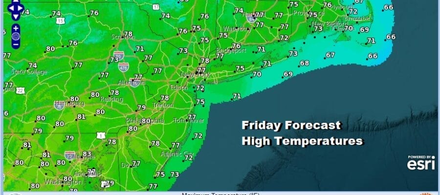
We have arrived at the doorstep of the Labor Day holiday weekend and the timing is perfect for a dry weather pattern to settle into the Eastern US. Today is going to be another nice day of sunshine. Post Tropical Storm Idalia is well offshore as it heads east southeastward toward Bermuda and it will have no impact here. The offshore tropical systems are creating a turbulent ocean so rip currents at the beaches are likely to be an issue all weekend long. Otherwise we are going to see sunshine today take highs up into the 70s with very low humidity. There are no issues on the radar as the Eastern US is will probably not see any showers or thundersstorms at all through the weekend.
SATELLITE WITH LIGHTNING STRIKES

WEATHER RADAR

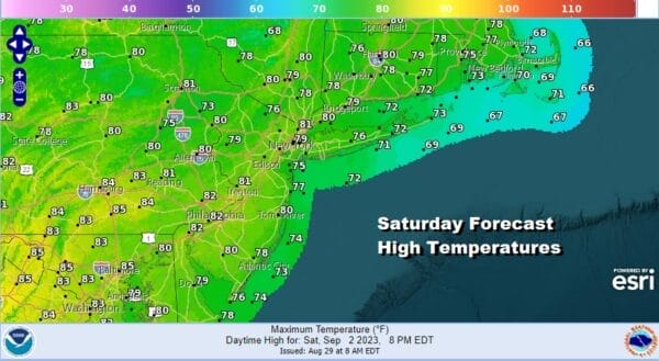
Another nice cool night lies ahead of us with clear skies. Lows by morning will be in the 50s inland and mostly lower 60s along the coast. Saturday looks great with sunshine all day long. High pressure will begin to slide offshore to the south and east so temperatures will come up a bit Saturday. Highs will reach the upper 70s ad lower 80s but humidity levels will remain on the low side.
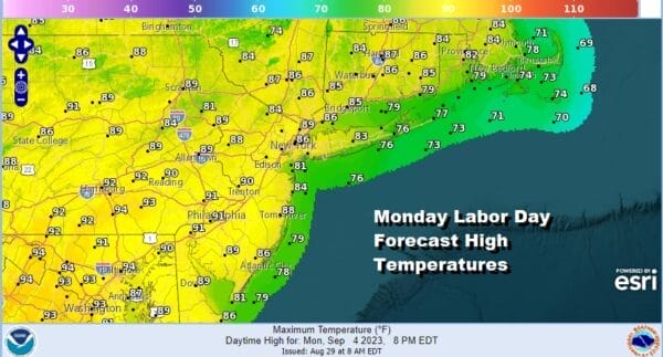
Sunday we will start to warm up and humidity levels will begin to creep up as well but it should still be somewhat tolerable. We will lots of sunshine and temperatures will climb to the mid to upper 80s. Monday will be a hot humid day with sunshine. Again no showers or thunderstorms or forecast but the humidity will be higher and it will be uncomfortable. Highs Monday will be in the upper 80s and lower 90s.

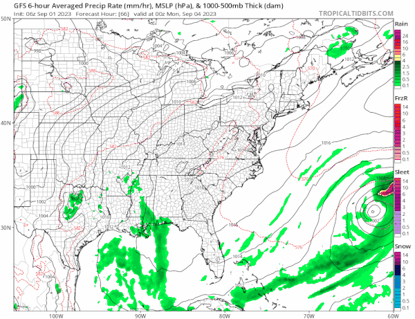
High pressure offshore extends well inland for Tuesday and Wednesday of next week. The ridge will eventually break down midweek and that will allow a cold front to finally break through and approach the Northeast and Middle Atlantic states Thursday. That front will probably bring a few showers through but it doesn’t appear to be a big rain producer.
Ahead of that front Tuesday and Wednesday will be hot humid days with sunshine. Highs will generally be in a range of 88 to 94 degrees both days. Thursday the front arrives with some showers and thunderstorms around. The front could get hung up and bring another round of showers and thunderstorms next Friday. There are no issues regarding the tropics as all the storms out there remain offshore. Enjoy the last vacation weekend of the summer season.
BE SURE TO DOWNLOAD THE FREE METEOROLOGIST JOE CIOFFI WEATHER APP &
ANGRY BEN’S FREE WEATHER APP “THE ANGRY WEATHERMAN!
MANY THANKS TO TROPICAL TIDBITS FOR THE USE OF MAPS
Please note that with regards to any severe weather, tropical storms, or hurricanes, should a storm be threatening, please consult your local National Weather Service office or your local government officials about what action you should be taking to protect life and property.
(Amazon is an affilate of Meteorologist Joe Cioffi & earns commissions on sales.)


