Sunshine Finishes Off the Weekend
Week Ahead Sees Shower Thunderstorm Risks Second Half

Sunshine Finishes Off the Weekend
Week Ahead Sees Shower Thunderstorm Risks Second Half
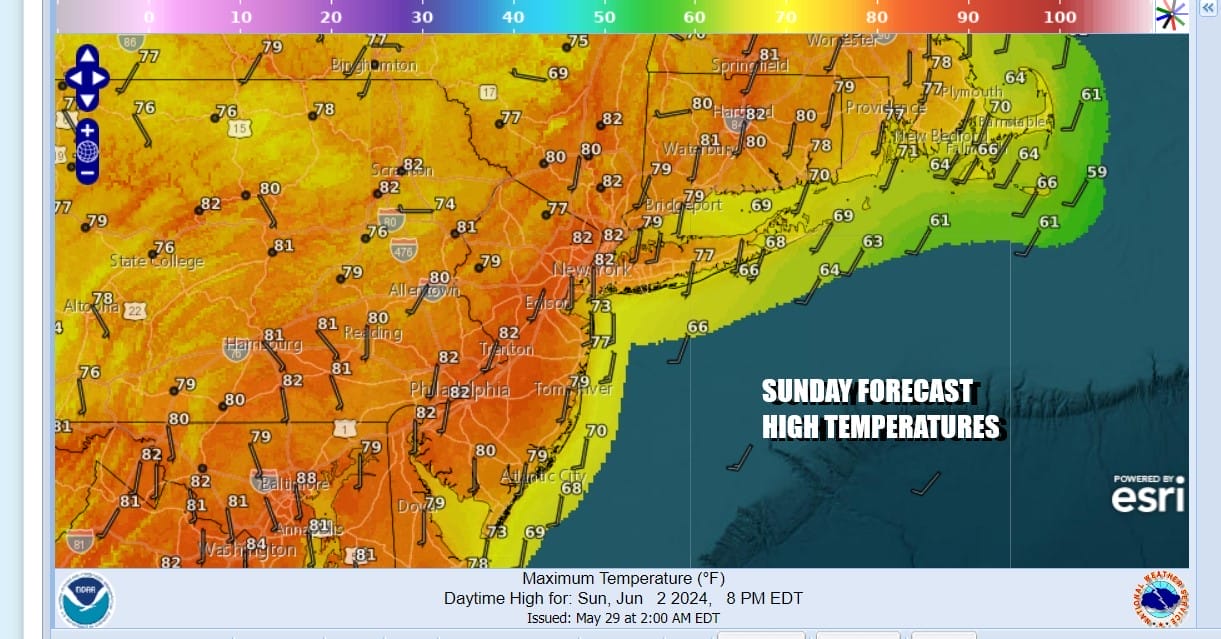
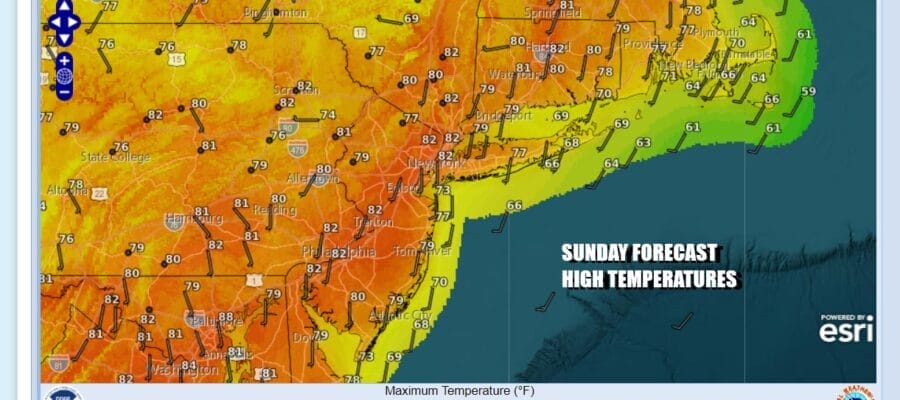
We are about to pull off a dry Sunday and cap off a dry weekend. This will be the first weekend in 17 where no rain fell on either weekend day. To the west we have an upper trough moving eastward with a dying area of showers and clouds. Some of those clouds will move in from time to time today but overall it will be a day of mostly to partly sunny skies from morning to afternoon. South winds along along the coast will keep areas exposed to the ocean in the 70s while inland highs should reach into the 80s without much difficulty.
SATELLITE WITH LIGHTNING STRIKES

WEATHER RADAR

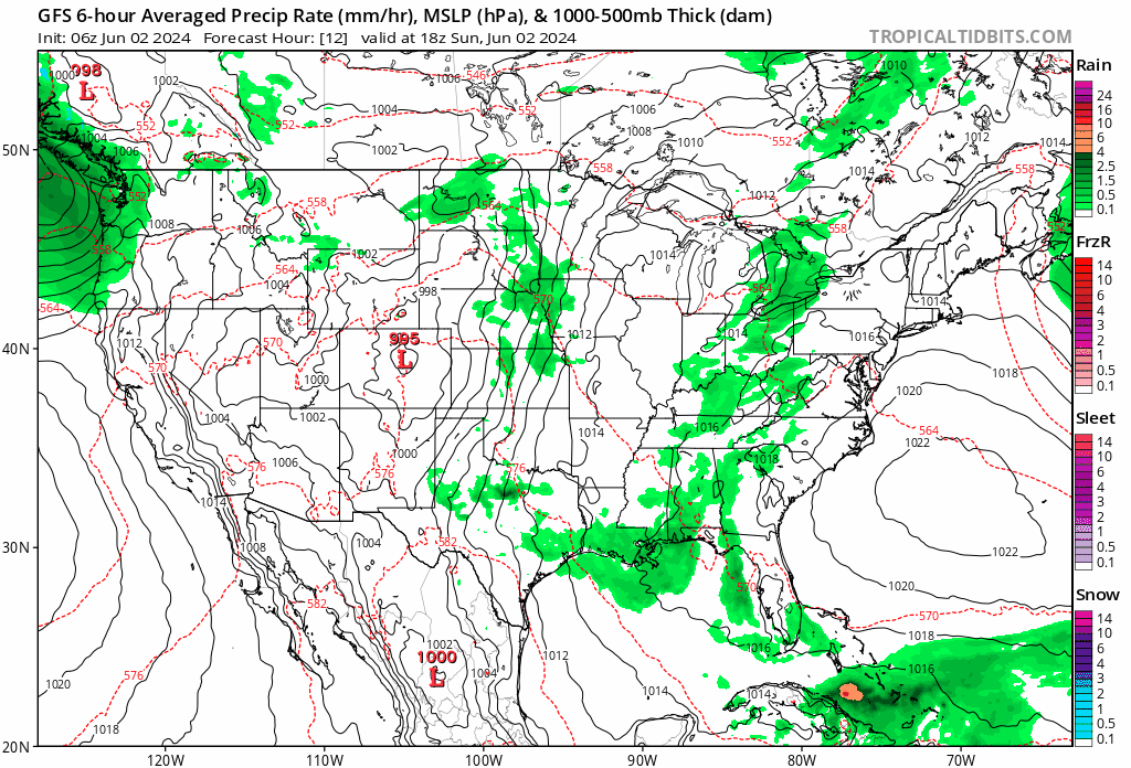
Showers on the radar loop are underwhelming and unimpressive. At the rate those showers are moving they would not reach Eastern Pennsylvania to Southern New England later this evening or more than likely overnight. Then there is the question of their survival since the area of rain continues to slowly weaken. We will mention the chance for some scattered showers tonight and lows by morning will be in the upper 50s to mid 60s.

Overnight night clouds will linger into Monday but we should see skies go partly sunny. We will leave in the chance there could be a shower or thunderstorm in one or two spots, mainly in the afternoon and evening. Monday highs will reach into the 80s inland and 70s will hold along coastal areas. Tuesday we probably will see more sunshine and fewer clouds. Winds will be onshore so we look for temperatures to be about the same as Monday. Highs Tuesday will reach the 80s in most places except for 70s near the coast.

We will probably squeeze out one more dry day Wednesday. High pressure in Northeastern New England is pinned between low pressure to the east and one to the west. This is slowing everything down but eventually low pressure and a cold front will head eastward into the Great Lakes and Ohio Valley. Tha front will reach the East Coast Thursday so we will probably see the chance for showers and thunderstorms developing as early as Wednesday night.
This leaves us with a dry day Wednesday with no worse than partly sunny skies and highs in the upper 70s to lower 80s. Showers and some thunderstorms will move through Wednesday night into Thursday and then we could see some lingering showers and thunderstorms later in the day. Highs will be in the upper 70s and lower 80s both Wednesday and Thursday. A cooler though unstable pattern will cover the Eastern US Friday and through next weekend which means there could be shower risks Friday and through next weekend with dry periods in between.
BE SURE TO DOWNLOAD THE FREE METEOROLOGIST JOE CIOFFI WEATHER APP &
ANGRY BEN’S FREE WEATHER APP “THE ANGRY WEATHERMAN!
MANY THANKS TO TROPICAL TIDBITS FOR THE USE OF MAPS
Please note that with regards to any severe weather, tropical storms, or hurricanes, should a storm be threatening, please consult your local National Weather Service office or your local government officials about what action you should be taking to protect life and property.
(Amazon is an affilate of Meteorologist Joe Cioffi & earns commissions on sales.)


