Dry Weather Through Sunday Afternoon, Scattered Showers Sunday Night,
Week Ahead Outlook

Dry Weather Through Sunday Afternoon, Scattered Showers Sunday Night,
Week Ahead Outlook

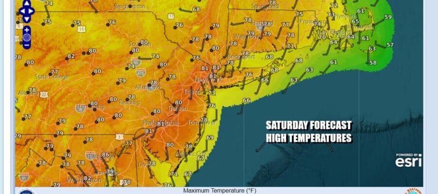
It has rained on at least one weekend day for the last 16 weekends. This weekend we will probably break that streak everywhere, at least if we consider the time period through early Sunday evening. Today and the daytime Sunday will be rain free and the satellite loops show clear skies up and down the Eastern Seaboard. Sunshine should be with us all day long. Temperatures should reach into the 80s inland and stay in the 70s along the coast especially along south and east facing shorelines. Radars are nice and quiet as well.
SATELLITE WITH LIGHTNING STRIKES

WEATHER RADAR

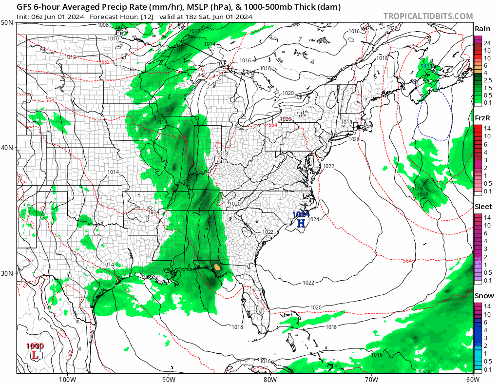
Showers and thunderstorms will be confined to a north south band from the Central Gulf States northward through into the Ohio Valley and the Lower Great Lakes. The upper trough driving this system is going to be weakening as it moves eastward. Most of the showers and thunderstorms will likely fall apart before the shortwave trough reaches the coast sometime during Sunday night.
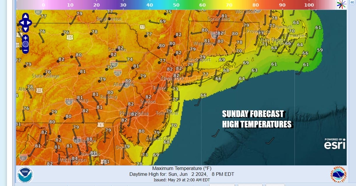
Tonight skies should be mainly clear other than some patchy low clouds that might develop along the coast. Inland lows will be in the mid to upper 50s and coastal/urban center lows will be in the low to mid 60s. Sunday we will see sunshine giving way to some afternoon arriving clouds. High temperatures again will reach into the 80s inland but cooler 70s will prevail along south and east facing shorelines.
As we move ahead to next week, it seems that much of the time it will be dry. High pressure will move east of New England so this will keep us in southerly flow into Wednesday. Part of the wind trajectory will be from off the ocean so that will likely keep temperatures from rising to high. Monday, Tuesday & probably Wednesday will be dry with probably no worse than partly sunny skies. Most highs will reach the upper 70s to some lower 80s each day with cooler readings along the shore. Nights will see lows in the upper 50s to mid 60s. Showers could come along Thursday with the next cold front and they may linger into Friday with highs both Thursday and Friday in the 70s.
BE SURE TO DOWNLOAD THE FREE METEOROLOGIST JOE CIOFFI WEATHER APP &
ANGRY BEN’S FREE WEATHER APP “THE ANGRY WEATHERMAN!
MANY THANKS TO TROPICAL TIDBITS FOR THE USE OF MAPS
Please note that with regards to any severe weather, tropical storms, or hurricanes, should a storm be threatening, please consult your local National Weather Service office or your local government officials about what action you should be taking to protect life and property.
(Amazon is an affilate of Meteorologist Joe Cioffi & earns commissions on sales.)


