Sunshine Dry Weather Through The Weekend
Pleasant Days Cool Nights Into Saturday

Now that we have gotten rid of the upper trough and cold front of yesterday, the risk for showers is non existent through the weekend and even into the start of next week. No rain is forecast so we can enjoy what is a pleasant air mass from Canada that has moved through the Plains, Ohio Valley and the South yesterday and now it moves into the Northeast and Middle Atlantic states. Look for sunny skies today with most highs in the upper 70s and lower 80s and very low humidity.
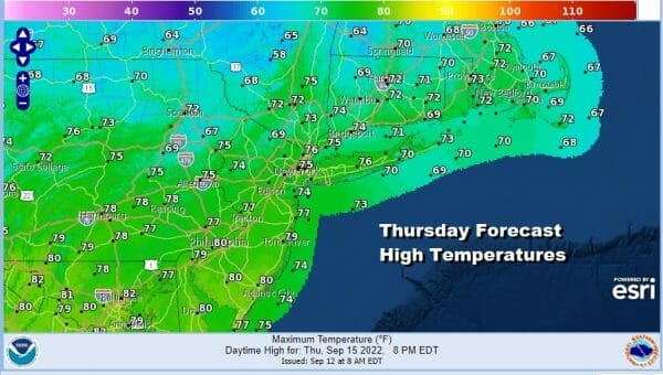
Tonight is nice and clear with lows in the mid 50s to lower 60s with 40s in the coolest spots well northwest of the coast. Thursday sees the coolest of this cool air mass build in so we have another day with lots of sunshine. Highs Thursday will be in the mid to upper 70s.
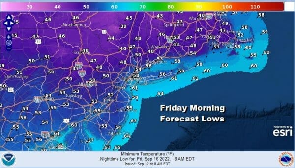
Thursday night into the Friday morning will bring the coolest temperatures since back last June. Lows under clear skies will be in the mid to upper 40s well inland and low to mid 50s warmer urban centers and along the coast. Friday will be another day of sunshine and pleasant conditions with highs in the 70s.

Friday night into Saturday morning will be another cool night under clear skies. Lows will be in the upper 40s well inland in cold spots and mid 50s to lower 60s just about everywhere else. The weekend looks good to me with no issues. We will see temperatures start to move up Saturday, probably back into the lower 80s and Sunday will be warm with highs in the low to mid 80s. Both days will feature a good deal of sunshine. Dew points will start to move up Sunday back into the 60s so it will start to feel a little more humid by then.

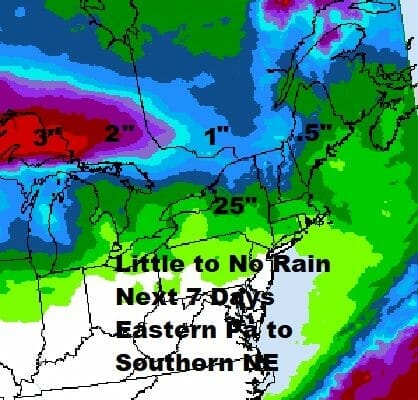
We mentioned earlier that we won’t see much if any rain in the next 7 days at least and not much in many areas means no rain at all. Most of the rain will either be falling along the border with Canada and points northward or offshore and by offshore I mean well offshore. The upper flow is northwest into the middle of next week and other than weak cold fronts, there isn’t any way moisture gets in here. The pattern might shift around a bit late next week and beyond but until then, enjoy the last weekend of summer.
BE SURE TO DOWNLOAD THE FREE METEOROLOGIST JOE CIOFFI WEATHER APP &
ANGRY BEN’S FREE WEATHER APP “THE ANGRY WEATHERMAN!
MANY THANKS TO TROPICAL TIDBITS & F5 WEATHER FOR THE USE OF MAPS
Please note that with regards to any severe weather, tropical storms, or hurricanes, should a storm be threatening, please consult your local National Weather Service office or your local government officials about what action you should be taking to protect life and property.


