Shower Thunderstorm Risks Shift East Into the Afternoon
Then Great Weather Wednesday Into the Weekend
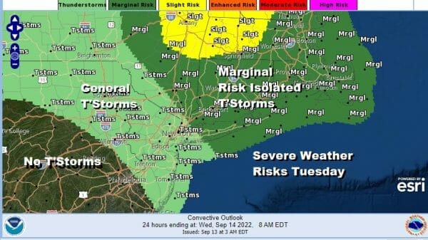
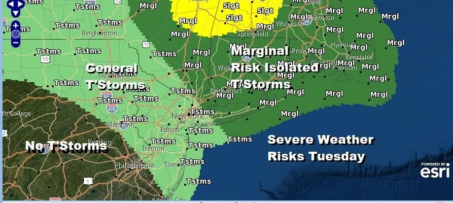
A cold front is moving through today and we had some overnight showers and thunderstorms play through. Now we wait for another round of showers and possible thunderstorms into this afternoon but the main area of development for severe weather will be from NYC and the Hudson Valley north and east with a marginal risk being indicated for Southern New England and Long Island to the Hudson Valley. General thunderstorms are possible as far south as Central NJ to Northeast Pennsylvania. No thunderstorms are forecast for Southeast Pa and points west and south.
SATELLITE

WEATHER RADAR
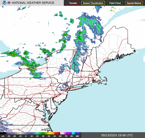
The swirl on the satellite is an upper low moving through the Great Lakes and that will head into Upstate NY later today and tonight and this is setting off this last round of showers and thunderstorms. Once that plays through weather conditions will start to improve late today as dry air starts to arrive on a northwest wind.
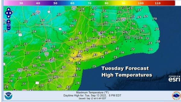
Areas to the west in to Pennsylvania and Western NJ might see improvement during the afternoon hours with some sun but areas to the east under the severe weather risk will likely have to wait. Look for changeable sky conditions in between with highs in the upper 70s and lower 80s.
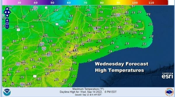
Tonight skies should clear out with most lows in the upper 50s to lower 60s. Wednesday we will see sunshine and highs will be in the upper 70s and lower 80s. Dew points and humidity levels will be quite low and actually turn even lower. Another weak front will pass Wednesday night and that will bring in the coolest air we have seen since back in June.
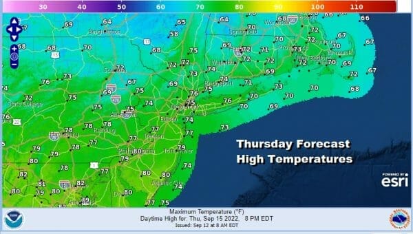
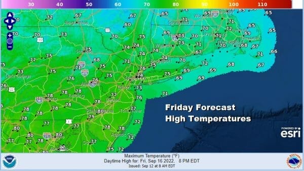
Thursday and Friday will be two days of sunshine separated by a very cool night Thursday night into Friday Morning. Thursday highs will be in the middle to upper 70s. Then by Friday morning we will be down in the 40s in many inland locations and most lows in warmer urban centers and coastal areas will be in the low to mid 50s.

Saturday and Sunday are looking to be two nice days. Another cool start will begin the weekend with Saturday morning lows in the 40s inland and low to mid 50s coast and warmer urban areas. Saturday we will see lots of sunshine with highs in the 70s with low humidity. High pressure moves offshore and the wind will turn west on Sunday. Temperatures will warm Sunday with sunshine and highs in the low to middle 80s. No rain is forecast until sometime next week. This is the last weekend of summer folks so enjoy it. We have seen many nice summer weekends so we will finish the summer with nice weather.
BE SURE TO DOWNLOAD THE FREE METEOROLOGIST JOE CIOFFI WEATHER APP &
ANGRY BEN’S FREE WEATHER APP “THE ANGRY WEATHERMAN!
MANY THANKS TO TROPICAL TIDBITS & F5 WEATHER FOR THE USE OF MAPS
Please note that with regards to any severe weather, tropical storms, or hurricanes, should a storm be threatening, please consult your local National Weather Service office or your local government officials about what action you should be taking to protect life and property.


