Sunshine Dry Conditions Continue But Cooler Weather
Showery Rains On the Way Wednesday Late Through the Weekend

Sunshine Dry Conditions Continue But Cooler Weather
Showery Rains On the Way Wednesday Late Through the Weekend

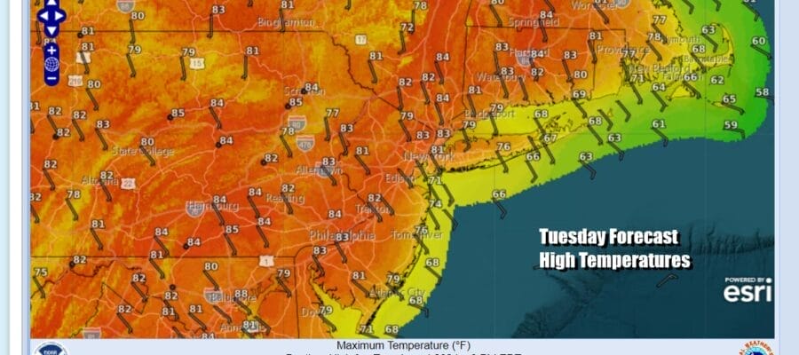
Satellite loops show hardly any clouds in the Northeast and Middle Atlantic states. We have another dry day of weather with lots of sunshine. Winds will be onshore and that will keep temperatures along coastal areas from New Jersey to Long Island and Southern New England in the 70s (60s at the beaches). Inland highs should be able to reach the low and middle 80s. There is nothing on the radar to worry about today or tonight.
SATELLITE WITH LIGHTNING STRIKES

WEATHER RADAR

The weather pattern across the United States is changing and we are headed for a trough in the Eastern US and a ridge developing in the Western US. This is going to mean that we will see cooler than average temperatures developing later this week and through the weekend (and probably next week) throughout much of the Eastern US while hot weather will be under the ridge in the Western and Southwestern US.

One positive development in all this is that the daily deluge of severe weather up and down the Plains and Mississippi River Valley is about to take a break though we have one more day of severe weather and elevated tornado risk from Texas Louisiana & Mississippi northward up and down the entire Mississippi and Missouri River Valleys to Minnesota and the Western Great Lakes.

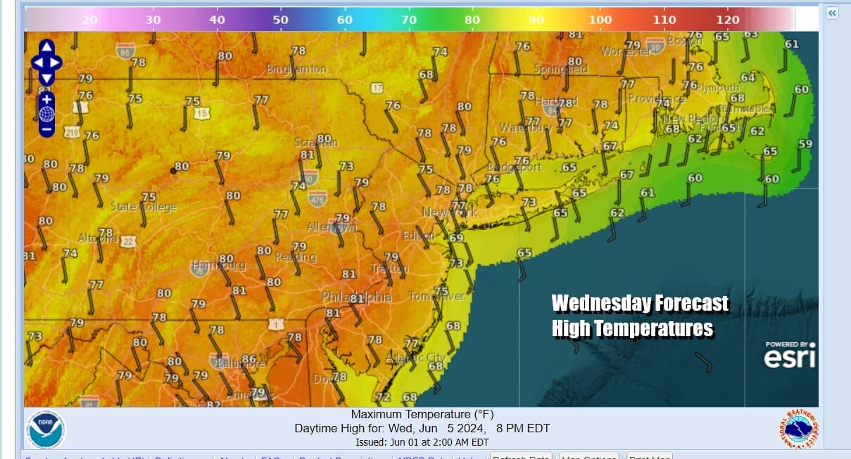
Wednesday sees an approaching cold front into the Eastern US so we expect to see sunshine Wednesday give way to some arriving clouds. Temperatures will be topping out again into the 80s in most inland areas but the winds from off the ocean will once again keep the coastal areas of New Jersey, Long Island & Southern New England in the 70s.
We will likely see showery rains and perhaps a few thunderstorms Wednesday night into early Thursday morning as the front passes. Right now we don’t expect widespread severe weather though we couldn’t rule out an isolated severe thunderstorm chance. Once the front moves offshore we will be dealing with a strong upper low in the Eastern Great Lakes and Northeast that will be sitting in this area through the weekend sending upper troughs through from time to time.
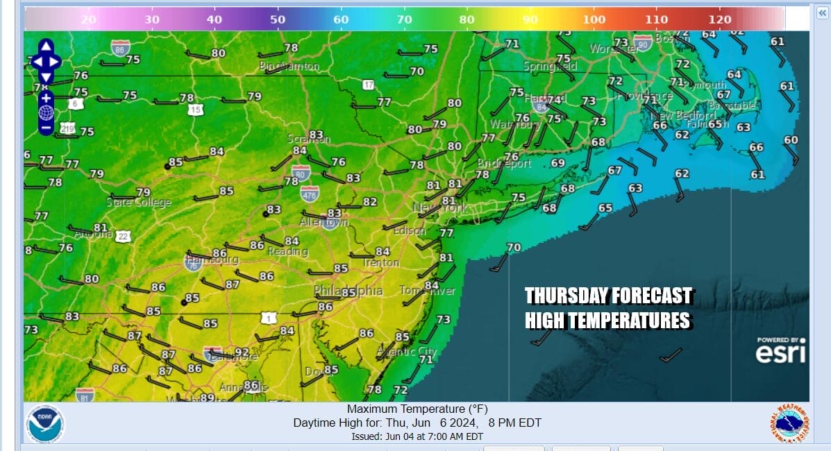
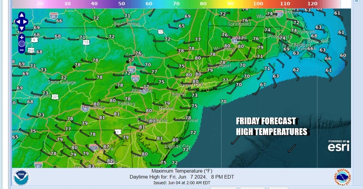
Thursday will be a day of sunshine that will probably give way to developing clouds and there could be some scattered showers or isolated thunderstorms. The best chances for this will be inland, north and northwest of the coast due to the cold unstable atmosphere. Thursday highs will reach into the 80s as we will have more of a west wind. However Friday it will be cooler with highs in the 70s to around 80 and another day of sunshine, some developing clouds, and the risk for scattered showers or an isolated thunderstorm.
Weather conditions will remain pretty much the same over the weekend with highs both Saturday and Sunday in the mid to upper 70s. Right now it appears that Saturday may be the better and the drier of the two weekend days as an upper trough swings through Sunday with an increasing chance for showers.
BE SURE TO DOWNLOAD THE FREE METEOROLOGIST JOE CIOFFI WEATHER APP &
ANGRY BEN’S FREE WEATHER APP “THE ANGRY WEATHERMAN!
MANY THANKS TO TROPICAL TIDBITS FOR THE USE OF MAPS
Please note that with regards to any severe weather, tropical storms, or hurricanes, should a storm be threatening, please consult your local National Weather Service office or your local government officials about what action you should be taking to protect life and property.
(Amazon is an affilate of Meteorologist Joe Cioffi & earns commissions on sales.)


