Cold Front Approaching Showers Thunderstorms Late Today Into Thursday

Cold Front Approaching Showers Thunderstorms Late Today Into Thursday
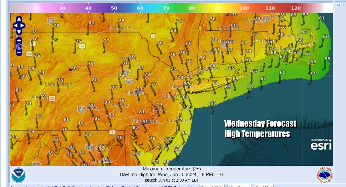
We will see some sunshine today however the satellite loops are showing an approaching cold front. Clouds are to the west and we will likely see sunshine give way to arriving clouds as the day wears on. We are still dealing a flow off the ocean thanks to high pressure positioned to the northeast. South to southeast winds both and the coast and inland will likely limit the strength and magnitude of showers and thunderstorms but there will be some and they will come through late today in Eastern Pennsylvania and then moving eastward into Southern New England overnight. Temperatures today will be in the 70s along most coastal locations while inland highs will likely reach the upper 70s and lower 80s.
SATELLITE WITH LIGHTNING STRIKES

WEATHER RADAR

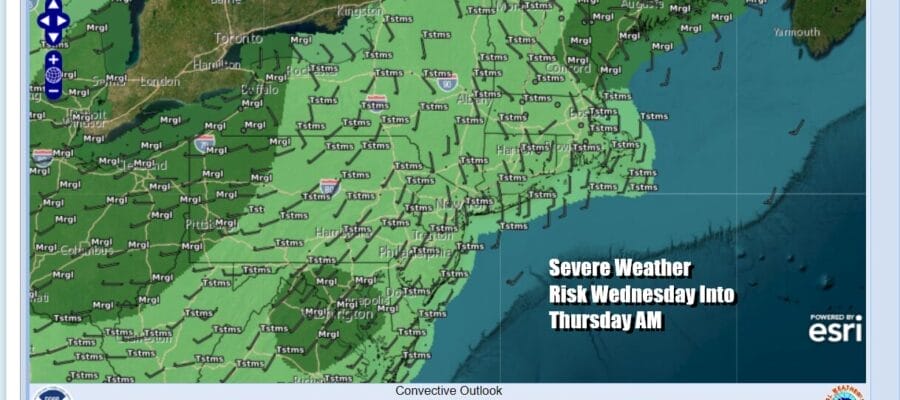
Radars are mostly quiet for now and the Storm Prediction Center is not indicating any severe weather risk except for a small area of isolated severe thunderstorms possible in Northeast Virginia to Central Maryland. This includes Washington DC and Baltimore. The other area is in Maine and Southeastern New Hampshire. General thunderstorms are forecast for the Northeast and Middle Atlantic by SPC.

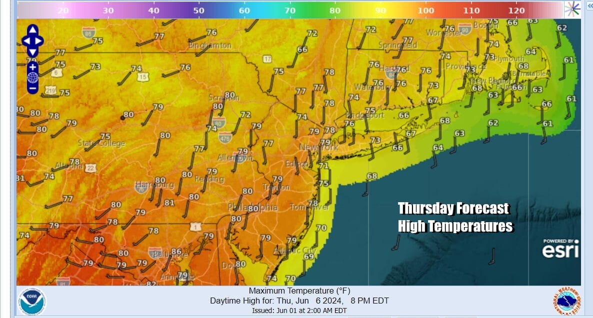
Showers and some thunderstorms will be running around tonight into Thursday morning. There will be short break and then one last push from west to east of a few showers late Thursday morning into the early afternoon. There after weather conditions should start to slowly improve from west to east. Developing sunshine and a west wind should send temperatures into the 80s.
Things begin to cool off Friday as an upper trough parks itself over the Great Lakes and Northeast Friday and lasting through the weekend. The rotating upper low will bring shortwave troughs of varying strengths though the Northeast and Northern Mid Atlantic. This is going to create a somewhat cold and unstable atmosphere aloft. This will lead to days where we start with sun but it will tend to self destruct to some degree especially inland.

All of this means that we will see a mix of sun and clouds Friday and Saturday. Temperatures both days will be in the 70s. There is the chance for some scattered showers or even a brief thunderstorm Friday but I would think the highest chances will be inland rather than the coast. Saturday will likely be the better of the two weekend days with sunshine and arriving clouds with highs in the 70s. We will likely see some showers Saturday night and there will be some showers around Sunday as another upper trough moves through. Sunday highs will be in the 70s. The cooler pattern will continue for the start of next week.
BE SURE TO DOWNLOAD THE FREE METEOROLOGIST JOE CIOFFI WEATHER APP &
ANGRY BEN’S FREE WEATHER APP “THE ANGRY WEATHERMAN!
MANY THANKS TO TROPICAL TIDBITS FOR THE USE OF MAPS
Please note that with regards to any severe weather, tropical storms, or hurricanes, should a storm be threatening, please consult your local National Weather Service office or your local government officials about what action you should be taking to protect life and property.
(Amazon is an affilate of Meteorologist Joe Cioffi & earns commissions on sales.)


