
Showers Thunderstorms Isolated Severe Storms Possible Late Today

Showers Thunderstorms Isolated Severe Storms Possible Late Today
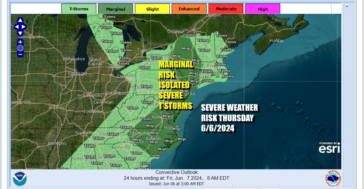
We have a warm front that has moved through Eastern Pennsylvania to Southern New England and that puts much of the Northeast and Mid Atlantic in a zone for severe thunderstorm risk later today. The Storm Prediction Center has a marginal risk for isolated severe thunderstorms from Northern New York and Western New England south into Eastern Virginia and North Carolina. This is includes New York City, Philadelphia, Baltimore, Washington DC, Richmond, and Raleigh Durham.

The warm front has moved by and that has placed Eastern Pennsylvania to Southern New England in a warm humid air mass for today. Highs will reach into the low and middle 80s especially away from the ocean. Scattered thunderstorms and isolated severe thunderstorms will develop with a cold front moving east and those storms will move through late this afternoon and tonight. Strong gusty winds and brief heavy rains are possible as the front goes by.
SATELLITE WITH LIGHTNING STRIKES

WEATHER RADAR

Once the front passes we turn to Friday and the weekend. An upper air storm over the Great Lakes and Southeastern Canada will be the focal point for weather through Sunday. It creates a cold unstable atmosphere alfot and that opens the door for some scattered shower and thunderstorm activity Friday Saturday and Sunday. However much of that activity likely will be well inland north and west of the coast from Northern Pennsylvania to the Catskills and the Middle Hudson Valley northward.
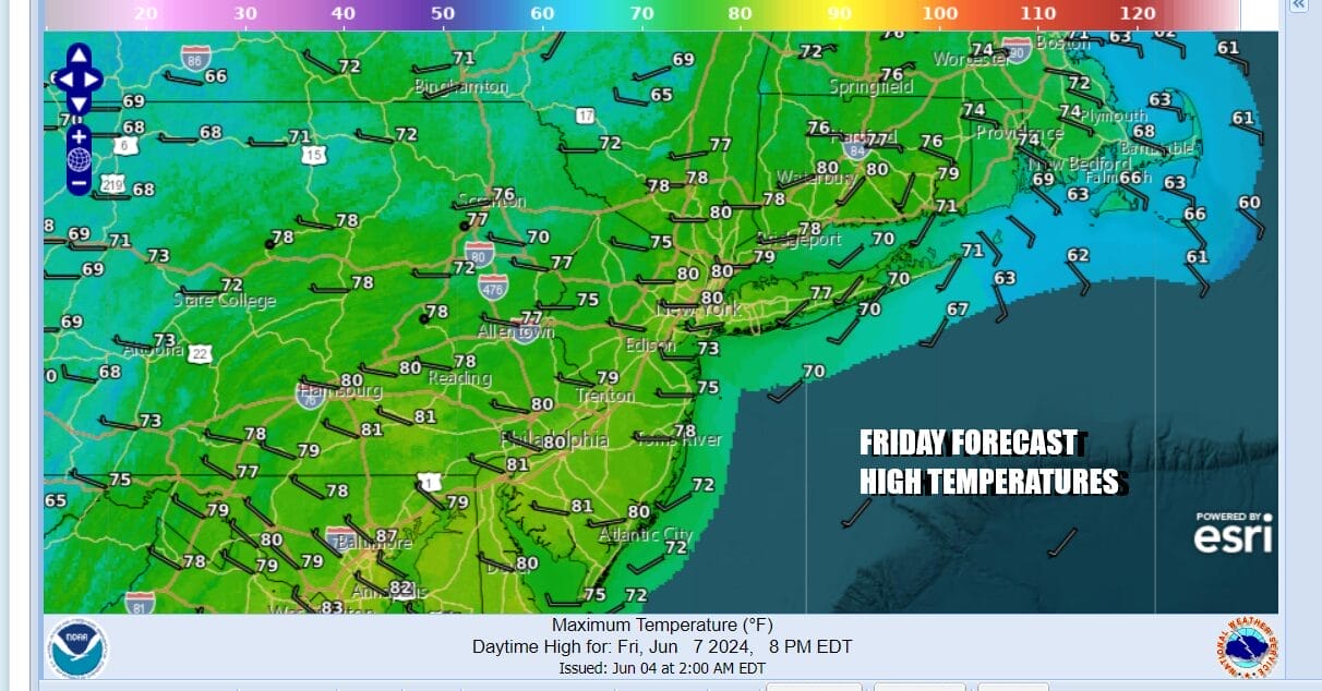
Friday will be no wrose than partly sunny in most places. It probably works out where the day starts mostly sunny and then clouds develop and we go partly sunny to mostly cloudy. We will throw in the chance for an isolated shower or thunderstorm. Best chances again will be inland and if they happen they will be brief. Highs willl be in the upper 70s to lower 80s.

Saturday and Sunday we look for a repeat with partly sunny conditions along the coastal plain and moslty cloudy conditions inland. Again we see the chance for scattered showers or an isolated thunderstorm. Saturday highs will be in the mid 70s to around 80 degrees. Sunday highs will be in the mid to upper 70s. If i had to choose the better weekend day I would go with Saturday.
BE SURE TO DOWNLOAD THE FREE METEOROLOGIST JOE CIOFFI WEATHER APP &
ANGRY BEN’S FREE WEATHER APP “THE ANGRY WEATHERMAN!
MANY THANKS TO TROPICAL TIDBITS FOR THE USE OF MAPS
Please note that with regards to any severe weather, tropical storms, or hurricanes, should a storm be threatening, please consult your local National Weather Service office or your local government officials about what action you should be taking to protect life and property.
(Amazon is an affilate of Meteorologist Joe Cioffi & earns commissions on sales.)


