
Most of Friday & the Weekend Will Be Fine Cold Front Passes Late Sunday

Most of Friday & the Weekend Will Be Fine Cold Front Passes Late Sunday
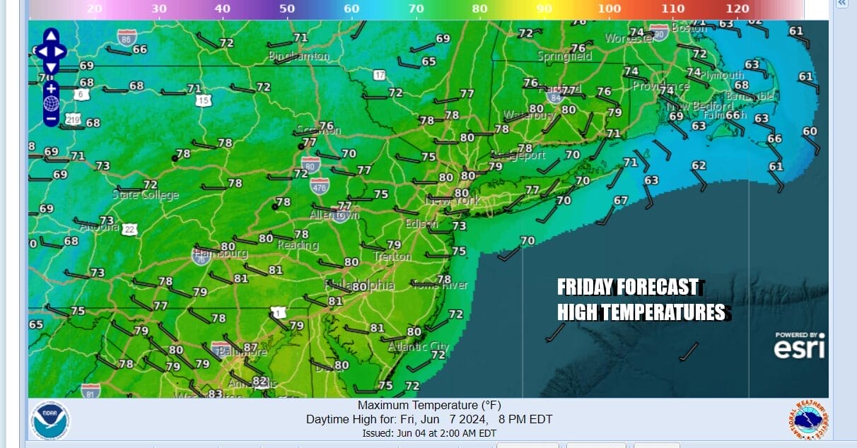
We have arrived at the door step of the weekend and Friday’s for the next few months are mostly getaway days for travelers and vacations. We had a cold front pass last night. Some of you saw showers and thunderstorms but others did not. Now we can move forward to drier and less humid conditions overall for the next few days. It won’t be picture perfect but it should be fine most of the time. Today will be no worse than partly sunny for much of the day. Inland areas could see more clouds as we do have a series of upper troughs moving through the Northeast. There could be some scattered showers or a thunderstorms but these should be well inland from the Catskills and northernmost Pennsylvania northward. Temperatures today will be topping out in the upper 70s to around 80 or so.
SATELLITE WITH LIGHTNING STRIKES

WEATHER RADAR

Most lows tonight will be in the mid 50s to around 60 or so under mainly clear skies. Warmer urban areas may finish closer to 65 or so. Saturday is looking like a nice day overall with again no worse than partly sunny skies. It should be a shower free day with no issues. Highs will be in the upper 70s to around 80 or so.

The upper troughs moving though the Northeast are due to a strong upper low in between the Great Lakes and Southeastern Canada which is creating a northwest flow of mostly dry air. The next upper trough and cold front will be heading here Sunday but it is a case of a front moving into a dry air mass and followed by yet another dry air mass. The result will be a cold front that passes Sunday evening with a dying area of showers and clouds and not much more.
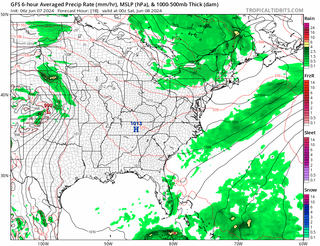
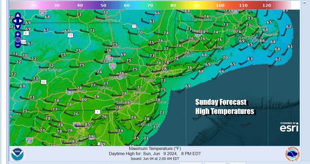
The GFS model times a frontal passage Sunday in the middle of the day so we will call it partly sunny for Sunday and put in the chance for a passing midday or early afternoon shower which will be minimal and last for a very short time, if you get one at all. Temperatures Sunday will be in the upper 70s to lower 80s.
Next week sees a cool high building southward from Central Canada and the Great Lakes as the northwest flow aloft continues. This leaves us in a mostly dry pattern through Wednesday with temperatures about where they should be for this time of year. The next chance for any rain probably comes next Thursday as a flow from the south starts to bring moisture up the East Coast. Have a great weekend.
BE SURE TO DOWNLOAD THE FREE METEOROLOGIST JOE CIOFFI WEATHER APP &
ANGRY BEN’S FREE WEATHER APP “THE ANGRY WEATHERMAN!
MANY THANKS TO TROPICAL TIDBITS FOR THE USE OF MAPS
Please note that with regards to any severe weather, tropical storms, or hurricanes, should a storm be threatening, please consult your local National Weather Service office or your local government officials about what action you should be taking to protect life and property.
(Amazon is an affilate of Meteorologist Joe Cioffi & earns commissions on sales.)


