
Sunshine But Still Chilly Showers Later Thursday
Rain Late Friday Into the Weekend
After a cold night, we are going to see temperatures moderate slightly today but not by much. ninds will be lower today and that alone should make it feel a bit better. There will be a fair amount of sunshine for much of the day across Eastern Pennsylvania to Southern New England. The core of this cold air mass is overhead and will begin to slowly exit to the east later today and tonight. However we will still have temperature issues today with highs just reaching the 40s to around 50 degrees. Nothing much is happening on local radars today.
SATELLITE WITH LIGHTNING STRIKES

WEATHER RADAR

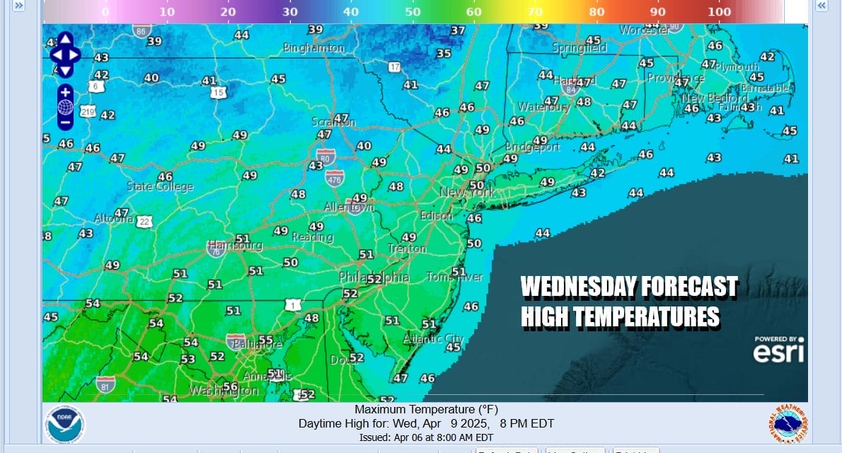
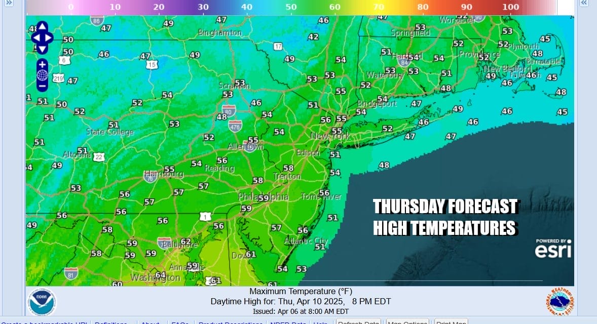
We see mainly clear skies tonight with most lows in the 30s with a few below freezing readings inland. Thursday might start with a little sun but clouds will be arriving as low pressure from the Great Lakes drops southeastward into the Appalachians. The will be an approaching area of rain with this system and some of it could reach the coast late Thursday or definitely Thursday night. Thursday highs will reach back into the 50s.
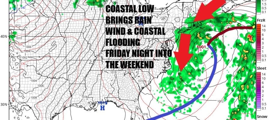
This low in the Appalachians will become the primary storm system as it shifts its way eastward to the Middle Atlantic coast by Saturday morning. An area of steady and potentially heavy rain will develop around the low center and push northward from Virginia to Southern New England and the Hudson Valley during Friday night and lasting through much of the day Saturday and even into Saturday night.

Winds will turn to the east with this system and we will be watching for the possibility of coastal flooding at high tide since we do have a full moon this weekend and these are the abnormally high spring tides. The upper air system with this developing low will be slow to move so we certainly will see clouds through Sunday and the offshore low could mean additional rain or showers are possible. The raw conditions with the ocean wind means that temperatures Friday and Saturday will be in the upper 40s and lower 50s at best and perhaps a little higher in the 50s for Sunday. Weather conditions should improve next Monday along with a short lived warm up.
BE SURE TO DOWNLOAD THE FREE METEOROLOGIST JOE CIOFFI WEATHER APP &
ANGRY BEN’S FREE WEATHER APP “THE ANGRY WEATHERMAN!
MANY THANKS TO TROPICAL TIDBITS FOR THE USE OF MAPS
Please note that with regards to any severe weather, tropical storms, or hurricanes, should a storm be threatening, please consult your local National Weather Service office or your local government officials about what action you should be taking to protect life and property.


