Sunshine Back Today Rain Late Thursday Very Cold Friday Saturday
A new high is building in today and we are seeing nice clear skies on the satellite picture. We will see sunshine all day long. Temperatures today will be struggling a bit as highs will reach the low and mid 50s. There are no weather issues on the regional or local radars today or for tonight either which should be mostly clear for most of the night. By morning some high clouds will start to arrive from the west ahead of an arctic boundary that will be moving through Thursday.
SATELLITE

REGIONAL RADAR

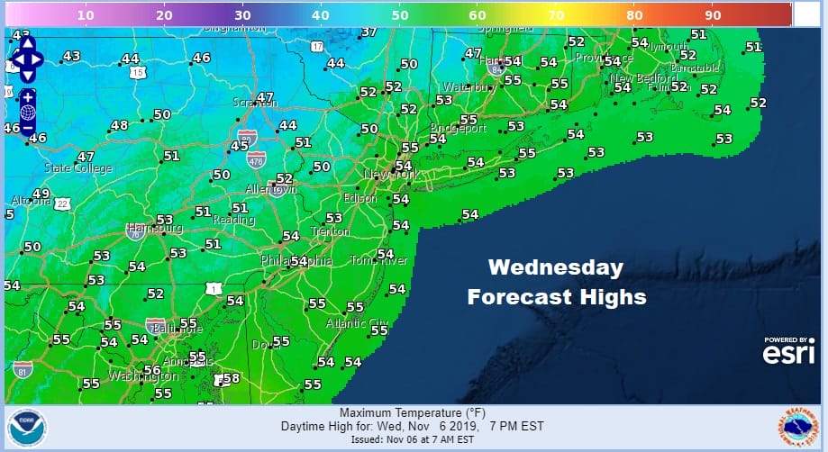
On to Thursday with this approaching cold front we will see thickening clouds with rain developing from west to east from late morning to late afternoon. Highs will reach the 50 along the coast but inland areas will settle in the 40s once the rain gets underway.

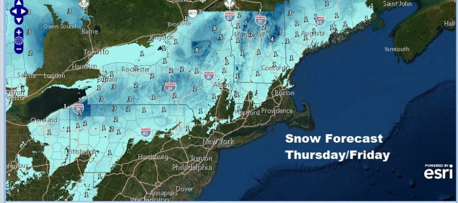
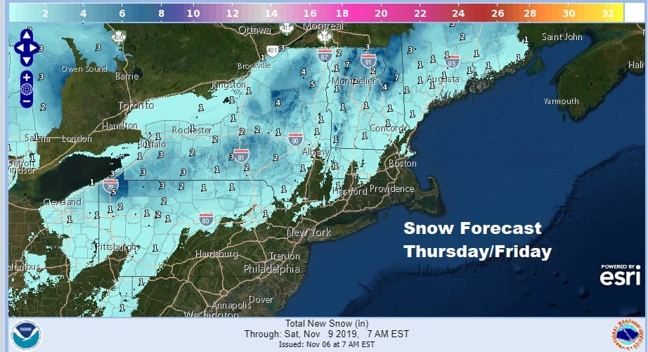
I have been completely underwhelmed by this system from the get go and while there will be some snow from this in the Northeast it really doesn’t impact us very much. This has always been about a wave of low pressure moving through with cold air racing east. The wave moves out before the cold air gets here. It is that simple. Precipitation could briefly change to some sleet or snow in Northeast Pennsylvania and Northwest Jersey northeastward into the Hudson Valley north of 84 and into NW Connecticut but it doesn’t amount to much.
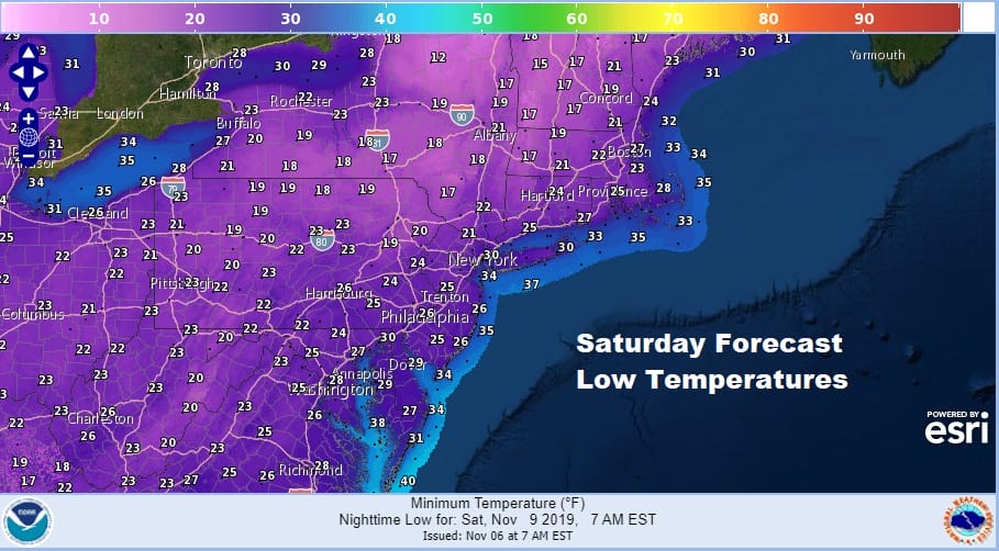
The bigger story is the cold air that is going to be sweeping in behind this system and that remains on course. By Friday morning inland areas could be below freezing and coastal areas in the middle to upper 30s. Friday will be a windy day with clouds and some sunshine. Temperatures will be in the upper 30s and lower 40s all day and wind chills will make it feel like it is down in the 20s. Then we head down for an area wide hard freeze and lows Saturday morning will be in the 20s with teens in many areas north and west of the coast.
The weekend looks good but cold. Saturday we will have sunshine but it will be another cold day with highs in the upper 30s and lower 40s. Sunday we will have sunshine with highs back in the upper 40s and lower 50s. The next arctic boundary will be approaching late Monday so look for increasing clouds Monday with highs in the 50s. Then the arctic boundary moves through and we watch to see if a wave develops on it. Another wave of low pressure and another shot of cold air will be racing eastward and we will see if the cold air gets in before the wave or if the wave goes by before the cold air arrives for Tuesday into Wednesday. We will address this in the longer range later today.
BE SURE TO DOWNLOAD THE FREE METEOROLOGIST JOE CIOFFI WEATHER APP &
ANGRY BEN’S FREE WEATHER APP “THE ANGRY WEATHERMAN!
MANY THANKS TO TROPICAL TIDBITS FOR THE USE OF MAPS
Please note that with regards to any severe weather, tropical storms, or hurricanes, should a storm be threatening, please consult your local National Weather Service office or your local government officials about what action you should be taking to protect life and property.


