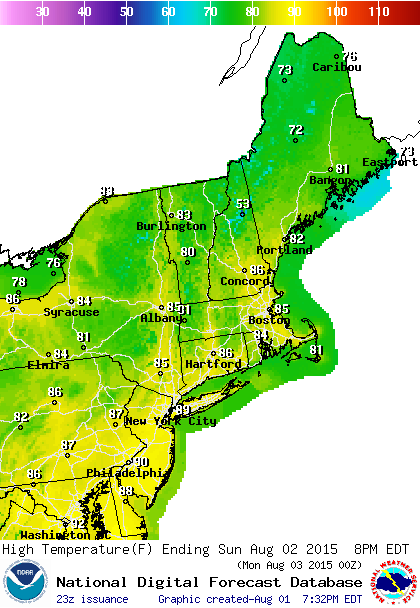
Saturday comes to an end on a good note. Radar does show a couple of isolated downpours over Northwest New Jersey and Eastern Pennsylvania but they will be gone soon. Overnight skies should clear out as dry air comes in for Sunday. The daytime Sunday we will see very warm conditions with sunshine but dew points will be under 60 which means it will be comfortable.
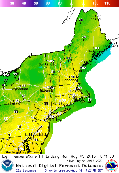
Monday as the next cold front approaches will bring higher humidity and sunshine with temperatures reaching the upper 80s to low 90s. There could be scattered thunderstorms in the afternoon and Monday night until the cold front passes early Tuesday morning. Tuesday we will see blue skies and sunshine with very warm temperatures up around 90 but humidity will be dropping as the day wears on.
Beyond Tuesday the weather gets a bit more complicated with this front stalling out offering the threat for showers as early as Wednesday night. Cooler temperatures are in store as the 90s take a back seat for awhile.