Summer Weekend Hot Saturday Severe Weather Possible Less Humid Sunday
We are headed in to the weekend after 2 terrific weather days of sunshine, minimal cloud cover and minimal thunderstorm activity. On the satellite picture we are seeing just a few patchy high clouds over the region. We will watch for a pop up shower or thunderstorm this evening over Southern New Jersey and Southeastern Pennsylvania. Everywhere else it should be a quiet warm evening. Humidity levels were not all that high today except in South Jersey & Southeastern Pennsylvania which is where the pop up risk exists. Otherwise tonight will be a warm night and it will turn more humid everywhere with lows in the 60s to around 70.
SATELLITE

REGIONAL RADAR

Regional and local radars are showing minimal activity but again for this evening in South Jersey & Southeastern Pennsylvania a few pop up thunderstorms will occur. Earlier in the week we thought there could be an overnight shower or thunderstorm scattered about. However now it seems we won’t see anything overnight.
LOCAL RADAR NEW YORK CITY

LOCAL RADAR PHILADELPHIA


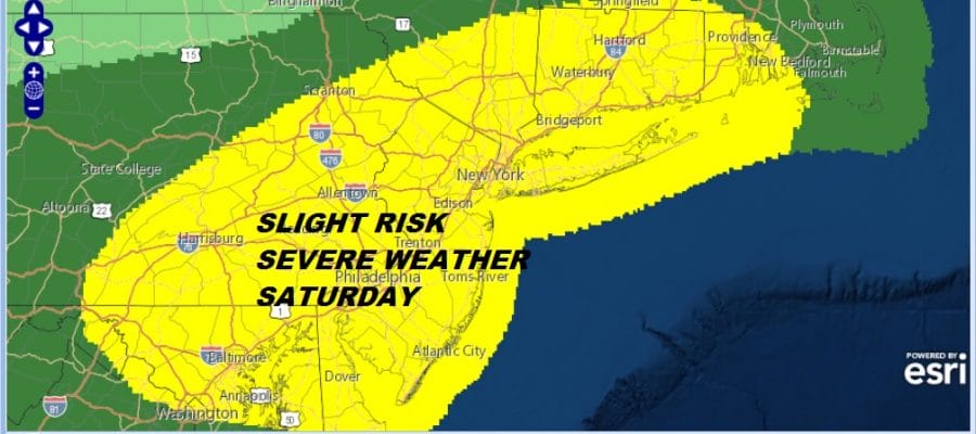
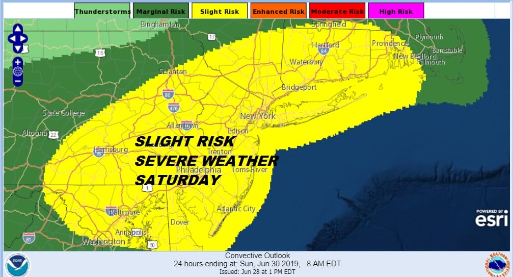
Saturday will be a hot and steamy day and definitely uncomfortable with sunshine taking highs into the upper 80s and lower 90s. Dew points will be rising to the upper 60s to lower 70s. Add a cold front dropping southward from upstate NY and you have the potential for thunderstorms. The Storm Prediction Center has much of Eastern and Southern Pennsylvania northeastward into New England at a slight risk for severe weather which was upgraded from marginal risk yesterday.
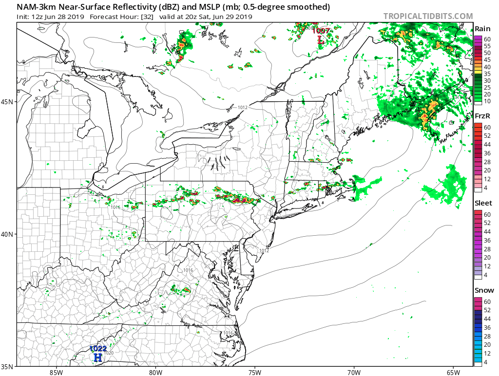
As far as timing is concerned look for thunderstorms to develop in northern areas around 3pm and they will be passing through from north to south between 3pm and 7pm. With this front oriented east-west, this will keep thunderstorms strong even in coastal areas since there will no marine influence. The NAM three has an aggressive line of thunderstorms and other models have similar looks.
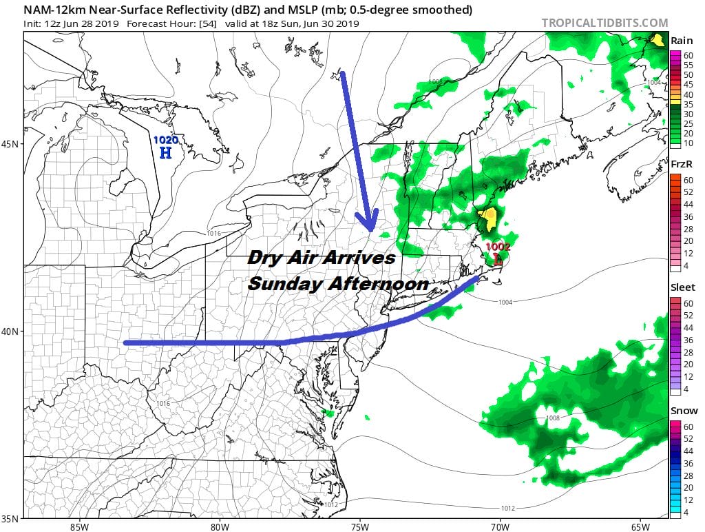
This is the first of two cold fronts. The second one comes through Sunday afternoon. Humidity levels will drop somewhat after the first front passes. The humidity will drop even more when the second one passes Sunday afternoon. We are not expecting much from the second front when it goes by other than some passing clouds. We should still see a fair amount of sunshine Sunday with highs in the upper 70s to middle 80s. It will be much more comfortable on Sunday especially after the second front goes by.
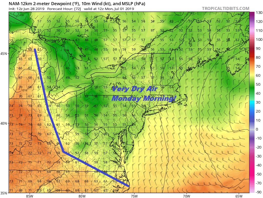
Sunday night will be nice and clear with lows in the 50s to lower 60s. This sets us for a beautiful Monday. The dry push goes well south into the Carolinas. We will have plenty of sunshine Monday which starts off a big vacation week with the 4th of July holiday on Thursday. Monday highs will be 80 to 85.
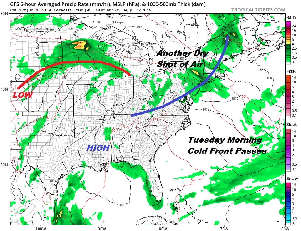
Another front approaches Monday night as the humidity rises briefly ahead of it with a few scattered showers or a thunderstorm when it goes by. The front reaches the coast a little before daybreak and weather conditions improve quickly with sunshine and warm conditions Tuesday and Wednesday. Highs both days will be in the 80s. Humidity levels will be moderate both days.
We will finish off the week very warm and humid with sun and clouds for both Thursday Jul 4th and Friday. There will likely be a few scattered late afternoon and evening thunderstorms on both days but much of the time it will remain rain free. Another front approaches next weekend which could increase the chance for thunderstorms but that is far enough ahead in the long range that we can wait to reach a conclusion about it.
MANY THANKS TO TROPICAL TIDBITS FOR THE USE OF MAPS
Please note that with regards to any tropical storms or hurricanes, should a storm be threatening, please consult your local National Weather Service office or your local government officials about what action you should be taking to protect life and property.


