
Summer Air Arrives Today Except Coast Weekend Outlook
Hot Humid Storms Late Sunday

Summer Air Arrives Today Except Coast Weekend Outlook
Hot Humid Storms Late Sunday
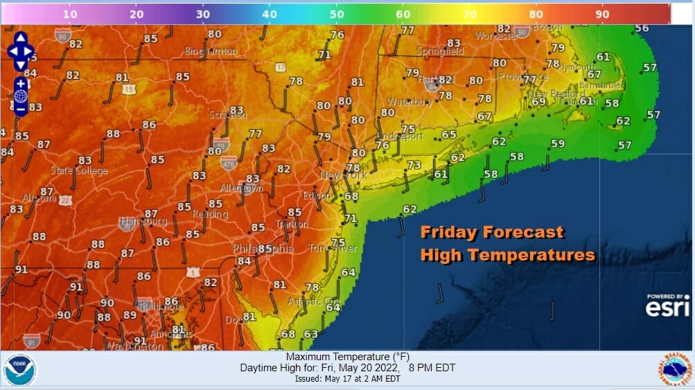
Today begins the first of 3 days of very warm to hot weather. There is going to be one exception to this and that is coastal areas of New Jersey, Long Island, Southern and Southeastern New England. Winds today will be south southeast off the ocean and temperatures will be held down somewhat in those areas. However inland we will see highs in the mid 80s to near 90 thanks to a fair amount of sunshine.

There is a marginal to slight risk for severe weather today mainly inland from Western New Jersey into the eastern half of Pennsylvania south to Maryland and a general thunderstorm risk elsewhere. We have been following an area of thunderstorms since last night from Southern Missouri that is moving eastward and has held up well overnight. At some point later today it will arrive in the risk zone and with the daytime heating, we could see the chance for thunderstorms and even some scattered severe wx. The area does come with a 2% tornado risk.
SATELLITE

WEATHER RADAR

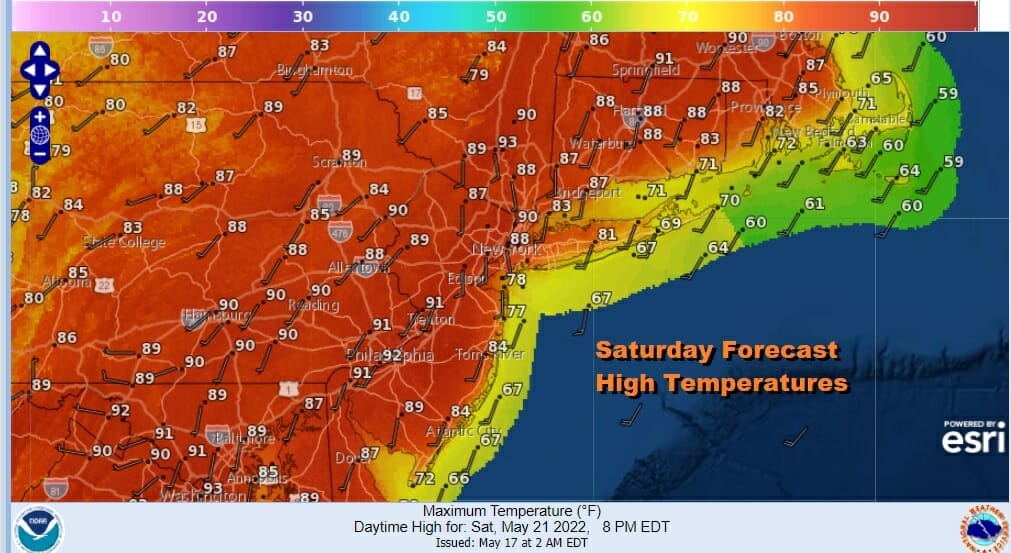
Other than the thunderstorms the weekend should be dry until late Sunday as the next cold front arrives. A warm night lies head with most lows in the low to mid 60s. That sets up a solid launching pad for blastoff Saturday. The wind bends to the southwest so except for the beaches, everyone will be hot. Sunshine will take highs to the low to mid 90s in many areas. We will see plenty of sun but the humidity will be high. Other than an isolated thunderstorm that develops it is a rain free day.
There are no changes for Sunday as it will be another hot humid day ahead of a cold front. Sunshine will take highs into the 90s again with cooler readings along the immediate shore. Right now we think thunderstorms stay away until very late in the afternoon and evening and those storms will likely be well inland, and they will probably fall apart as they near the coast Sunday night.
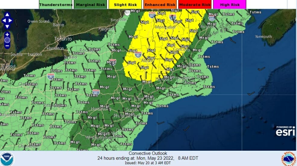
The Storm Prediction Center has laid out a risk are for late Sunday but the primary risk will be in upstate NY and Northwestern New England and a marginal risk for an isolated severe thunderstorm further south. The front looks to get hung up somewhat on Monday leaving us in clouds and a few showers but then it should get better for Tuesday. The heat will be gone and temperatures will be closer to average. The next chance for showers and thunderstorms will come late next week and ahead of the Memorial Day holiday weekend where I am remaining optimistic about at this stage.
BE SURE TO DOWNLOAD THE FREE METEOROLOGIST JOE CIOFFI WEATHER APP &
ANGRY BEN’S FREE WEATHER APP “THE ANGRY WEATHERMAN!
MANY THANKS TO TROPICAL TIDBITS & F5 WEATHER FOR THE USE OF MAPS
Please note that with regards to any severe weather, tropical storms, or hurricanes, should a storm be threatening, please consult your local National Weather Service office or your local government officials about what action you should be taking to protect life and property.


