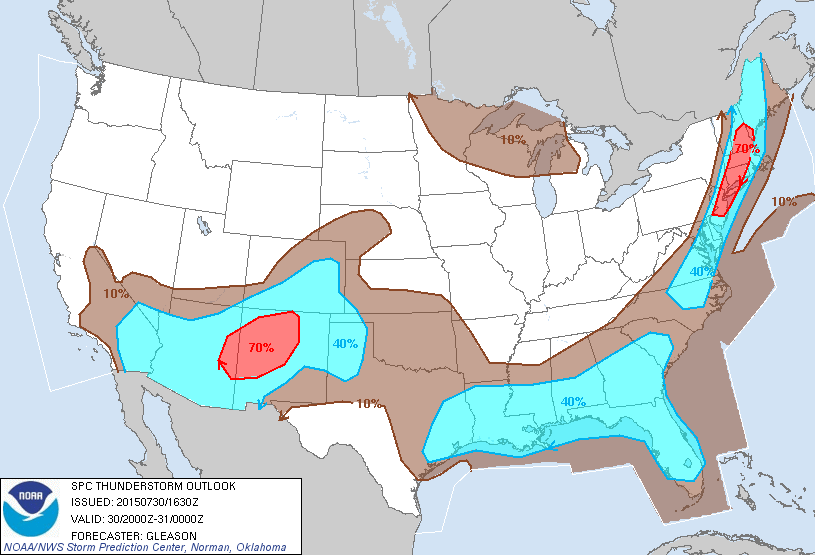
Latest radar shows strong thunderstorms in eastern Pennsylvania moving east and they should be moving across New Jersey between 2 and 5pm and from New York City east after 5pm. Some individual cells could reach severe criteria as they move across. Once they move east of NYC they might weaken some over Long Island as the south wind and marine layer play a factor. Inland storms over the Southeastern Hudson Valley and Connecticut should maintain their strength. Storms should also maintain strength over all of New Jersey and Southeastern Pennsylvania.
Thunderstorms should be done between 7pm and midnight from west to east and dry air returns for Friday though temperatures will still be very warm. At least the humidity will be done and it will be a bit more comfortable Friday and into the weekend.