Strong Gusty Winds Wednesday Night Thanksgiving Day Storm System Late Weekend
Thanksgiving week has begun and with it dry air has returned after yesterday’s rain. Low pressure is east of Nova Scotia this morning. We are seeing some patchy clouds on the satellite but we should see at least some sunshine today. Winds were gusty overnight but they will ease somewhat as the day wears on. Temperatures should be rather reasonable today with highs reaching the upper 40s and lower 50s, This is about average for this time of year.
SATELLITE

REGIONAL RADAR

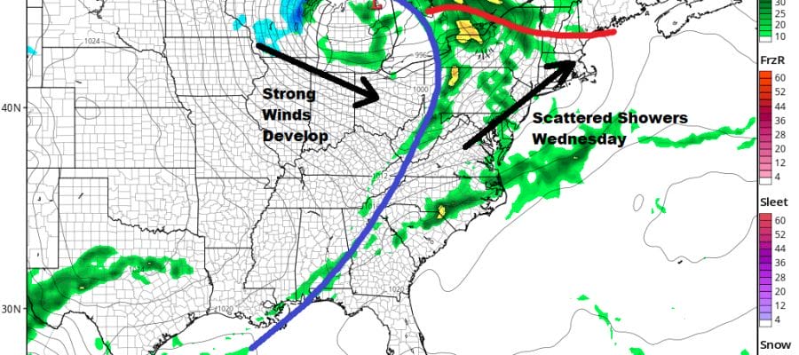
We see no important weather issues right into the first part of Wednesday. Skies should be clear tonight with most lows in the 30s. Tuesday looks like a nice warm day with sunshine taking highs to the upper 50s and lower 60s. Then we turn to Wednesday with a cold front approaching. There is the chance for a few scattered showers late in the day. Clouds will keep temperatures a little lower Wednesday with highs just in the 50s.
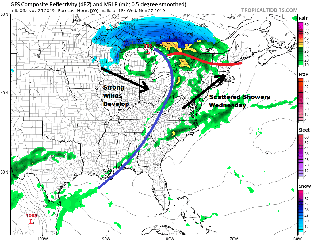
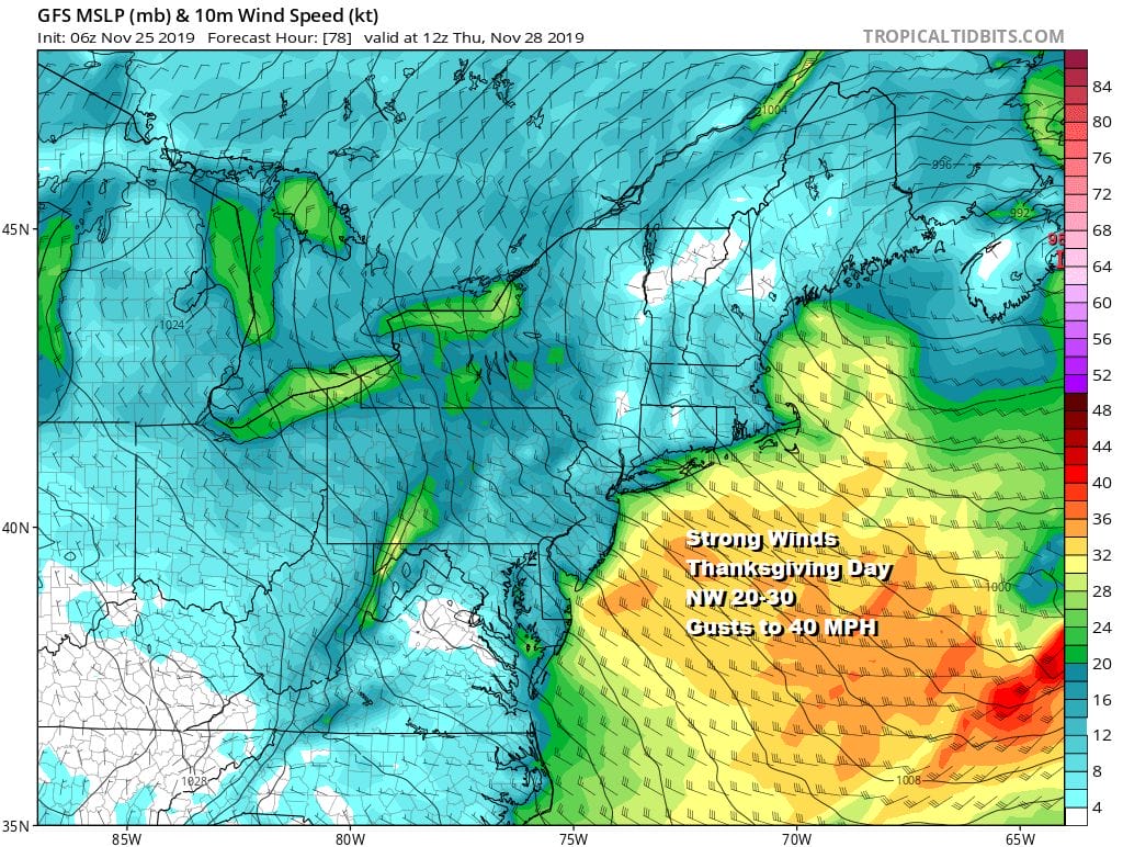
The gradient tightens Wednesday night as low pressure heads into Maine and then to Nova Scotia strengthening along the way. Winds are going to increase Wednesday night and Thursday morning we will be seeing northwest winds at 20 to 30 mph with some gusts to 40 mph. This is going to be an issue for Thanksgiving Day Parades in NYC & Philadelphia where balloons may not be launched with these gusty winds being forecast.

At least the weather will be dry Thursday with some sunshine with highs mostly in the 40s. It does beat last year which was one of the coldest Thanksgivings we have ever seen as highs did not get out of the 20s in most places. Sunshine finishes the week for Friday with less wind and highs in the low to mid 40s with nighttime lows in the 20s to near 30.

Wednesday’s storm system becomes the weekend blocking low that is sitting over Newfoundland. We have been discussing this on our subscription platform all weekend regarding how the block impacts the next low that will be a major storm for the Southwest Rockies and Plains midweek before turning its attention eastward over the weekend. The track of the low will hinge on the storm to the East and whether it gets out of the way…or if it gets out of the way at all. Models will continue to grapple with this for days yet taking us in all sorts of directions. We can say right now that Saturday will be dry with sunshine and arriving clouds with highs just into the 40s. Then we look to next Sunday and the likelihood of precipitation across the Northeast and Mid Atlantic states as low pressure redevelops somewhere nearby and then heads northeast. We will be covering this on our Patreon Platform with our weather in 10 members only video later today once the new model cycles are done.
BE SURE TO DOWNLOAD THE FREE METEOROLOGIST JOE CIOFFI WEATHER APP &
ANGRY BEN’S FREE WEATHER APP “THE ANGRY WEATHERMAN!
MANY THANKS TO TROPICAL TIDBITS FOR THE USE OF MAPS
Please note that with regards to any severe weather, tropical storms, or hurricanes, should a storm be threatening, please consult your local National Weather Service office or your local government officials about what action you should be taking to protect life and property.


