
Stormy Pattern Continues But Sunday Monday Dry
Stormy Pattern Continues But Sunday Monday Dry
We continue to roll along in what seems to be a pattern of a storm system comnig through every 3 days. Yesterday’s storm system moved out leaving a solid 1 to 2 inches of rain. Saturday was spent in leftover clouds and in some places some leftover rain. Now at least we have 2 days to look forward to.
The satellite loop shows the coastal storm moving away from New England and some dry air is moving southeast from the Great Lakes. That dry air should take care of things for Sunday and Monday with sunshine both days, though clouds may arrive later Monday afternoon with temperatures back into the 50s for the most part.
We can also see the energy from the next storm dropping southeast from the Central Rockies into Texas. This is going to create a serious severe weather event for Southeast Texas and SW Louisiana on Sunday. That storm system responsible will take a similar track as yesterday’s only a little further north.
SATELLITE LOOP

REGIONAL RADAR

LOCAL RADAR NEW YORK CITY

LOCAL RADAR PHILADELPHIA


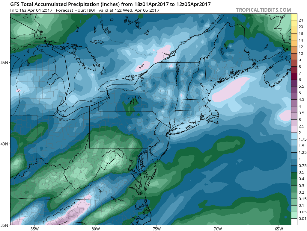
Radars should remain quiet through Monday. Rain will move in Monday night and last into Tuesday night and some of the rain will be heavy. This could be another 1 to 2 inch rain producer with a strong southeast inflow into the developing low to the north. Once that system moves away weather conditions will improve for Wednesday before the next storm system coming from the west brings rain on Thursday into Friday. We are likely to warm up ahead of that one and there could be some thunderstorms with the cold front when that front moves through Thursday night. It may take a day or two for that one to clear out as the upper air energy is likely to linger for a few days.
 GET JOE A CIGAR IF YOU LIKE

LANDSCAPE COMPANIES FOR YOUR NEEDS
LONG ISLAND ROCKLAND COUNTY Connecticut

![]()

ROCKLAND COUNTY TRI STATE SNOW REMOVAL JOHNSTOWN PA


FiOS1 News Weather Forecast For Long Island
FiOS1 News Weather Forecast For New Jersey
FiOS1 News Weather Forecast For Hudson Valley
NATIONAL WEATHER SERVICE SNOW FORECASTS
LATEST JOESTRADAMUS ON THE LONG RANGE
Weather App

Don’t be without Meteorologist Joe Cioffi’s weather app. It is really a meteorologist app because you get my forecasts and my analysis and not some automated computer generated forecast based on the GFS model. This is why your app forecast changes every 6 hours. It is model driven with no human input at all. It gives you an icon, a temperature and no insight whatsoever.
It is a complete weather app to suit your forecast needs. All the weather information you need is right on your phone. Android or I-phone, use it to keep track of all the latest weather information and forecasts. This weather app is also free of advertising so you don’t have to worry about security issues with your device. An accurate forecast and no worries that your device is being compromised.
Use it in conjunction with my website and my facebook and twitter and you have complete weather coverage of all the latest weather and the long range outlook. The website has been redone and upgraded. Its easy to use and everything is archived so you can see how well Joe does or doesn’t do when it comes to forecasts and outlooks.
Just click on the google play button or the apple store button on the sidebar for my app which is on My Weather Concierge. Download the app for free. Subscribe to my forecasts on an ad free environment for just 99 cents a month.
Get my forecasts in the palm of your hand for less than the cost of a cup of Joe!


